Featured

Mike and Holly’s Road Trip

Ferry from Dover to Calais

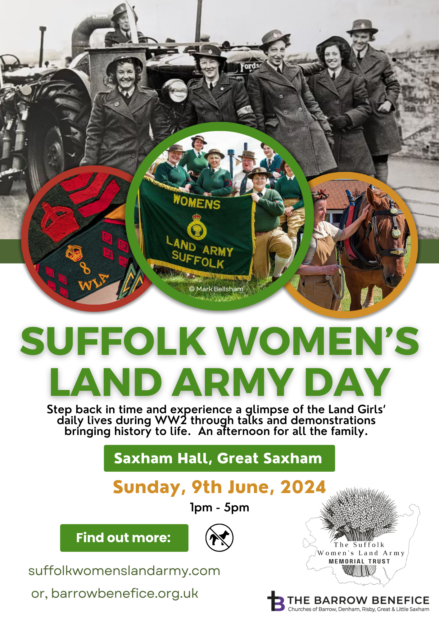
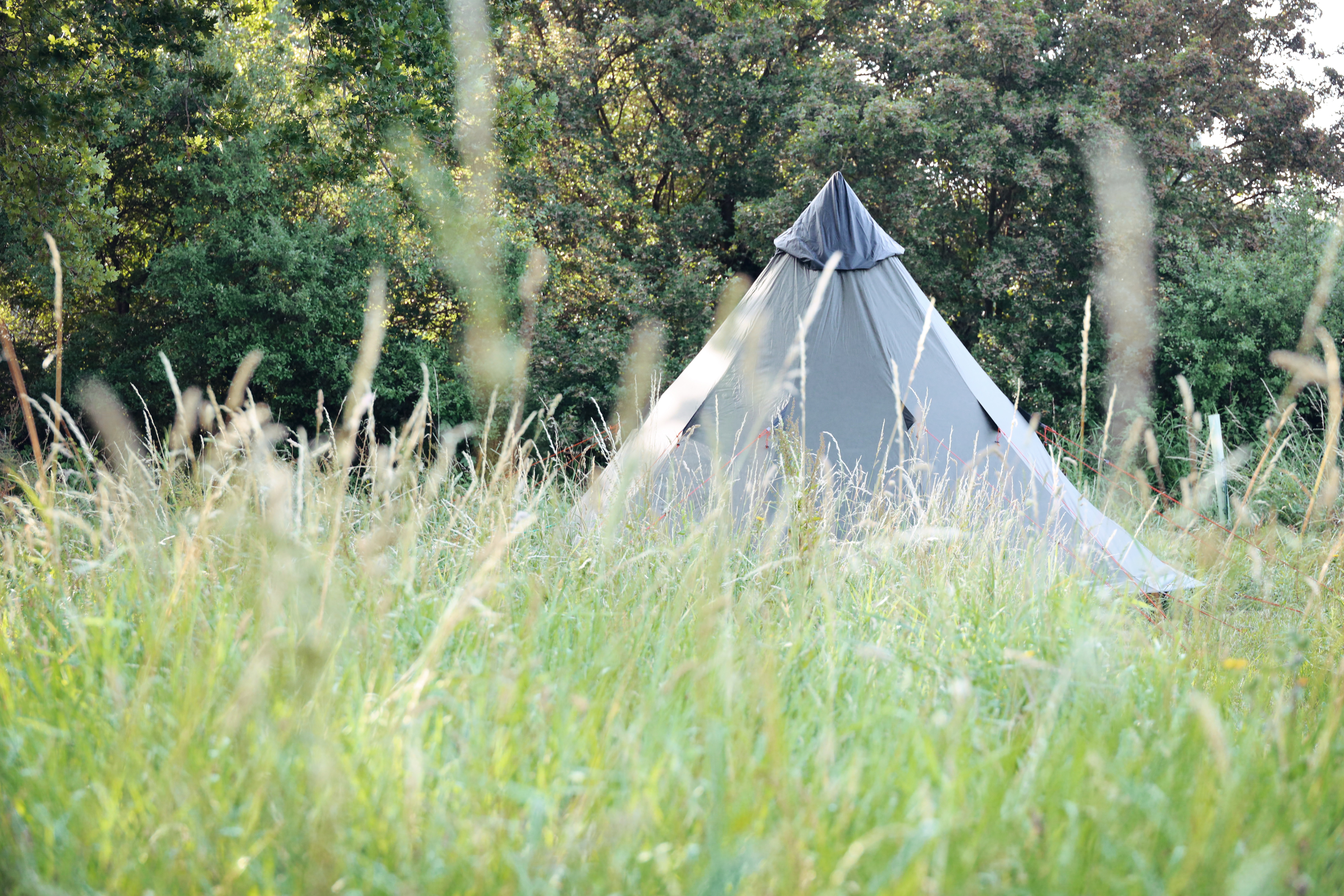
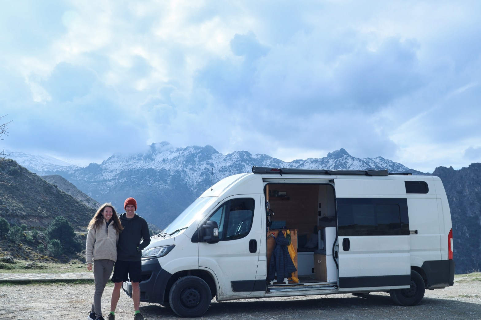
This is the personal blog page where we will share some notes about the places we visit and the walks we do for our friends and family who are interested in where we go and have gone on our road trip through Europe. There are also some grid references to various free camp spots we stayed in throughout Europe and the Balkans too.

Enjoy! H&M x

Click on the buttons below to skip to a country of your choice!

6 month overview video

France

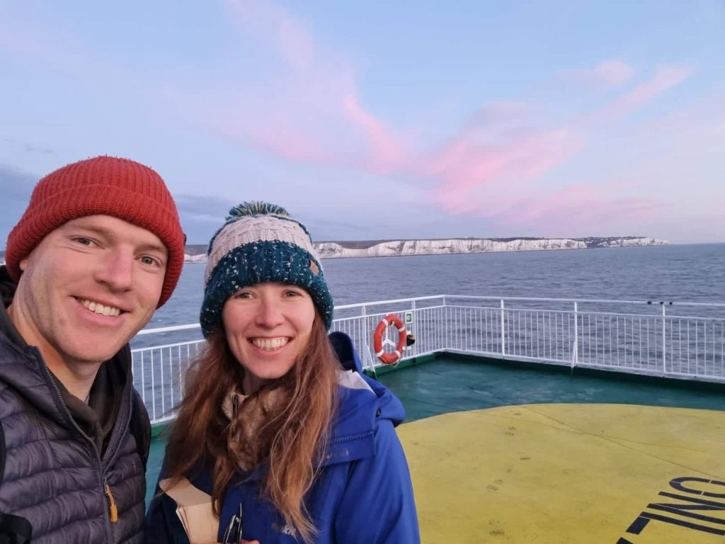
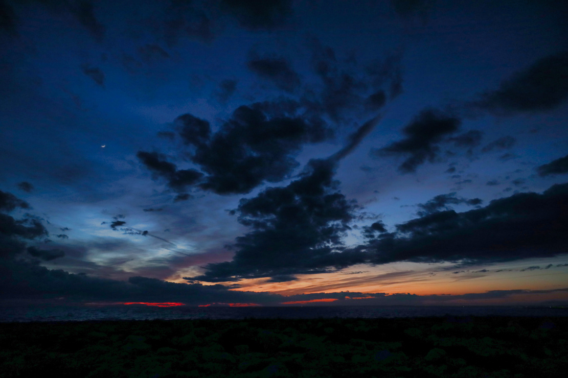
We watched the sunrise and light up the Dover Cliffs on the ferry to Calais. Upon arrival at Dover we had our Covid passes on our phones checked but not the ‘engagement-sur-l-honneur’ document which they said you must have. We also got our passports stamped so we have visual proof of entry.

Château de Chambord
Château de Chambord, France

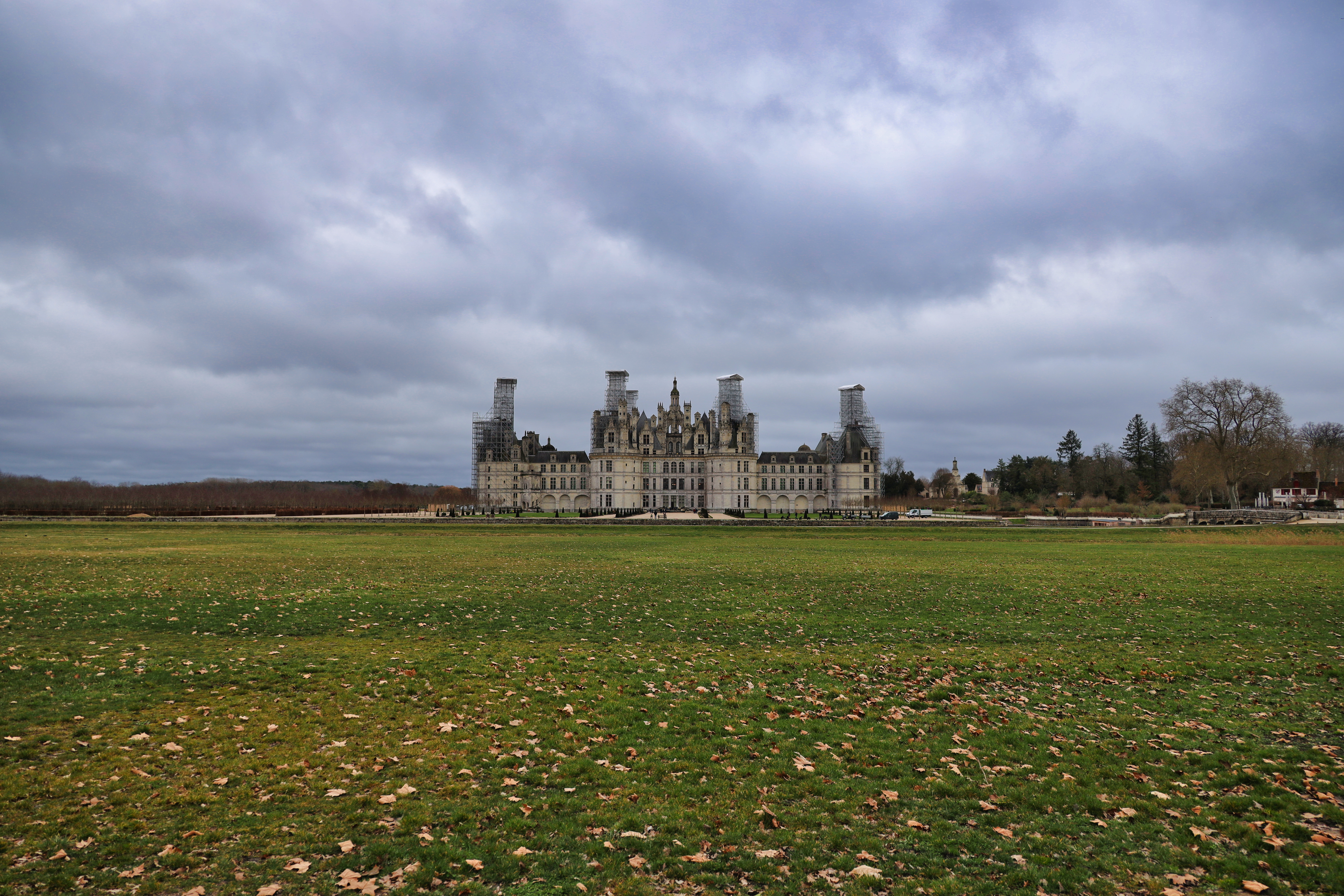
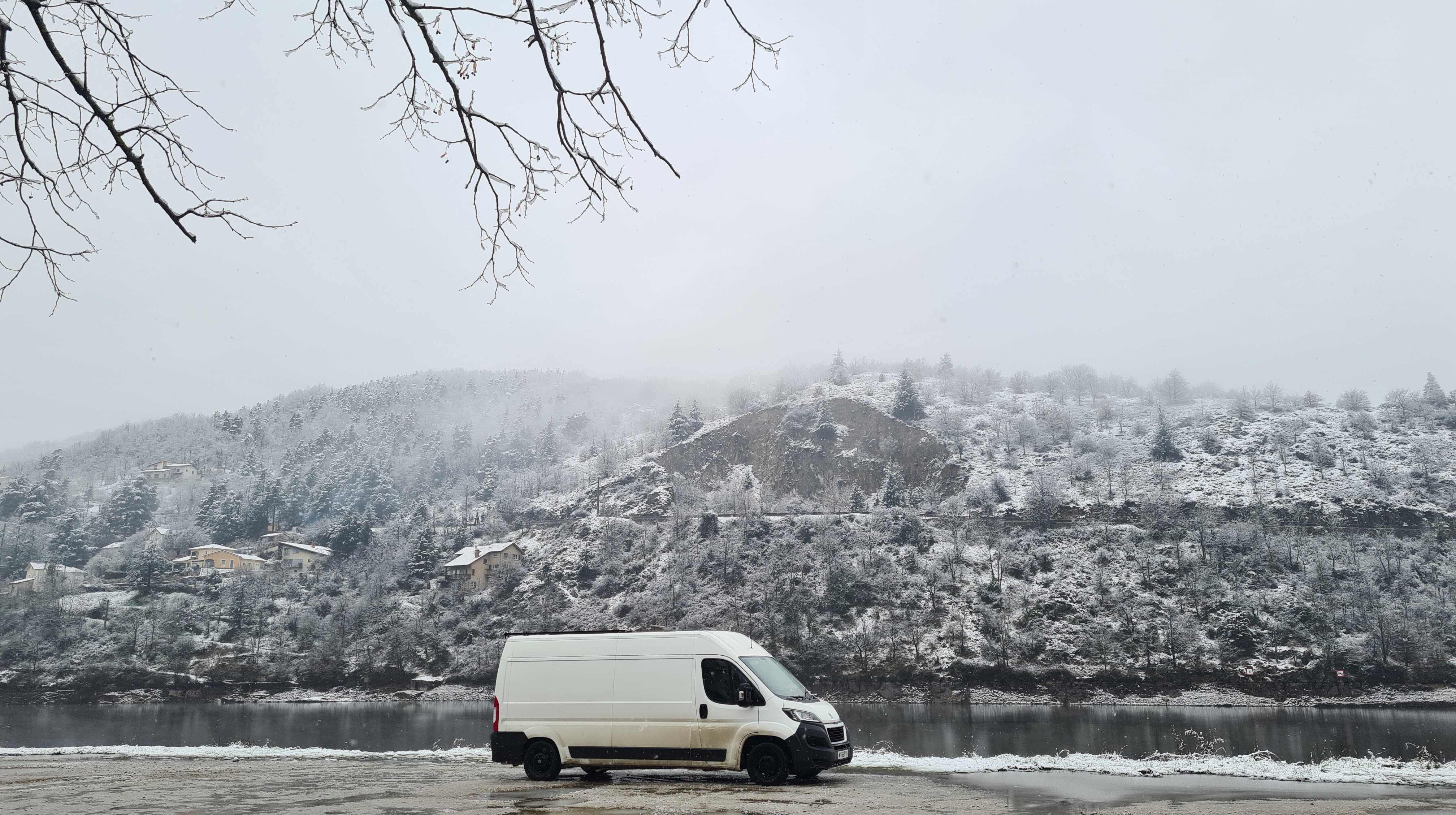
Château de Chambord is the biggest chateau in the Loire Valley. We are passing through to get to the south of Spain whilst the weather is still bad ‘up north’. We will be driving further south towards the border near San Sebastian over the next few days. Overnight Free Camp Location at Château de Chambord: 47.6171981,1.51454,16.48

Ustaritz, France
Ustaritz, France

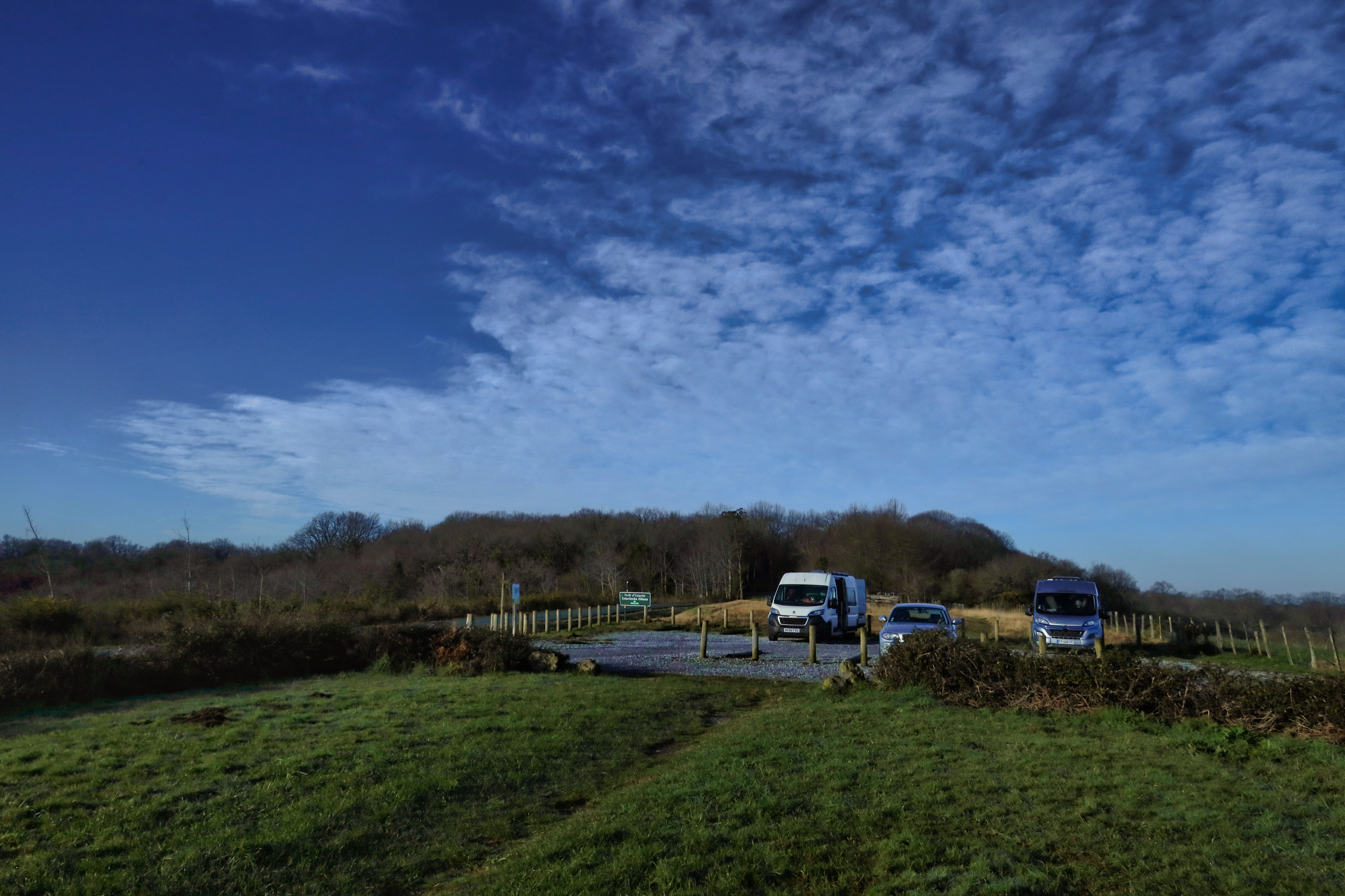
We have had engine trouble! Well, the engine oil cap fell off and oil leaked everywhere. We have been to a garage and they led us to a scrapyard, who couldn’t help us. We then went to Peugeot who were not helpful considering we have a Peugeot Boxer. However, Citreon were amazing, as were Norauto. When travelling in a van it’s good to know that the European (and better) version of Halfords is Norauto. Overnight Free Camp Location at Uztariz: 43.386605,-1.4941218,16.96

Basque Country, Spain

Top of page ↑

Spain

Our travel video for Flight Free UK

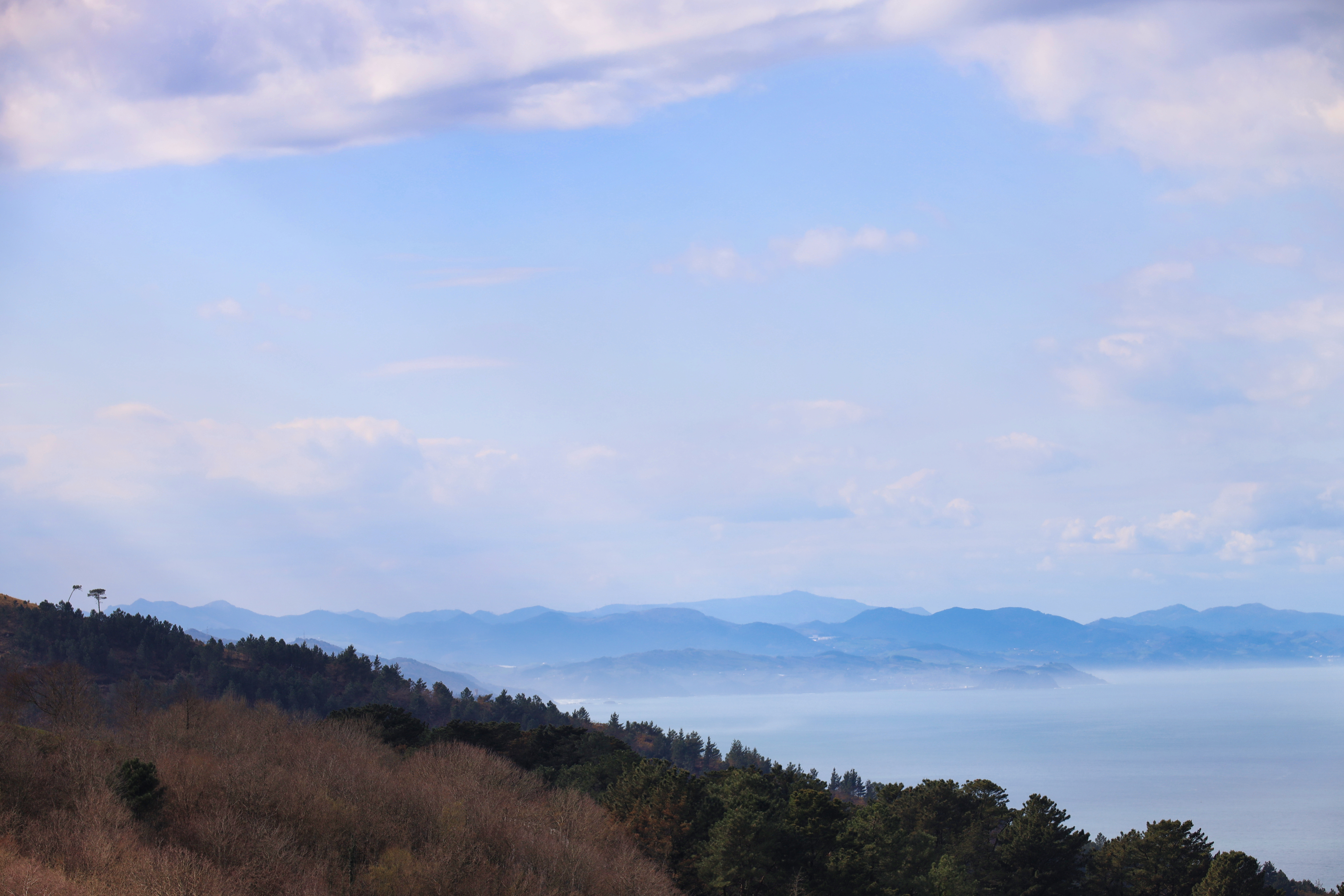
We have made it into Spain. There were no checks at the border near San Sebastian. We decided to head up the hill near Hondarribia to Jaizkibel. The views were beautiful and so we went for a walk and had lunch. It then started to rain, so we took that as a hint to continue our journey south. Overnight Free Camp Location at Jaizkibel: 43.3531357,-1.8424644. We were asked to make a film about our trip to Spain to promote travelling on the ground instead of flying, you can find out more about the company here.

Salamanca
Salamanca, Spain

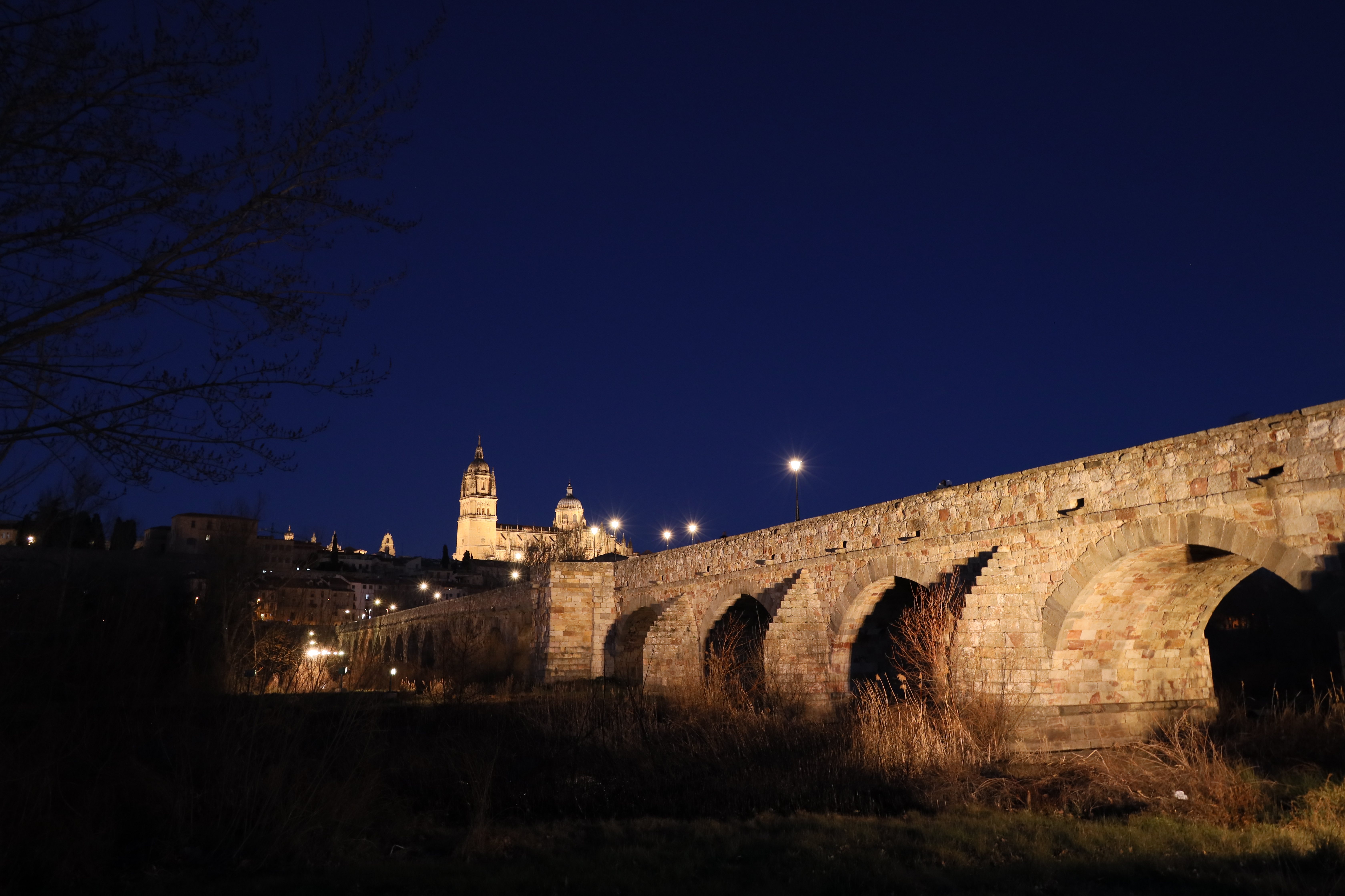
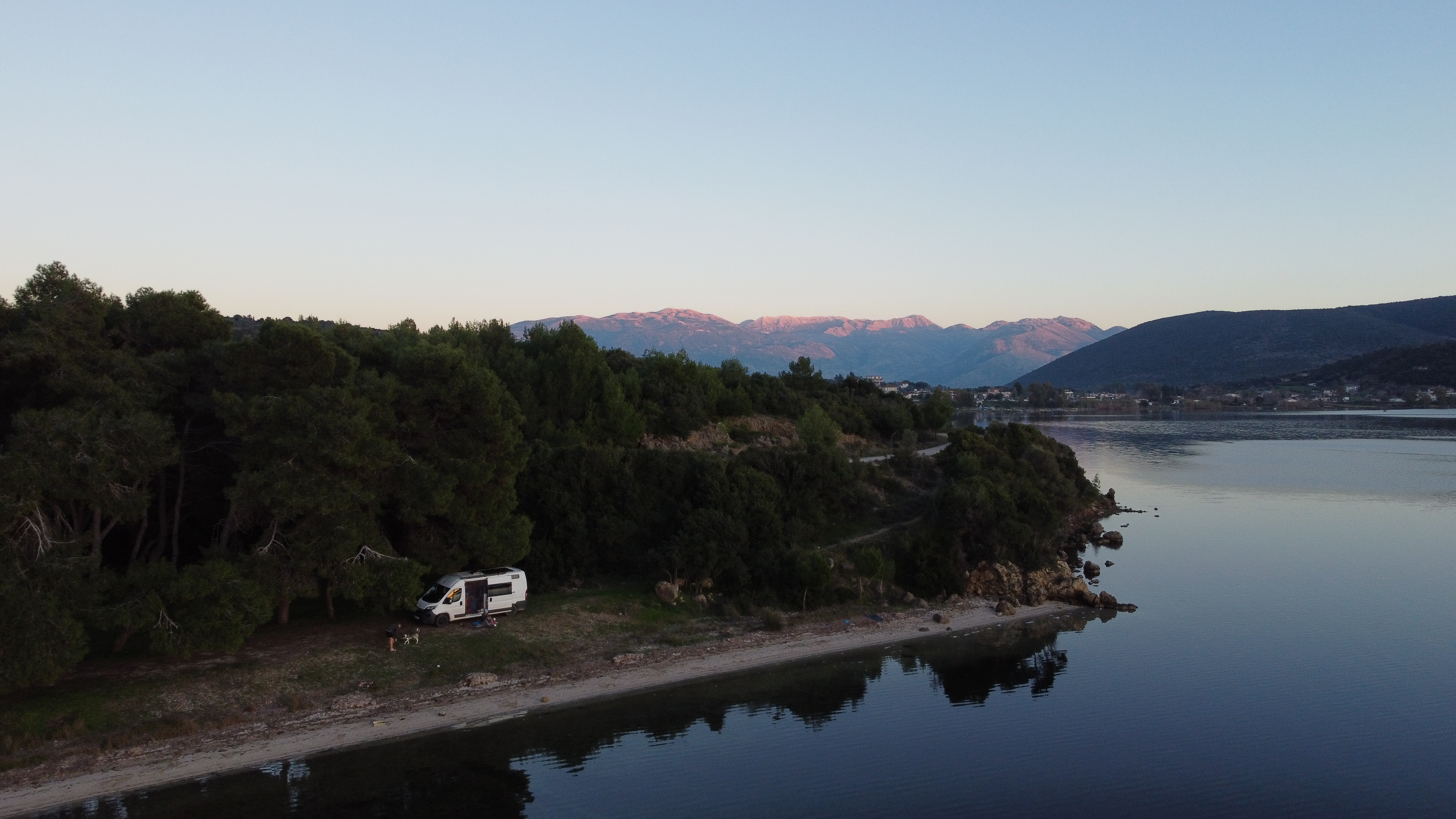
We had a lot of driving today crossing the vast emptiness of midland Spain, which looks like one of the centre of the concrete industry. We finally got to the beautiful UNESCO city of Salamanca. This roman bridge was declared an Artistic Historic Monument in 1931 and was the main road into the city until 1973. Overnight Free Camp Location at Salamanca: 40.9596571,-5.6753829

Mogarraz in the Parque natural de Las Batuecas-Sierra de Francia, Spain

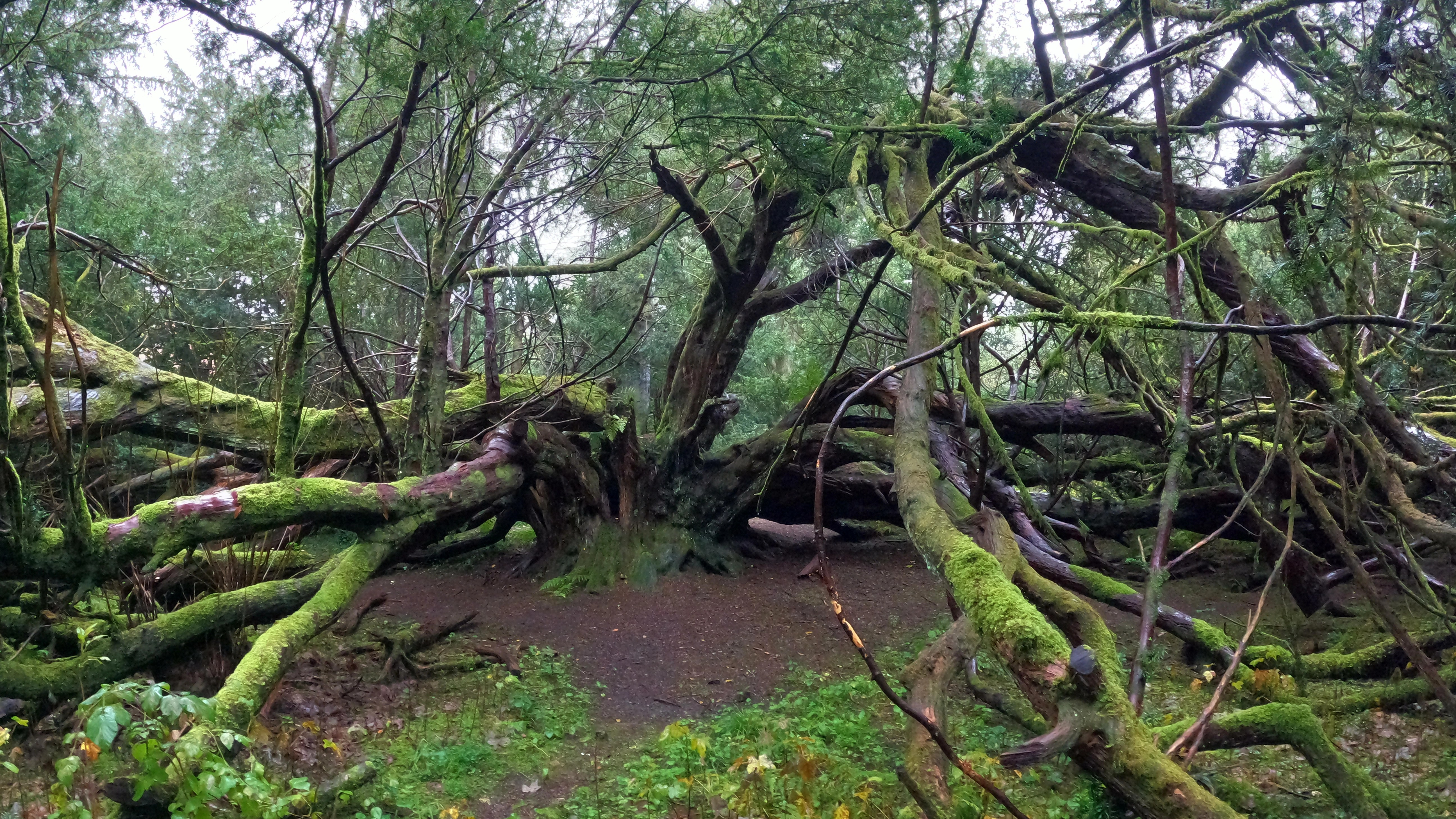
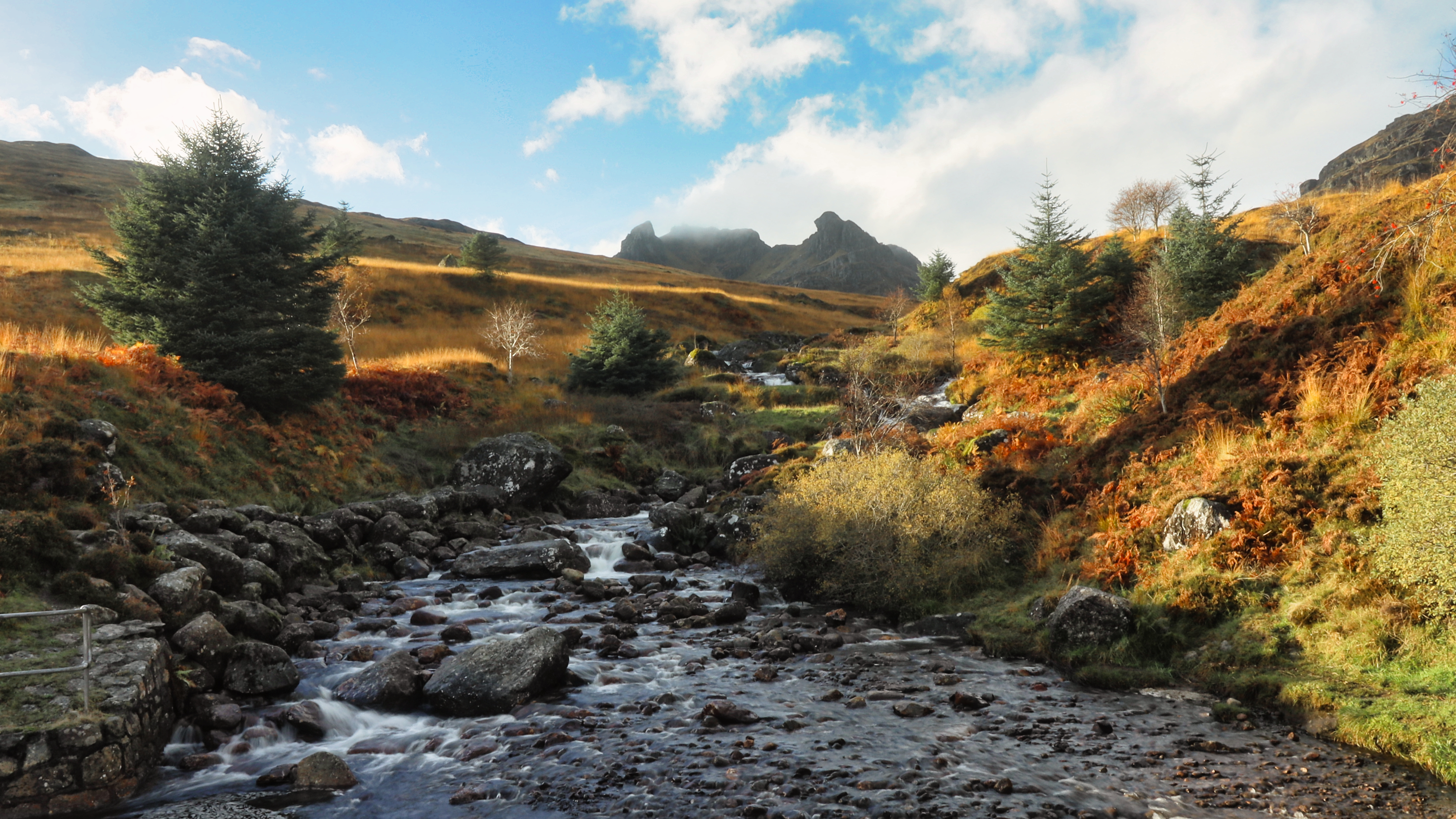
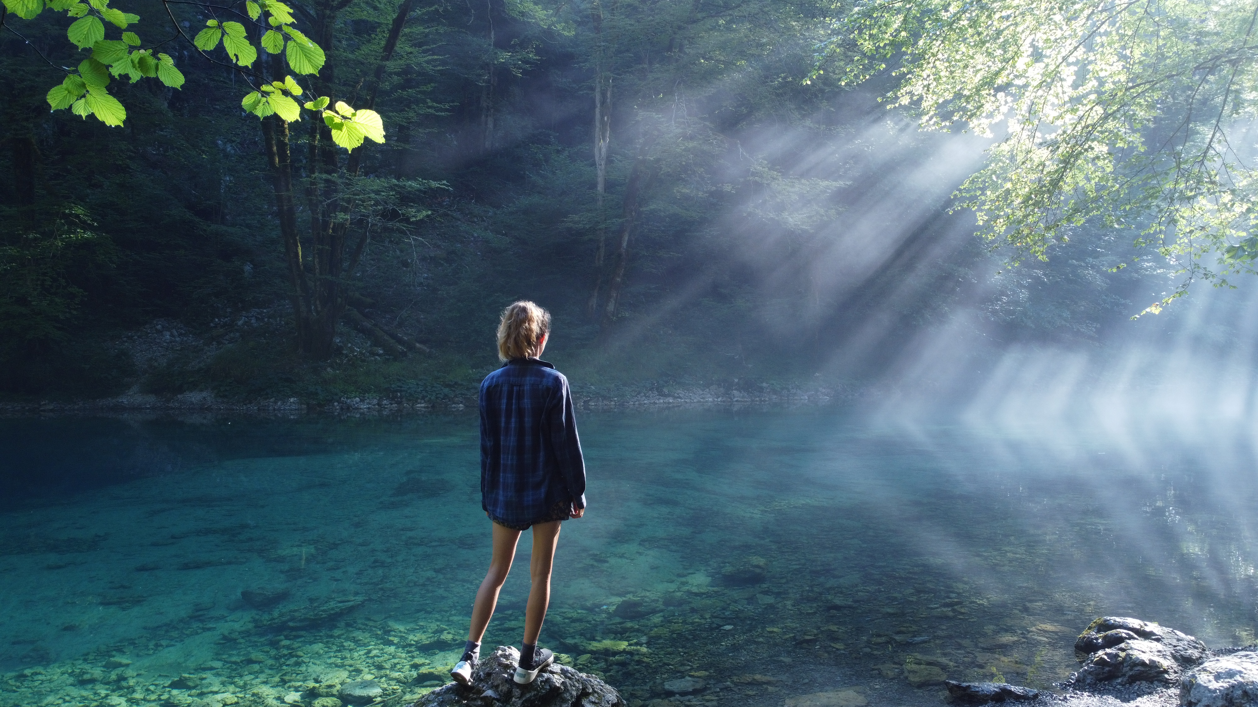
Camino Del Agua is the woodland walk that we did today. It is a circular route through the Parque natural de Las Batuecas-Sierra de Francia and finishes at the beautiful village of Mogarraz. It is quite a popular walk full of little bridges, glens and bird life. This village has unique architecture and the square had a really nice atmosphere which we would recommend visiting. You can see the route for the walk we did on AllTrails here. Overnight Free Camp Location at Alberca: 40.4889649,-6.1169799

View from Peña Carbonera 1505m, Spain

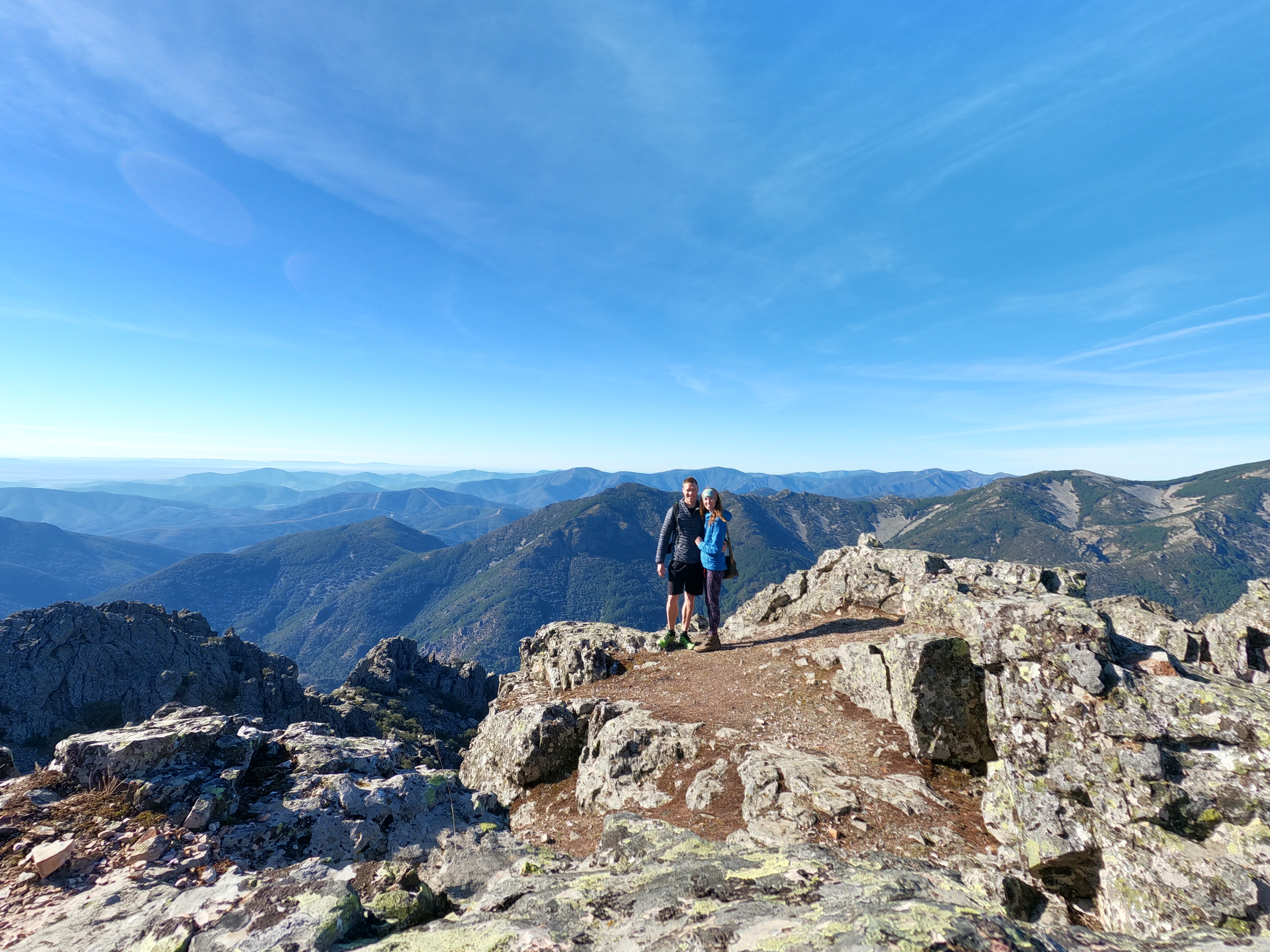
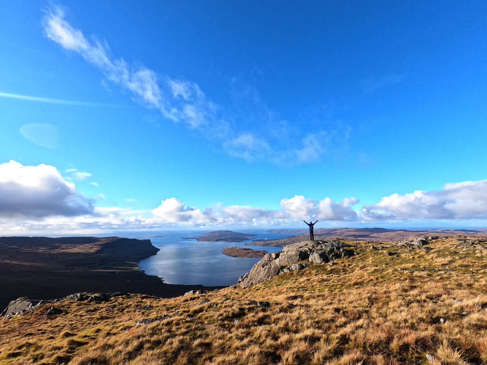
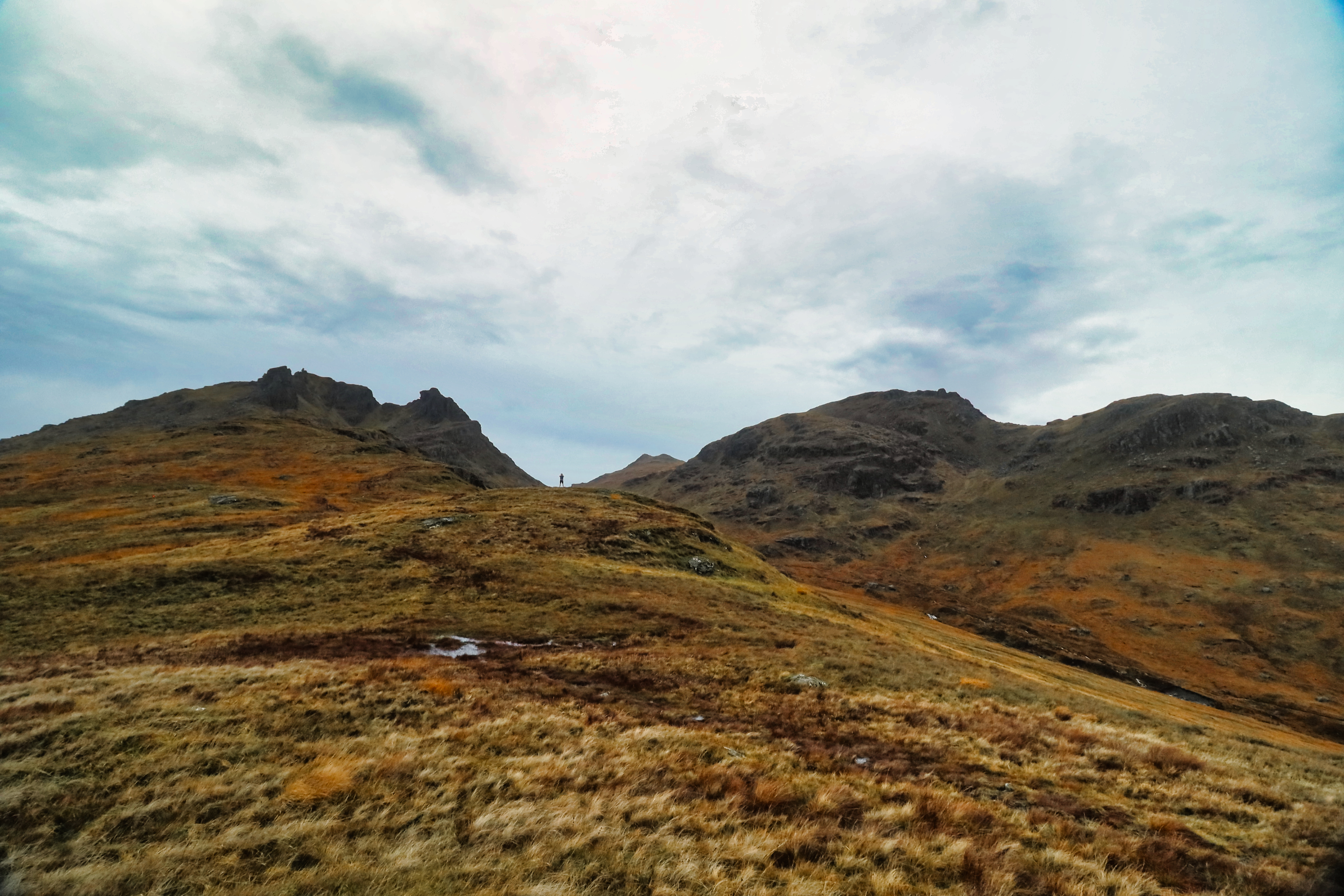
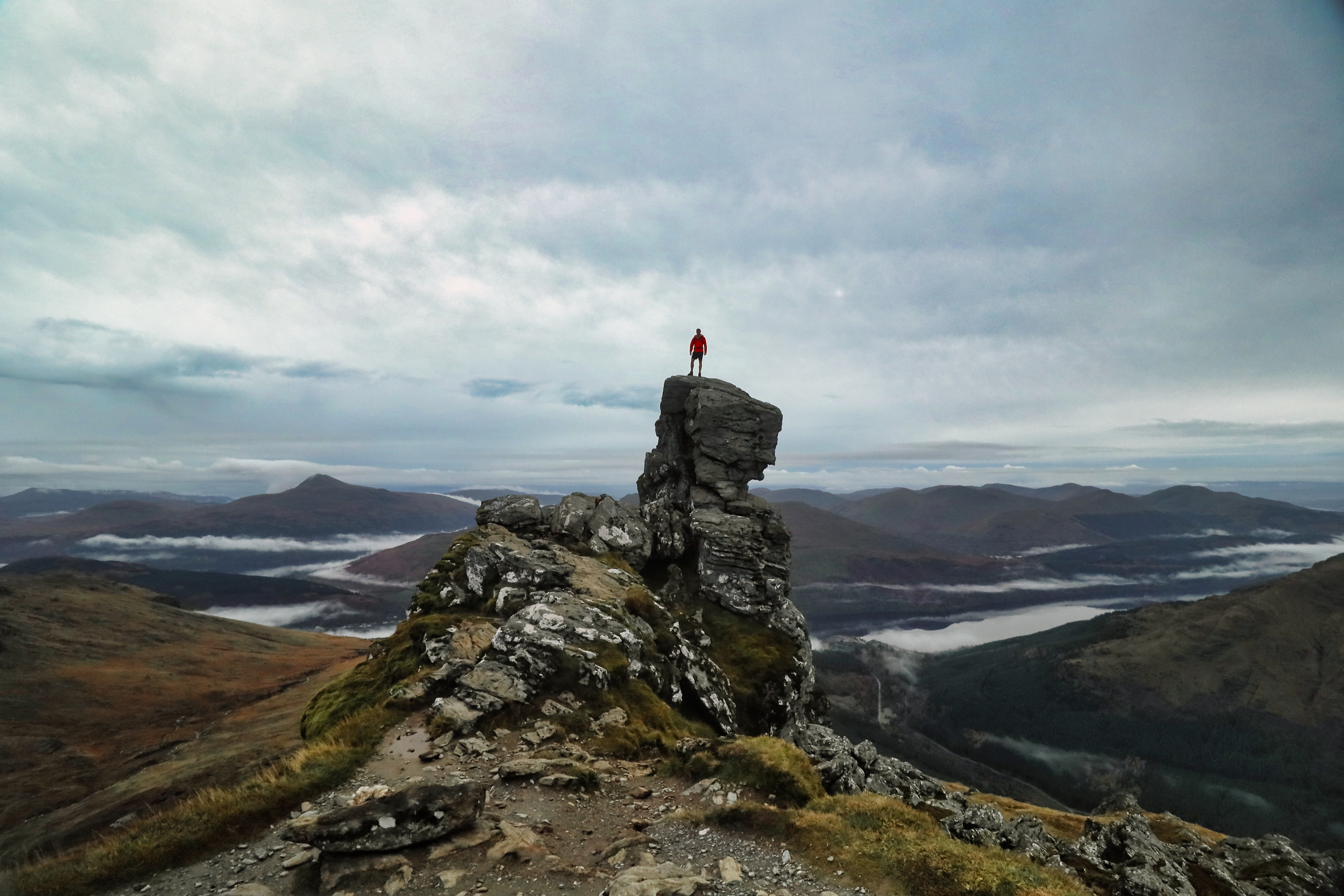
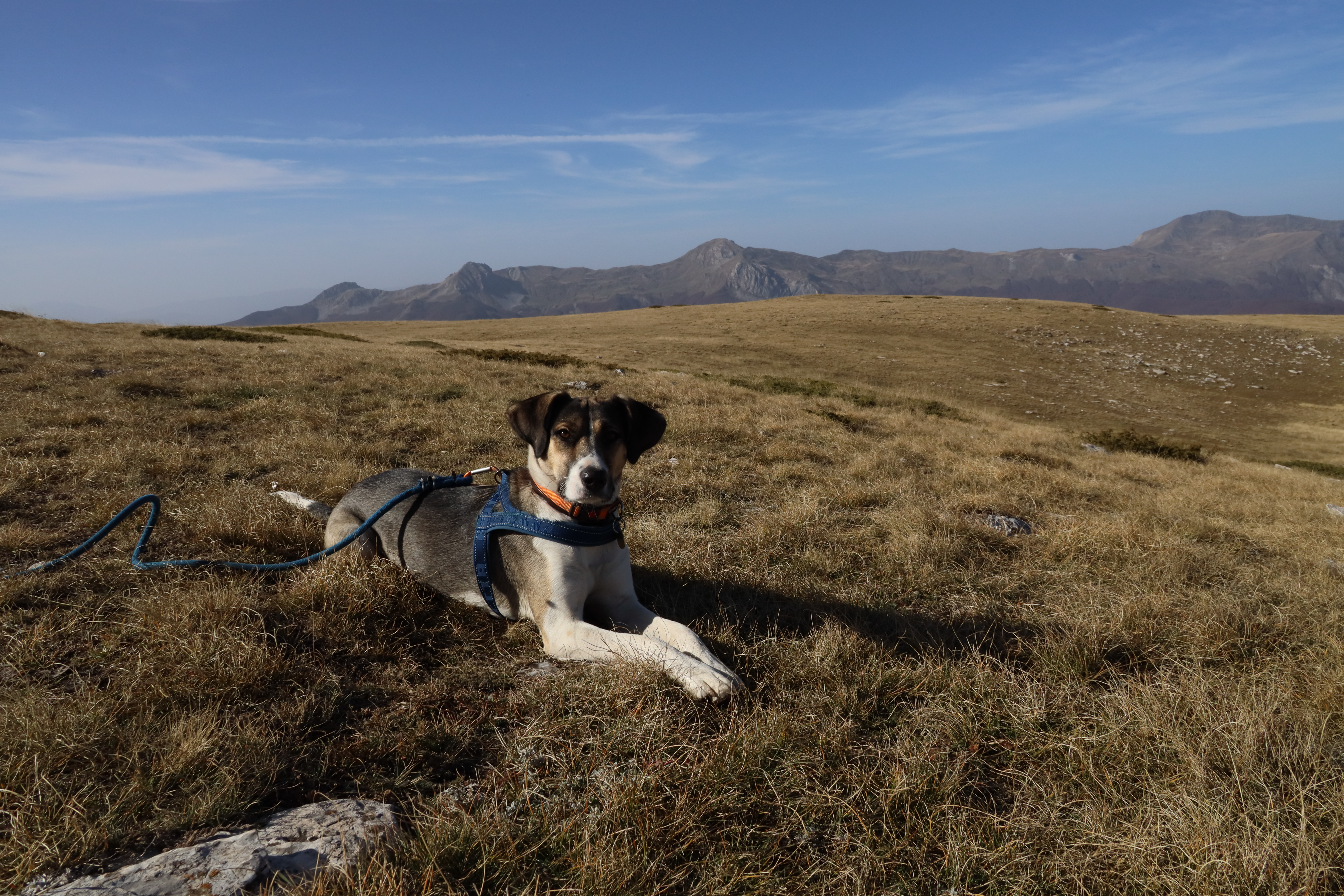
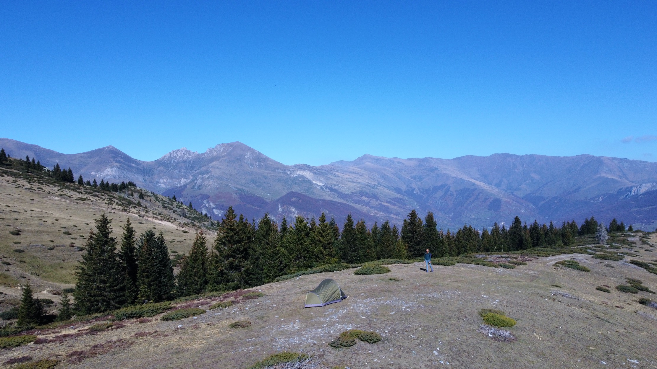
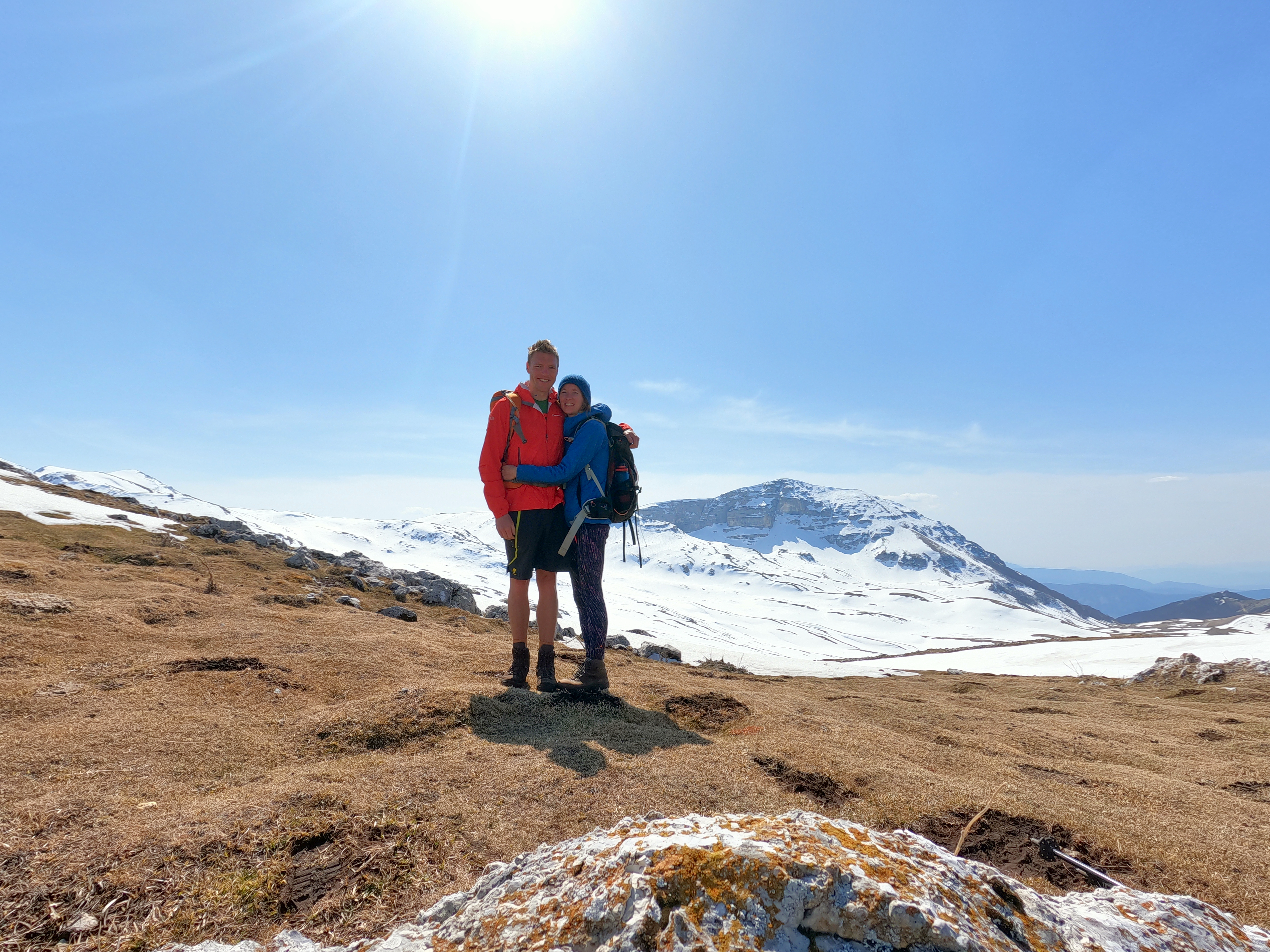
The image above is from our Puerto Del Portillo, Peña Huevo (1414m) Peña Carbonera (1505m) Walk. This has been one of the best walks of the trip so far with amazing views and we saw águila real (golden eagles), buitres negro (vultures) and cabra montés (mountain goats). We have a great little park spot so will be staying in this area for a while as it is also pretty quiet. Overnight Free Camp Location at Batuecas: 40.4572106,-6.1364564

pine processionary caterpillar (Thaumetopoea pityocampa)
Pine processionary caterpillar (Thaumetopoea pityocampa), Spain

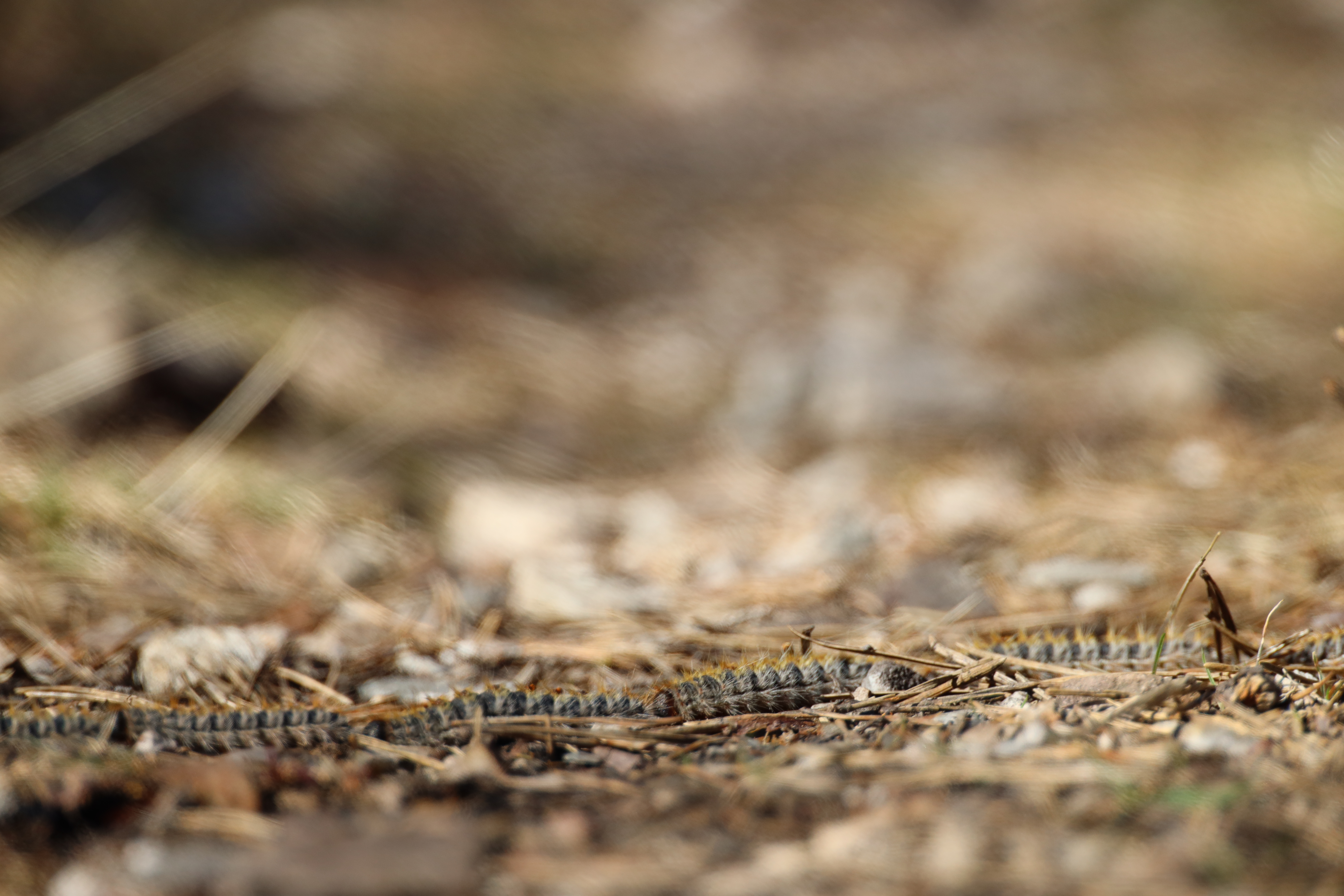
On the walk today we saw a few of these caterpillar trails. They were touching head to bum in a row of about nearly two meters. A little bit of research shows that these are all following the pheromones of one female and are heading into the ground to cocoon themselves.

portugal wild camp spot near lake
Portugal wild camp spot near lake

Top of page ↑

Portugal

Today we drive to Portugal just north of Badajoz. There were no border checks on the back road we took in. We then travelled through Alentejo to a lakeside where there was a bar called ‘Bar da barragem do Caia’ which was open and had sunset views. We saw another campervan parked down by the lakeside and so we joined them and then decided to walk back up to the bar for another beer.  Overnight Free Camp Location at Barragem do Caia: 39.0058751,-7.1405687

Herdade Paço Do Conde
Herdade Paço Do Conde Winery, Portugal

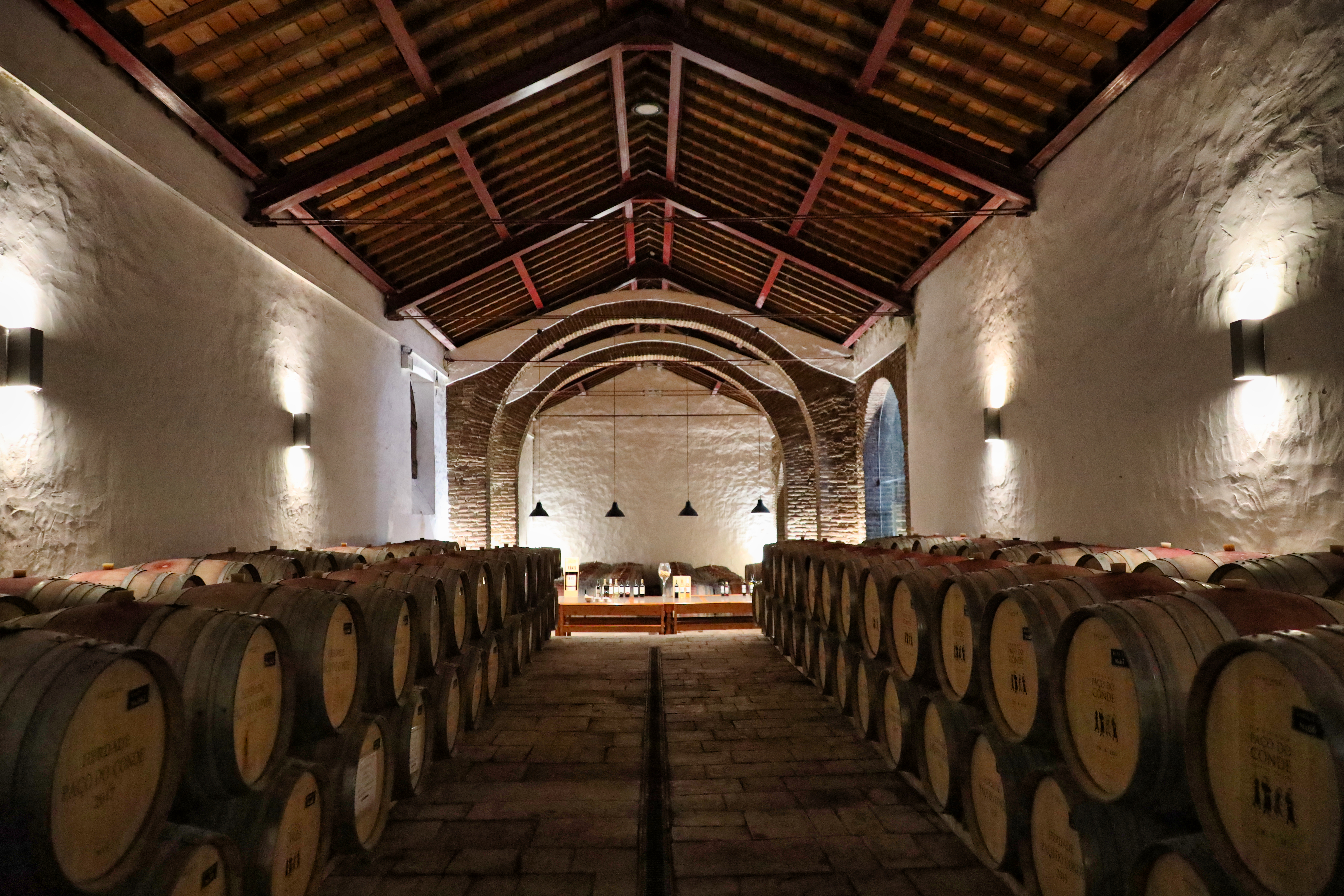
Today we visited a winery which now features on the website I am working with, CamperGuru, a cool new site listing loads of great camp spots. We parked up by the lakeside and listened to the birds for the evening. We also tasted some of their olive oil in their tasting barrel room, and brought a bottle. 

Park up spot along the Guadiana river

We have spent a few days following the Guadiana river through Alentejo, which happens to also be the Spanish / Portuguese border. The Parque Natural do Vale do Guadiana is where they have reintroduced the Lynx, unfortunately we didn’t see any even though we did find a cool park up spot in the middle of nowhere down a track, just down the road from Mertola. Overnight Free Camp Location near Mertola: 37.623659, -7.664010

Guadiana river in the background

As we get into the Algarve region, we explored the small town of Alcoutim which has toilets and showers at the marina. It is a small marina where the boats can moor up for free away from the Algarve coastline and they had a great cafe with our favourite treat, Pasteis de Nata. Overnight Free Camp Location in Alcoutim: 37.4683443,-7.4723328

Overnight Free Camp Location near Alcoutim: 37.4227384,-7.4555543

Top of page ↑

Spain (again)

We are back in Spain now and are exploring the Costa de Luz, the coast of light, however it is more like the Costa de viento, the coast of wind. There are a variety of places along here where some the motorhomes just do not move on, it is full of German, Dutch and Spanish vans who look like they live here full time. Rota seems to be the Benidorm for motorhomes.. I wont bother sharing the link to this place as we didn’t stay long and wouldn’t recommend it.

There are however some cool spots, which are choca-block again with full-time vanners, who don’t move on. So we did spend a night in a quiet woodland near the Parque Nacional de Donana, but decided to move on the next day. The coast here is too close to the industrial area of Huelva which pollutes the estuary.

Views across to Gibraltar and Morocco

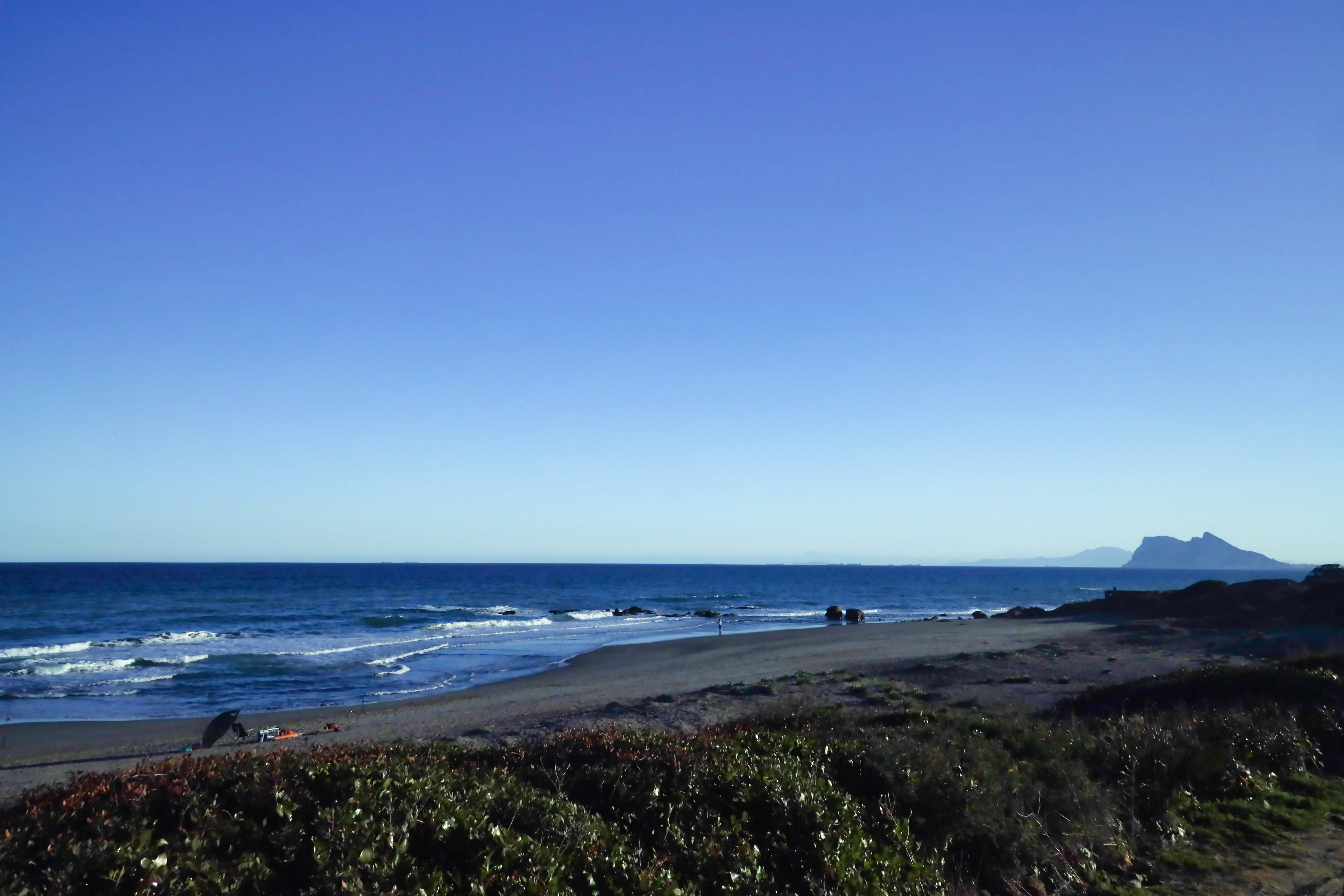
The wind which was scheduled for the week has made us head inland over the top of Gibraltar into the Parque Natural Los Alcornocales. Here we found a beautiful little walk through the Cork and Gall Oak woodlands following a stream with views through the mountain range and vultures overhead. It was peaceful here, but we have been inland for a while so needed to head to the coast. We found a cool park up which is one of our favourite so far, just outside Gibraltar, not far from the drug smuggling area of La Linea. Overnight Free Camp Location at Parque Natural Los Alcornocales: 36.2273115,-5.5862262.

Parque Nacional Sierra de las Nieves

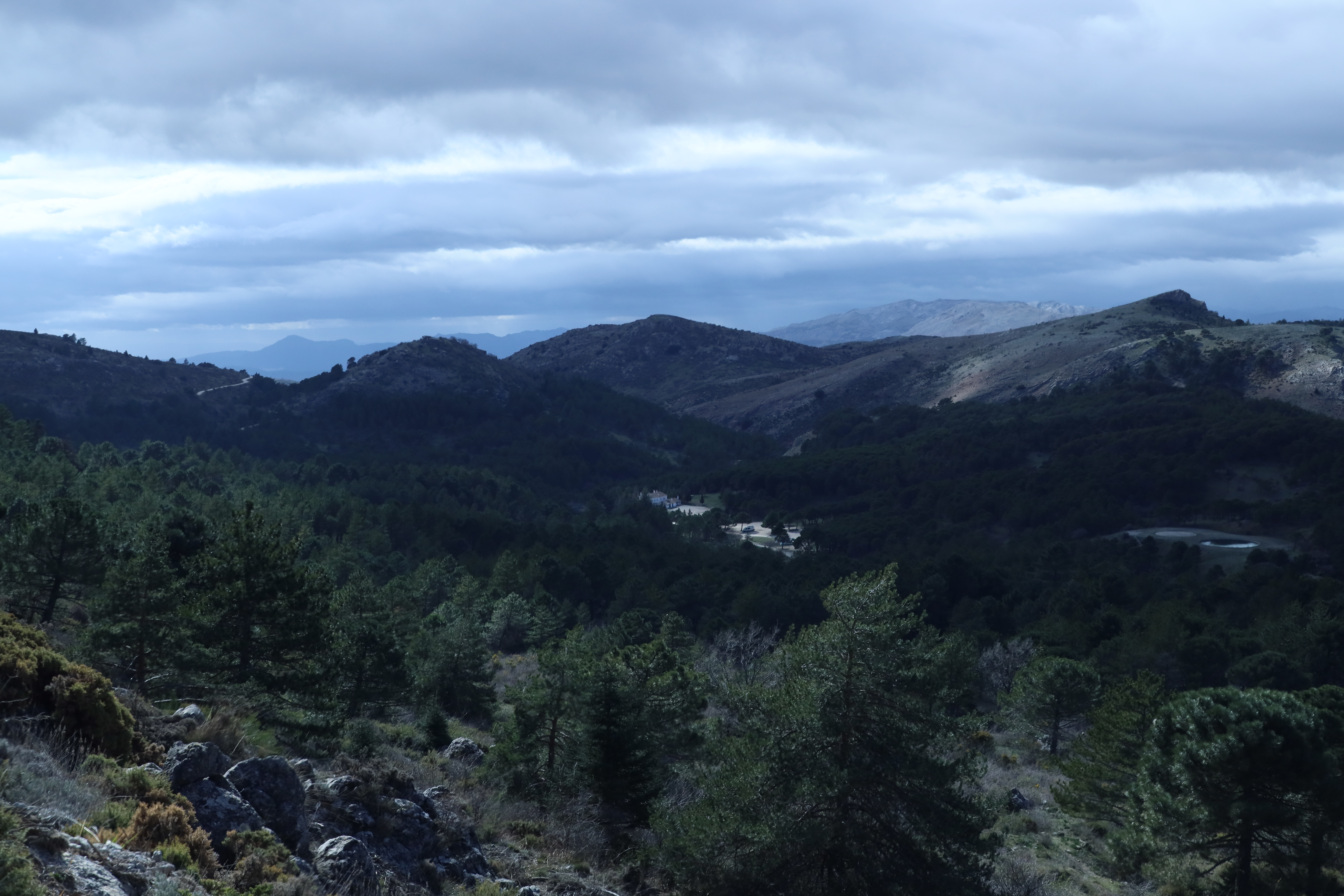
After a few days enjoying the sunshine with some yoga on the beach, a bit of sea swimming, only a little, then we decided to head inland to the Parque Nacional Sierra de las Nieves. We walked up 1778m and in the morning woke up to a frozen ice land. The drive up to this spot was 8km on track and we were just hoping the road wasn’t icy. Mike ran down and I followed in the van. All was absolutely fine.  Overnight Free Camp Location at Parque Nacional Sierra de las Nieves: 36.6903393,-5.0463962.

Puente Nuevo bridge in Ronda

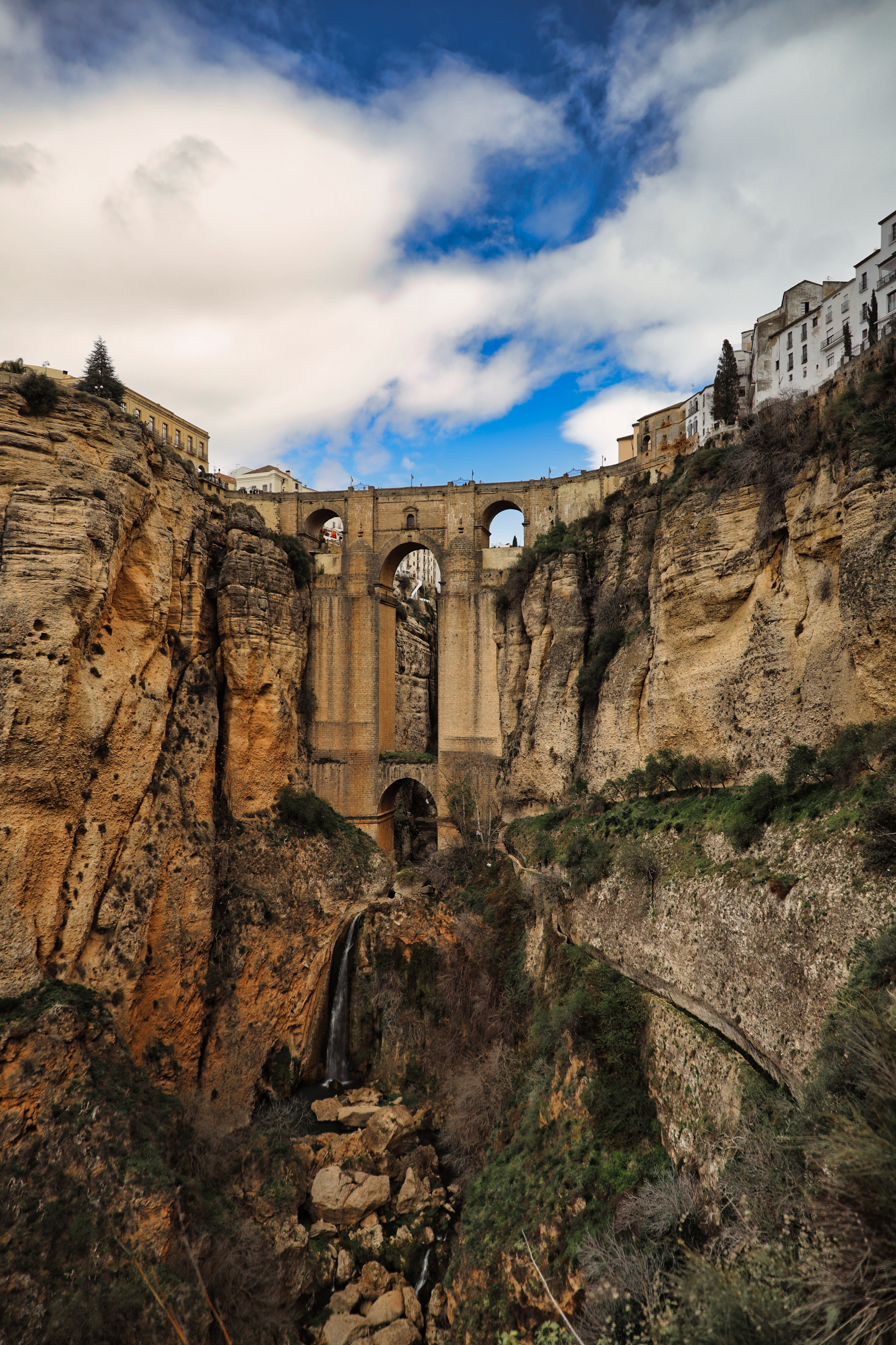
We then went to Ronda. It is a mountain town which is home to the birth of bull fighting, which is not why we went in the slightest, however I wanted to see this bridge. The Puente Nuevo bridge is crosses a gorge over about 300 feet.
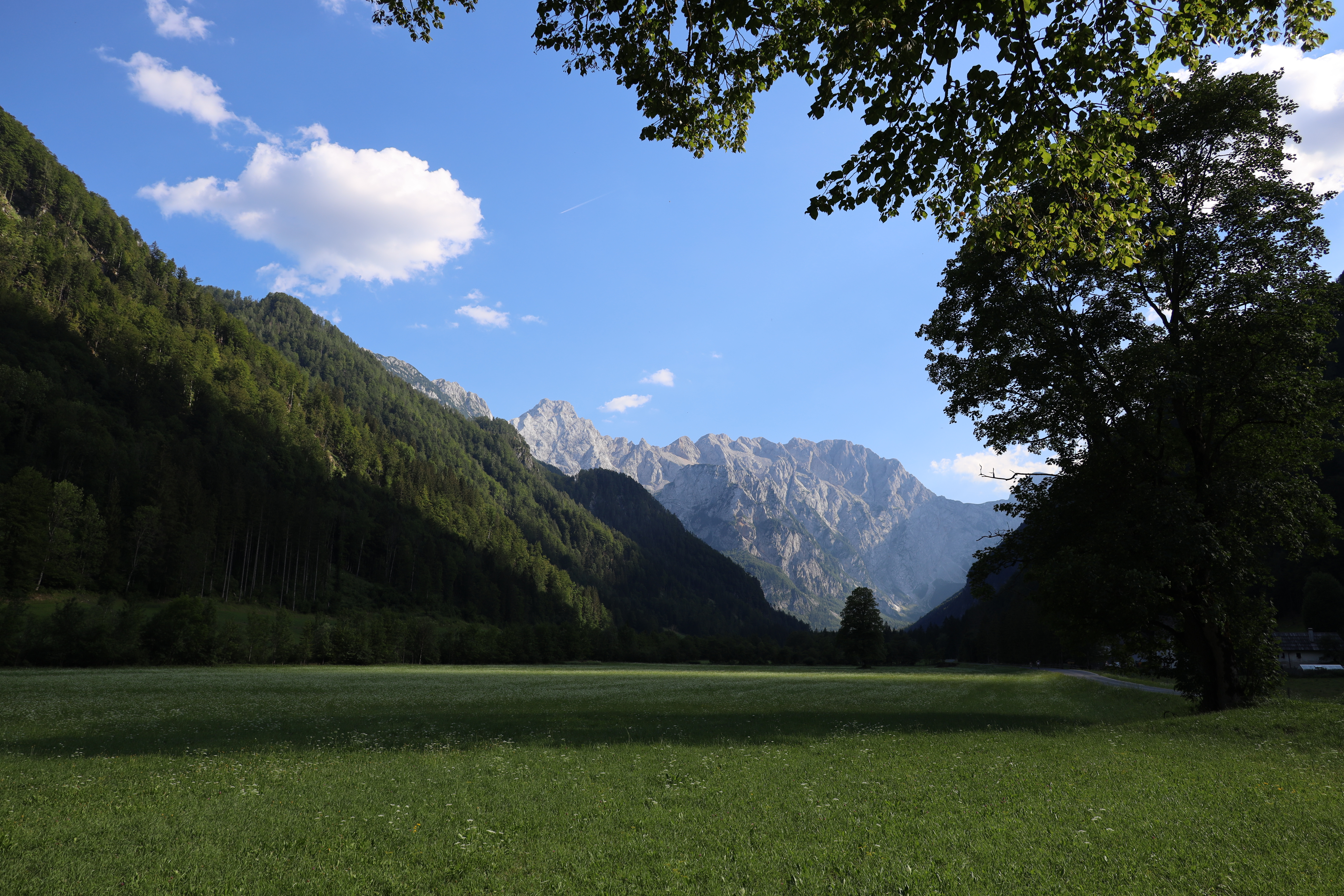
The Sierra Nevada

The Sierra Nevada mountain range is Spain
The Sierra Nevada view from La Boca de la Pescá 1518m

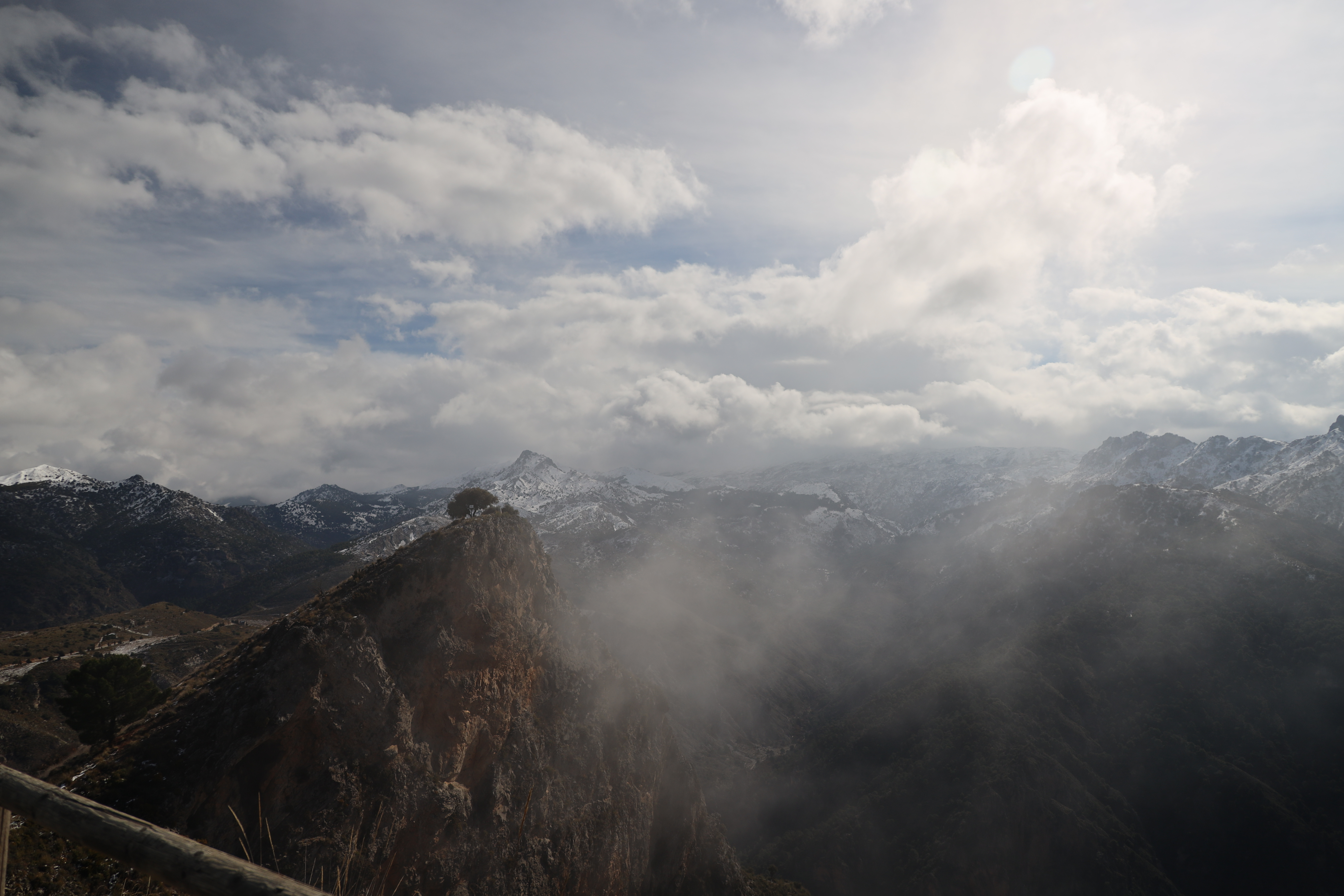
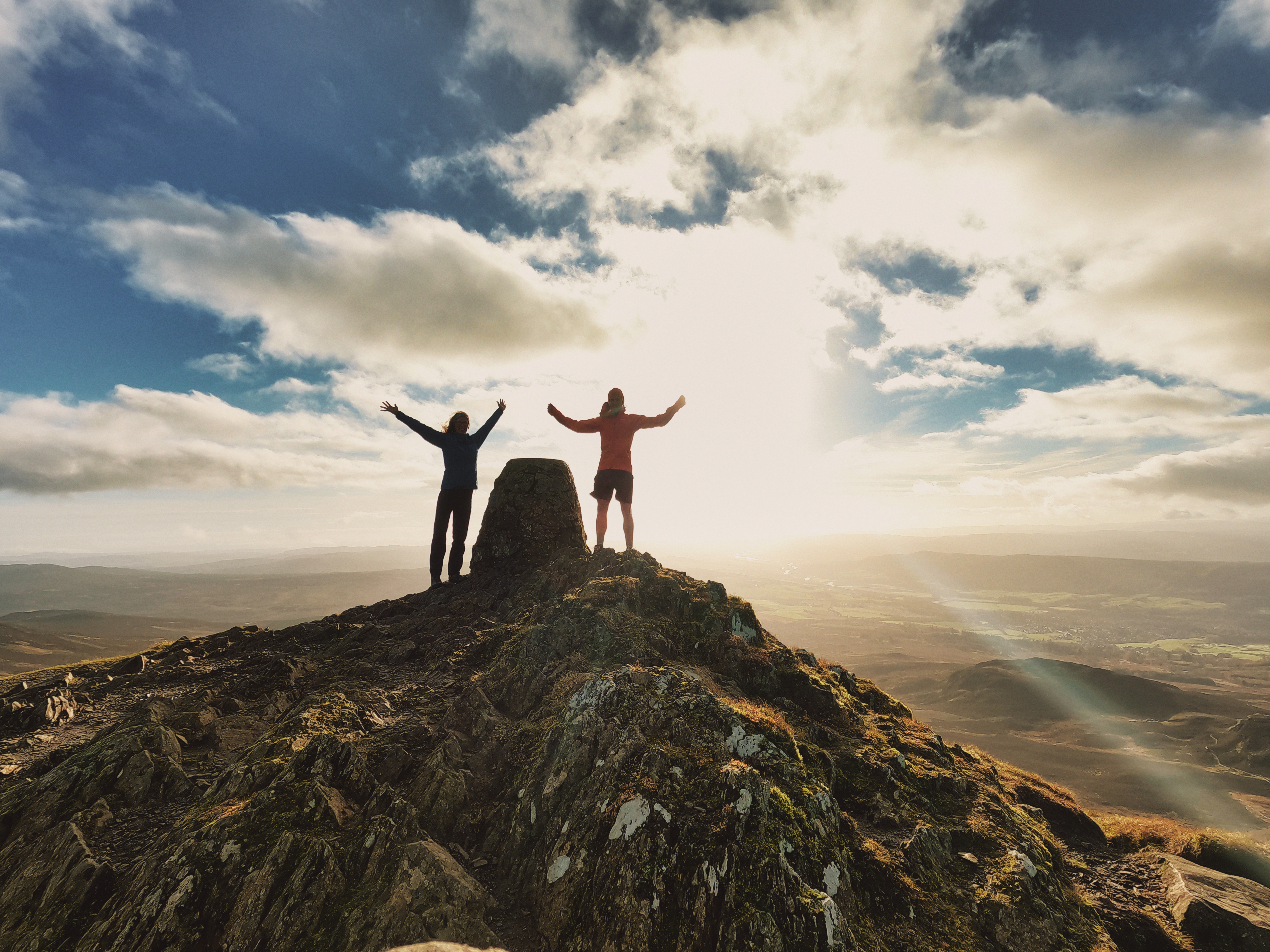
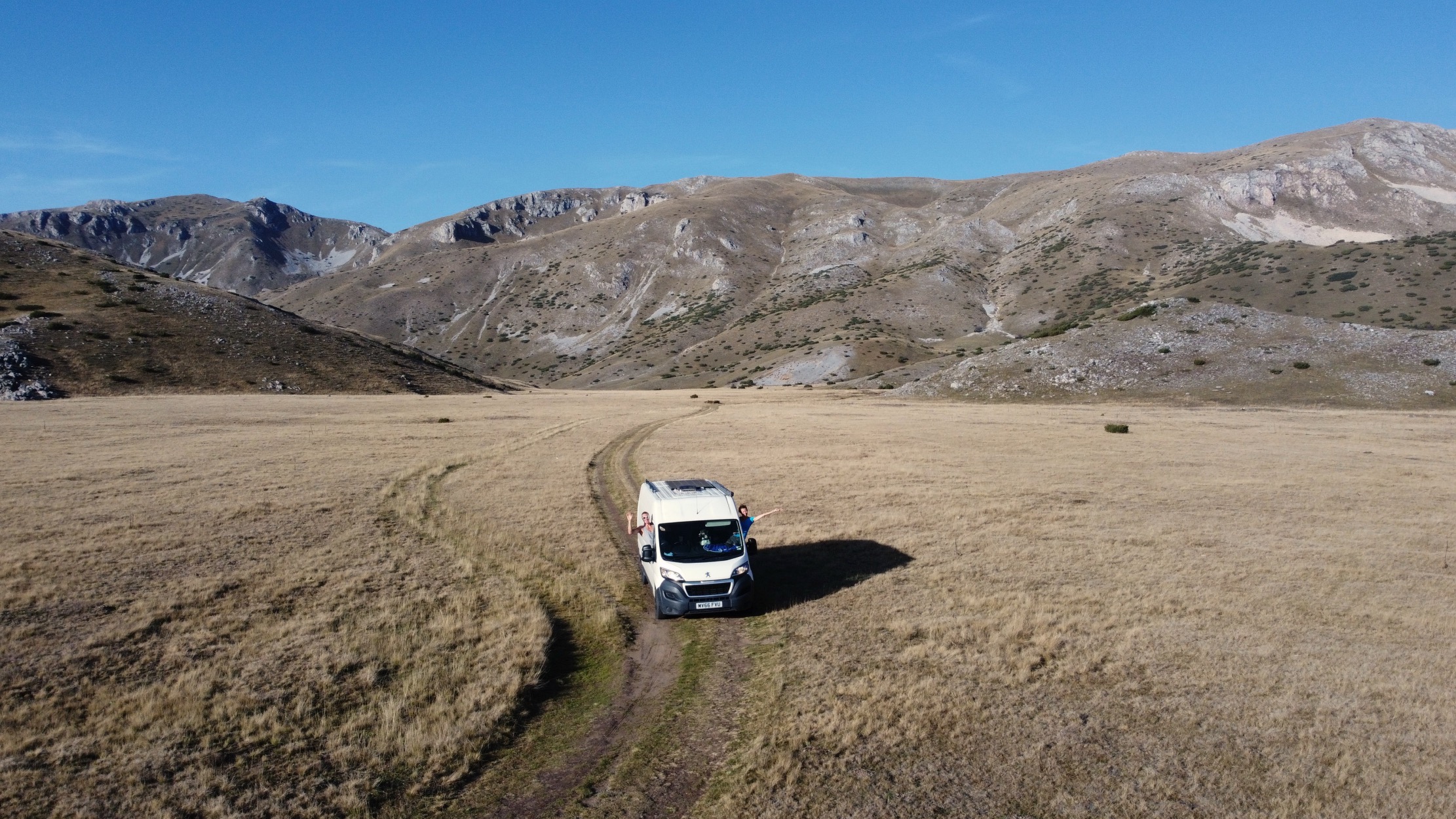
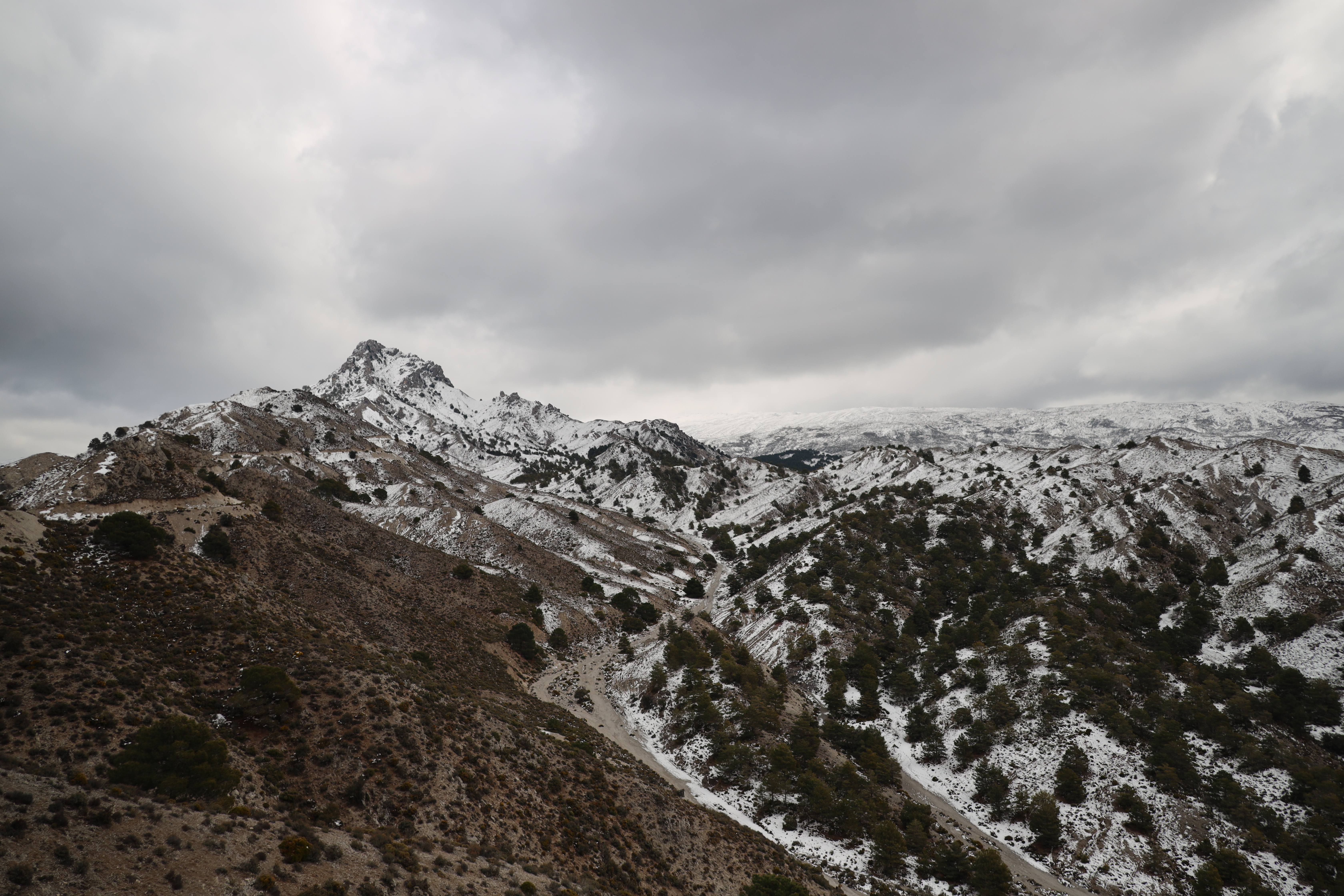
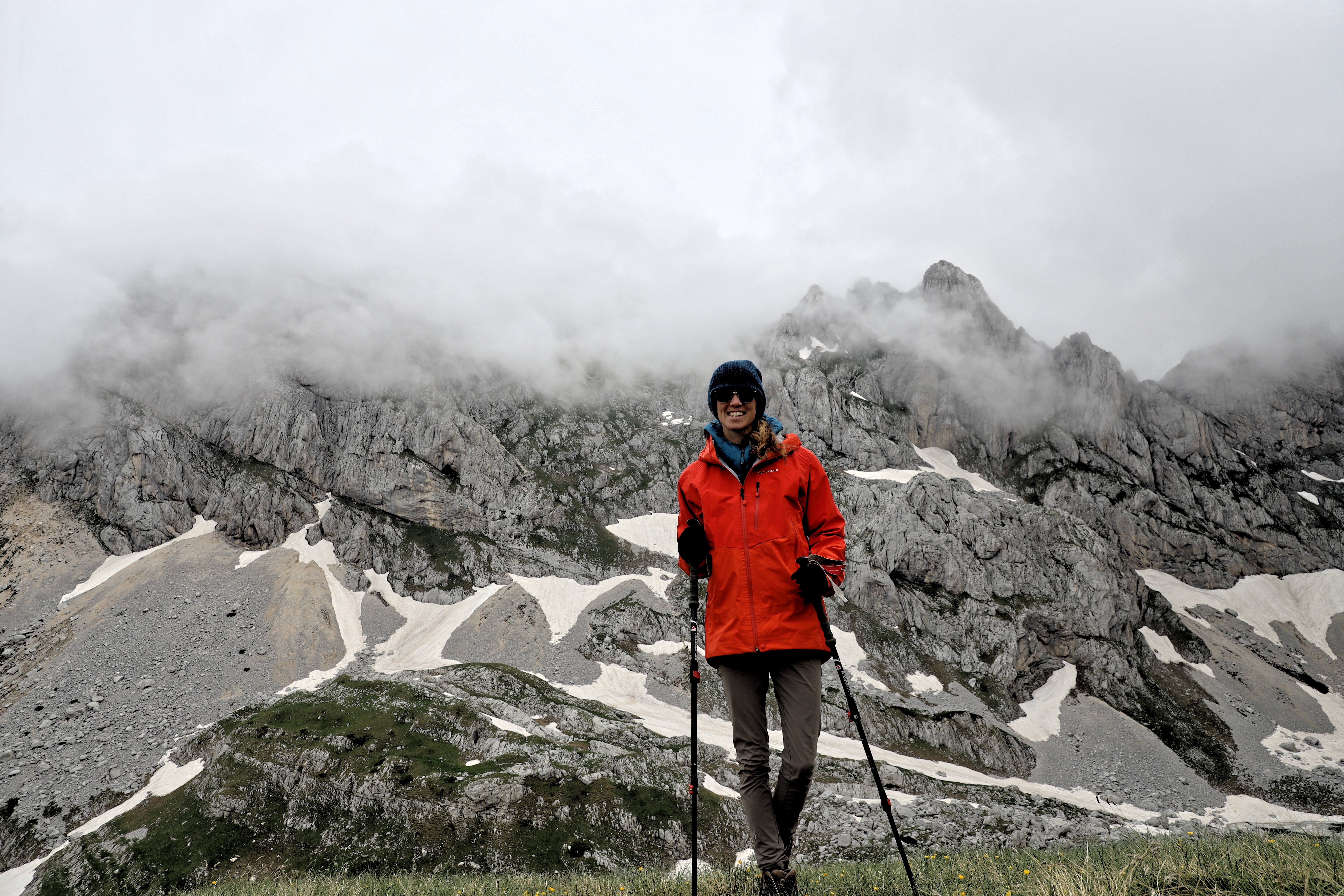
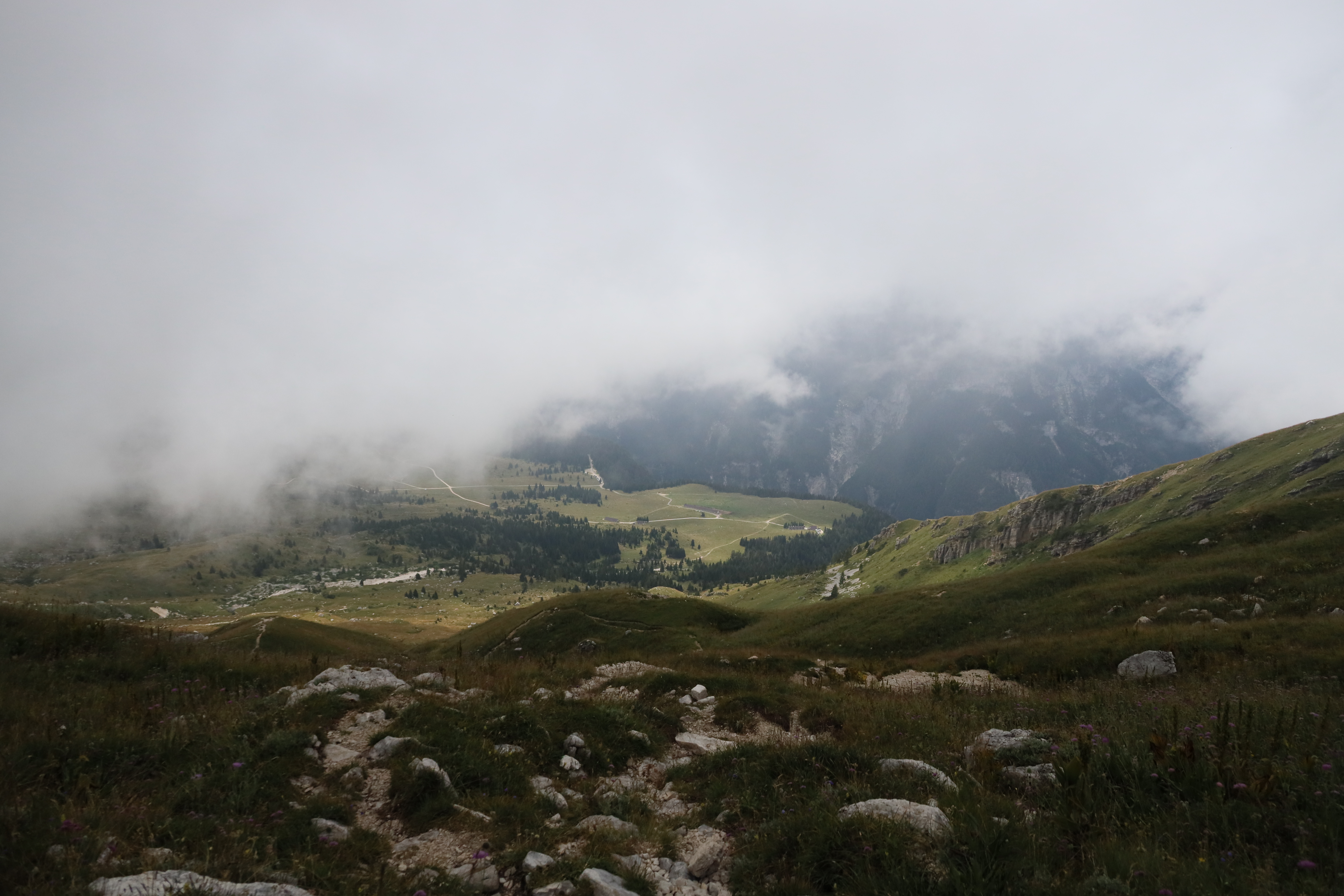
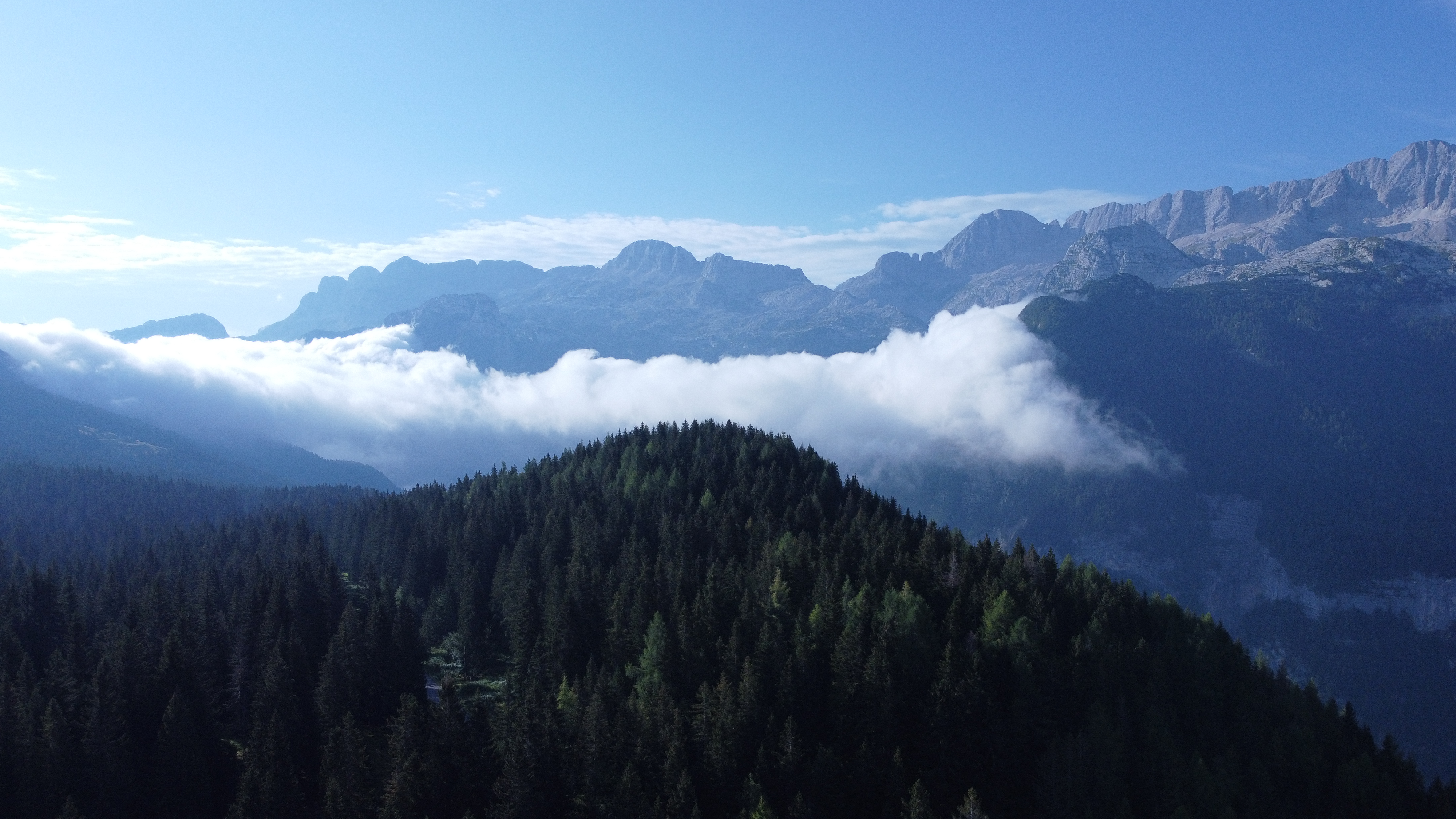
We spent three days in this beautiful national park. I have wanted to visit the Sierra Nevada for a while now as it is where you can find some of the biggest mountains in Spain. One of the walks we did was up Cerro del Trevenque (2083 m). We also did a circular route up La Boca de la Pescá at 1518m. Overnight Free Camp Location at Sierra Nevada: 37.0635514,-3.5585236.

Sierra Nevada Cerro del Trevenque 2083 m
Cerro del Trevenque (2083 m)

We then headed to the coast for a few days where we visited Almeria and had a brake pad change, then overnight at beachside town of Roquetas de Mar. Overnight Free Camp Location at Roquetas de Mar: 36.80440897142173, -2.576065098369255.

Carboneras
Carboneras

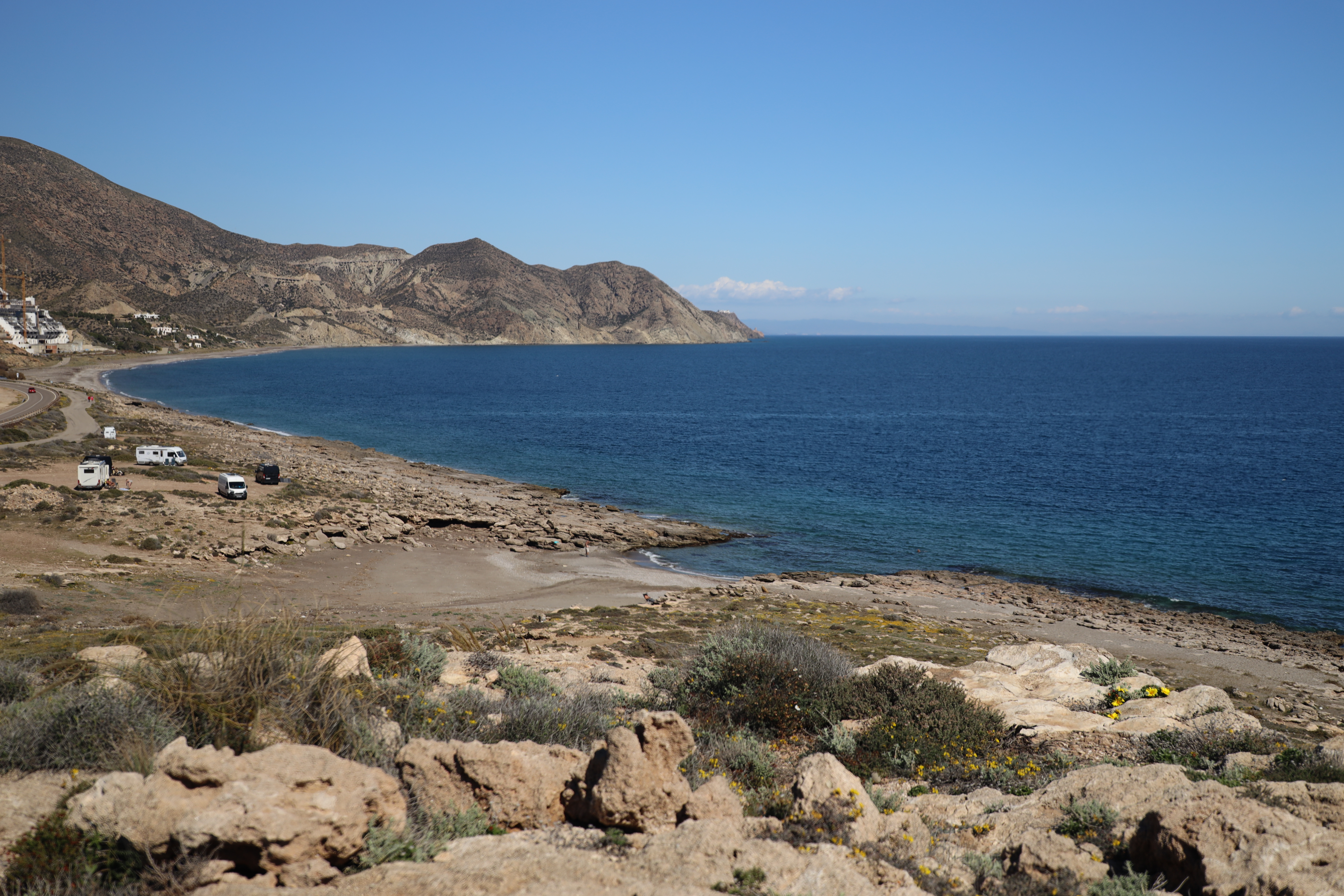
Then we went over to the quiet cove of Carboneras where we went for a swim, walked up the Torre del Rayo and explored the ‘Templo Hippie de Miguel Ángel’ before heading inland to the Sierra Espuña National Park.

Templo Hippie de Miguel Ángel

Top of page ↑

Sierra Espuña

La Santa, just outside Totana

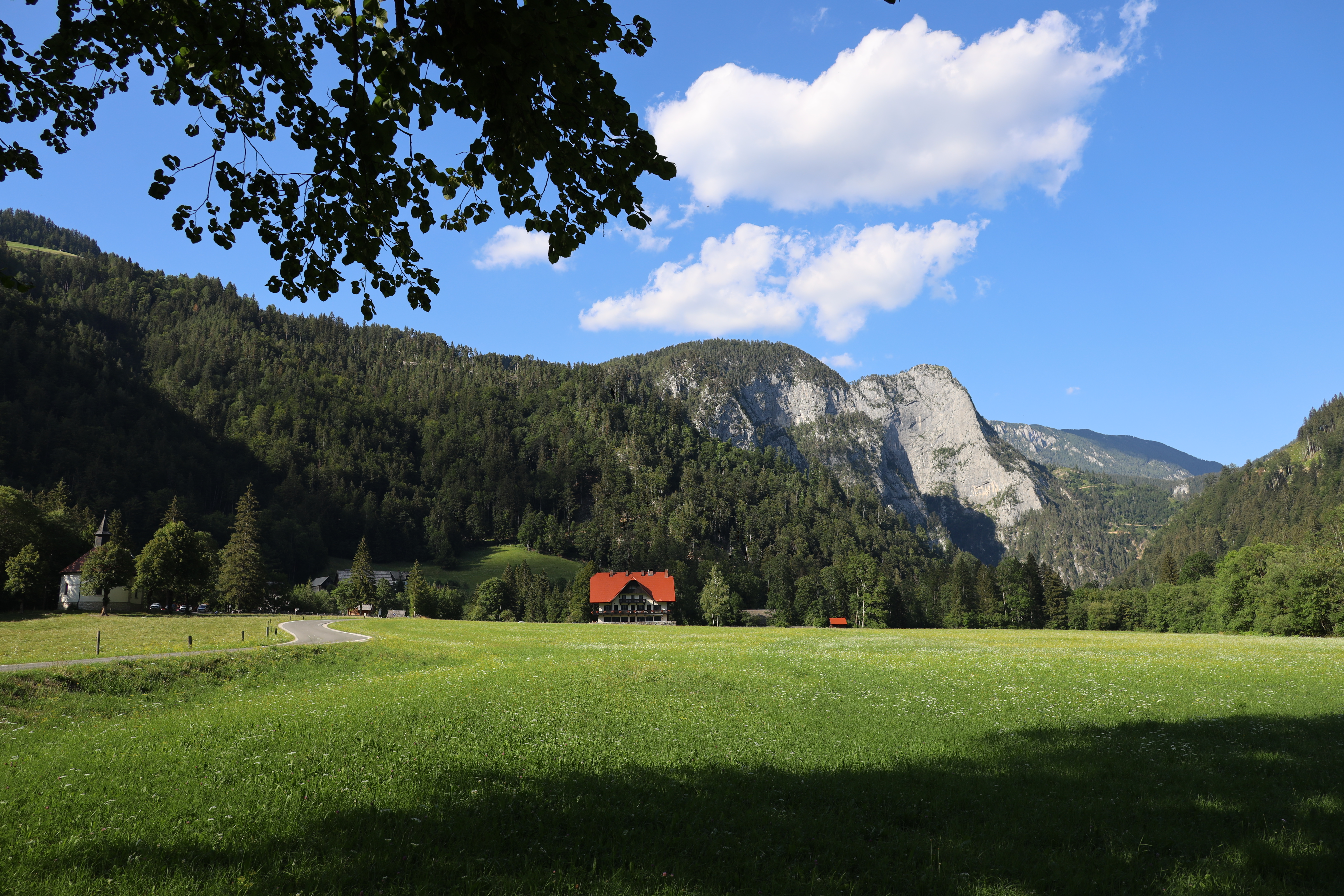
I have been to the Sierra Espuña, just outside Mercia, once before with Julia (read the article here) and really wanted to go back with Mike. We stayed in the carpark at La Santa monastery which had an amazing cafe with great coffee! There were loads of walks and bike tracks around and we spent 3 nights here just exploring the mountains and the small village of Aledo.

Some of the CamperGuru team

After leaving the mountains we met up with the CamperGuru team who we are working with to help create an awesome website for cool and unique spots to sleep for campervanners. After this we stayed along the coastline at Santa Pola as there was good signal, good weather and the 6 nations was on!

Cala del Faro de Santa Pola

We bypassed Alicante and headed up into the mountains above Benidorm to a free campsite outside the small mountain village of Castell de Castells. Here we did a couple of walks through the olive groves and up into the mountaintops. Then we stayed at a campsite in Campbell which is going to feature on CamperGuru. Will post the link here when it is live.

Castell de Castells olive groves

We were going to head to Valencia for the Fallas Fesival however the Sahara sandstorm came over and now there is just a storm and it is raining so we couldn’t see any fireworks so just headed to a monastery in the hills above Valencia to sit it out.

Monserrat Mountain Range outside of Barcelona

The weather has turned and so we have decided to drive up the coast to go hiking in the Monserrat Mountain Range near Barcelona. Now, instead of heading inland at Tarragona towards the Pyrenees we are going to take the ferry to Italy for the better weather. We will take the Barcelona to Civitavecchia ferry with Grimaldi Lines. Our tickets have a cabin which I think will be useful for the 20 hour, overnight journey.

Top of page ↑

Italy

Riserva Naturale Regionale Montagne della Duchessa

When we arrived we headed inland to the mountainous national park after visiting some thermal pools.

Cusano Mutri, Province of Benevento

We drove to Cusano Mutri in the Province of Benevento as we didn’t want to drive the coastline between Rome and Naples. We found this beautiful mountain top village and an easy park up spot. We were shown around the village by an 83 year old man who spoke no English and then had amazing pizza at Millenium Pizzaria.

Pompeii
Pompeii

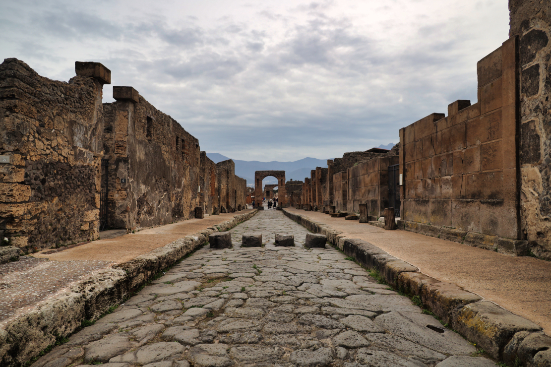
We then drove to Pompeii which was really interesting. We stayed at a campsite we found on CamperGuru as we didn’t want to risk free parking as we heard stories about van break ins around the Naples area.

Port of Acciaroli
Port of Acciaroli

We then decided to drive the other side of the Cilento and Vallo di Diano National Park in the province of Salerno along the coastline. Probably wouldn’t advise this route unless you are in a VW T5 as this is probably the worst road we have been on! We did find some cool ports and beaches but the road was pretty tricky and falling away down the cliff at some points.

Alberobello trulli Unesco World Heritage Site

We visited the Alberobello Trulli houses which is now a Unesco World Heritage Site. I am so pleased we came here off season as it was pretty quiet, I would hate to visit in the peak season, you wouldn’t be able to move!

Puglia Sunset
Puglia Sunset

We spent some time in Puglia exploring the olive groves and beaches. We parked up one night on the west coast and watched a beautiful sunset as bats danced around our heads. After a few days exploring this area we took the ferry from Brindisi to Igoumenitsa.

Top of page ↑

Greece

Exploring the islands off Lefkada

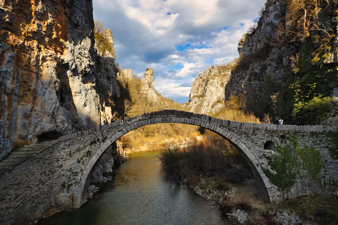
From Igoumenitsa we took a few days to get to meet our friends on the island of Lefkada. We were based in the Town of Lefkada which makes a great place to stay to mountain bike, go out on the water, and hike. After this we went to Vikos Gorge  Pindus Mountains of north-western Greece. Eripus is the region and there were many bridges built between the villages of Zagori.

Pindus Mountains
Pindus Mountains

There are 45 bridges throughout this region connecting all 46 hidden villages, apparently paid for by a wealthy resident or a nearby monastery the local priest to help the locals go about their business and the goods to be imported.
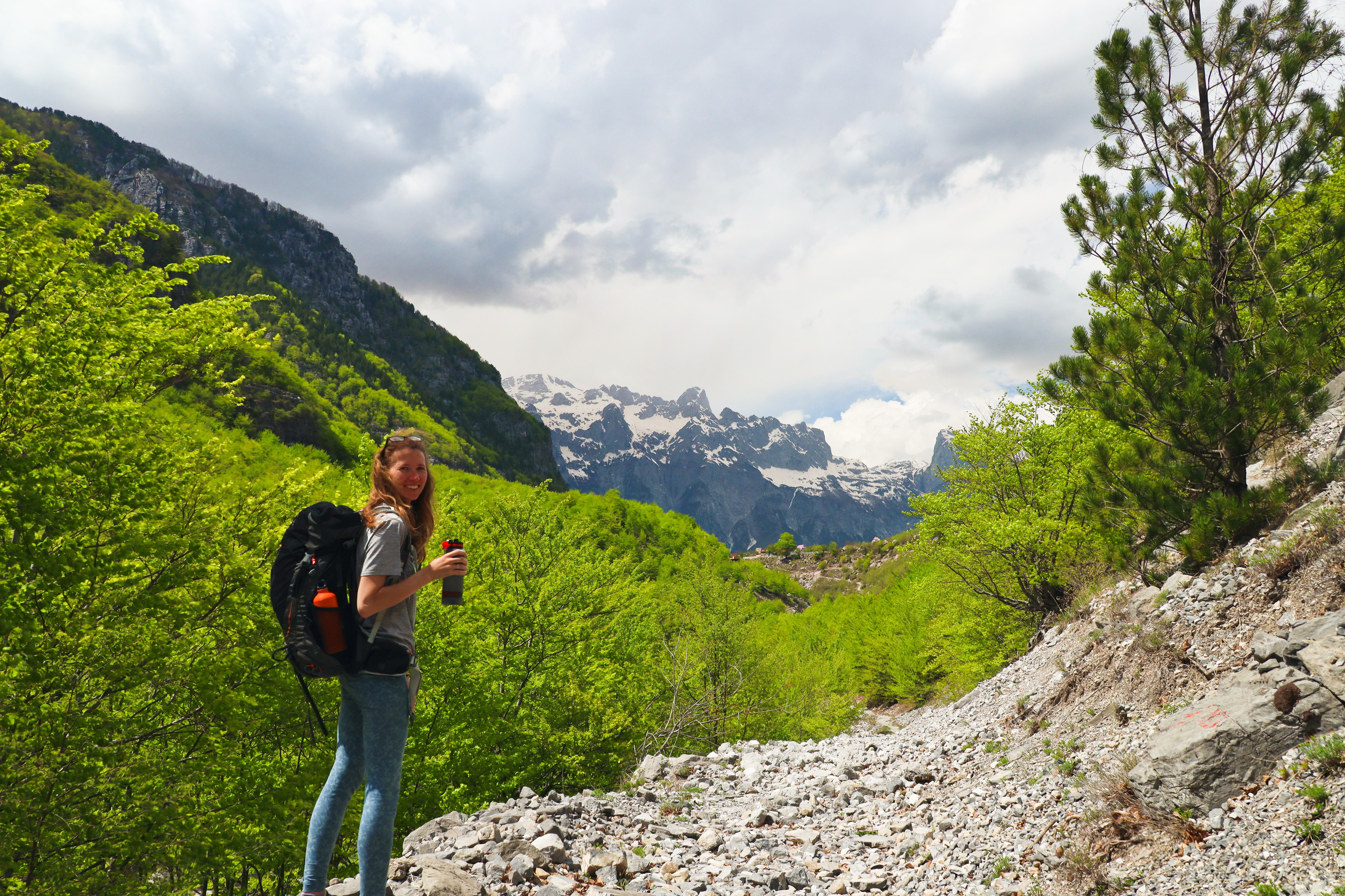
Pindos Mountains Bridge

Top of page ↑

Albania

From the mountains we headed further north into Albania. At the border of Kakavia we were asked for our passports and the vehicle ownership document, which we showed the V5C which seemed to suffice. Our first port of call was to pick up a sim card from Vodafone in Gjirokaster. We got 30gb for 2000 Leke which is about £13. The secret tip I will now share with you is to download the My Vodafone AL app to get an extra free 10gb.

Permet Hot Springs
Permet Hot Springs

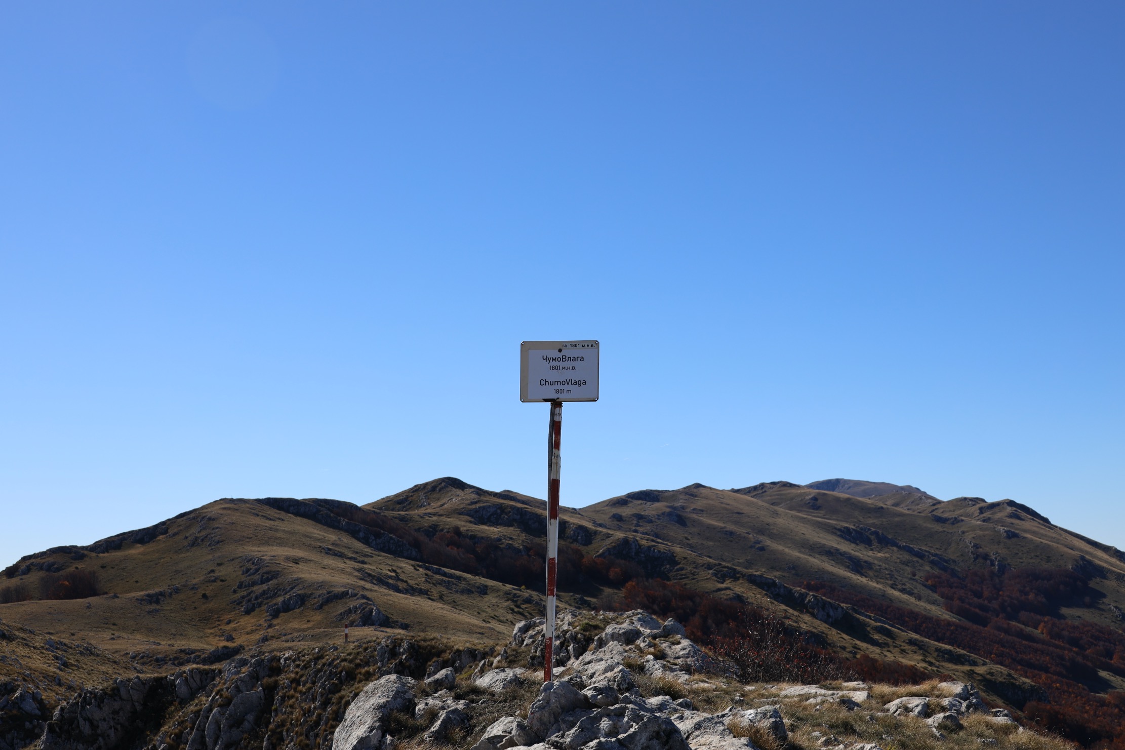
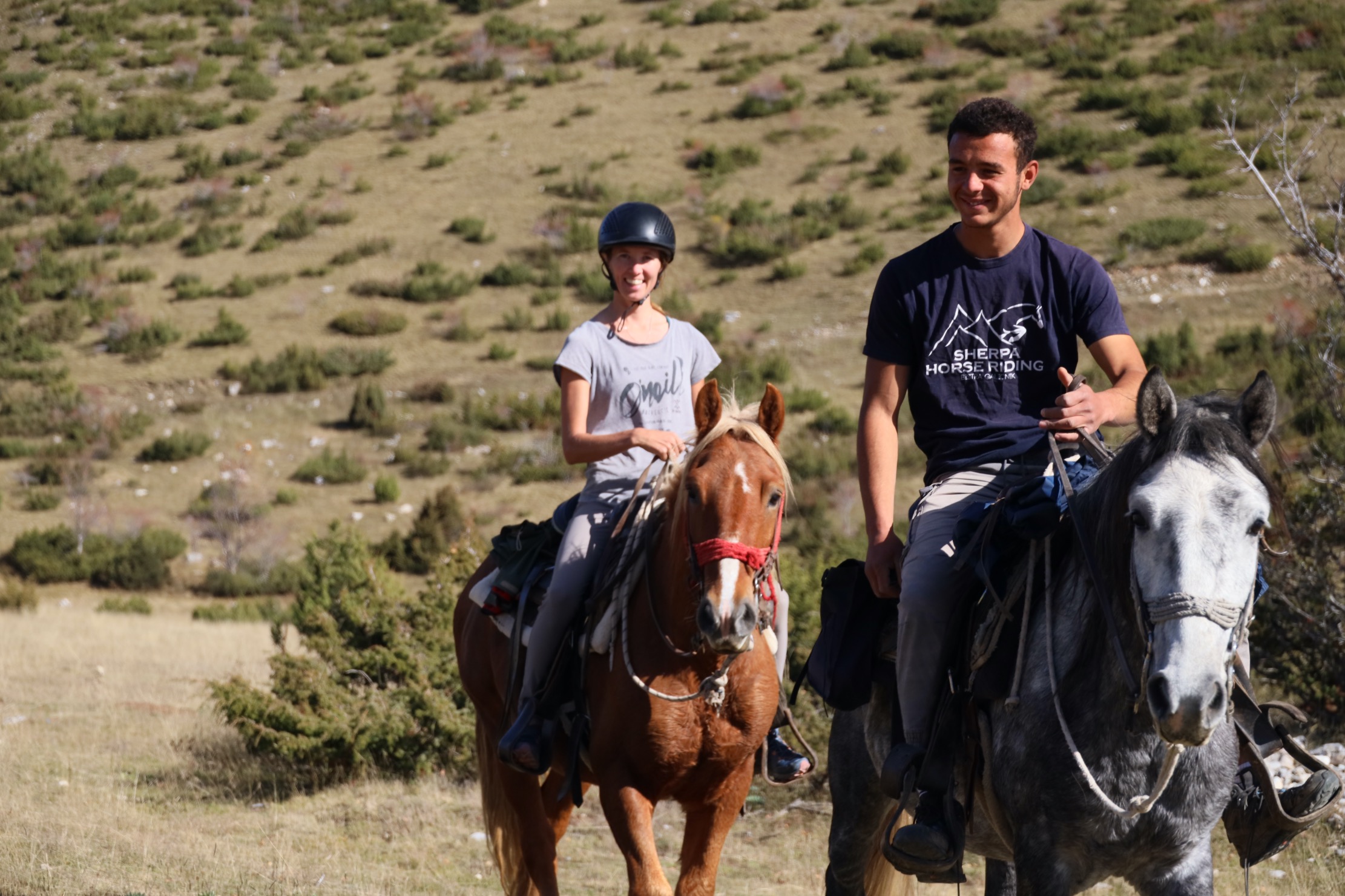
From the UNESCO town of Gjirokaster, and after visiting the castle, which was amazing, we headed into the moutains to the Lengarica Canyon and to stay in a meadow at Permet Hot Springs. There were about five other vans and a few stray dogs which we fed. There was only one walk which was an eight mile circular route along and over the canyon which was pretty cool.

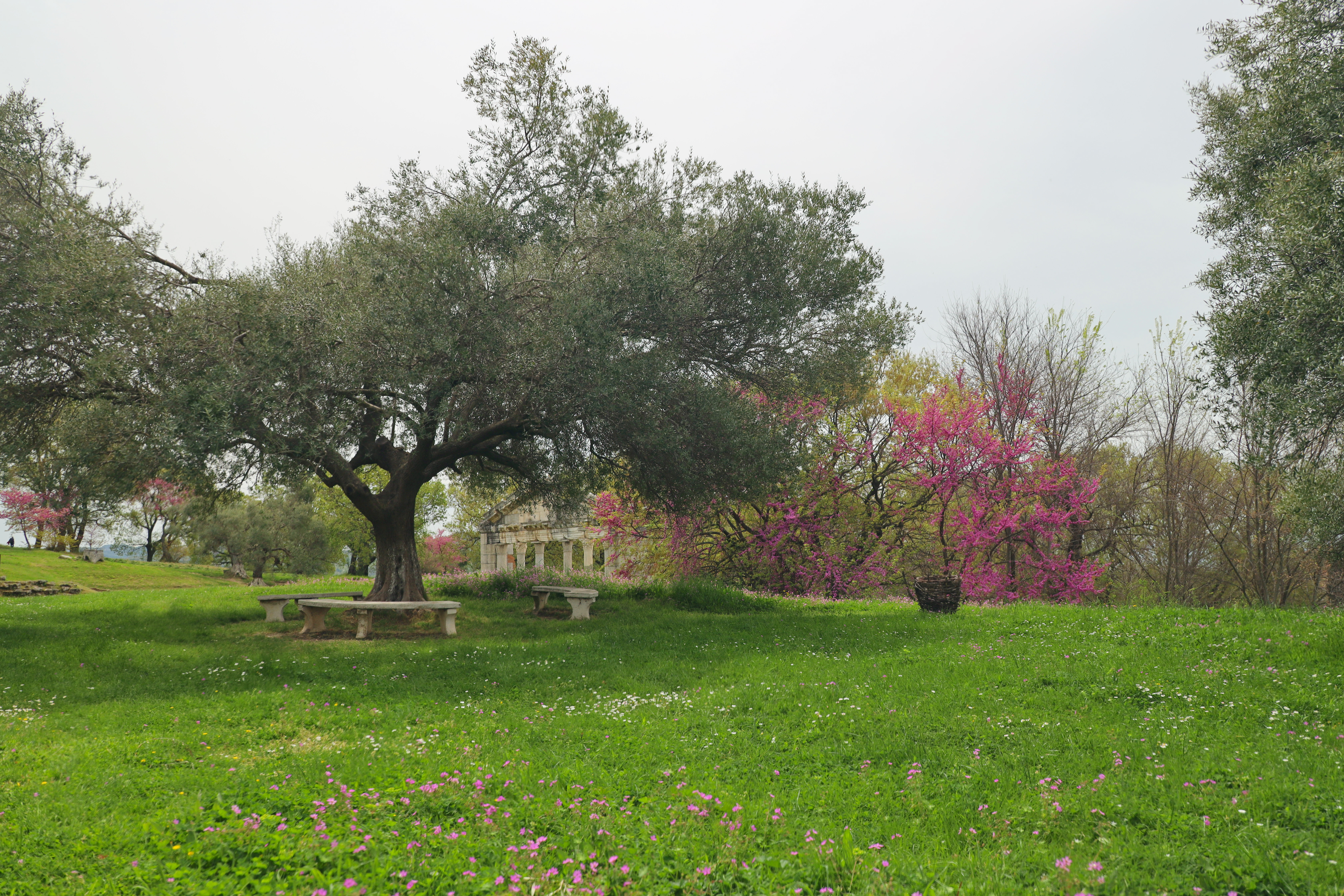
We drove to Vlore and then to Berat, which was okay but probably wouldn’t go back there because Vlore had loads of building work going on and it actually was really smelly, which I wouldn’t normally mind but this was pretty intense, the beaches were full of litter and the stray dogs looked in such poor condition. Berat castle was nice to look around and we had lunch at this highly recommended place, Temi, which turned out to be pretty average. The highlight to the few days in that area was a trip to Apollonia. It is a really preserved archaeological site which is really easy to get to in a van. The information boards are in English, French and Albanian.

Apollonia
Apollonia

We spent then a few days at Buona Vila near the Shkumbin river which flows down from the city of Elbasan. It is near the Divjaka-Karavasta National Park which is great for wildlife but also full of litter that has flowed down from the mountain villages and from the city.

Top of page ↑

Buona Vila
Buona Vila

Here at Buona Vila we made some amazing friends, Serge, Haffsa and Luca were a French/German/Moroccan family travelling in their amazing van and we really got to know them well and had a right laugh. One evening together we had a bonfire with marshmallows and in the distance we saw another bonfire, which turned out to be a cabin on fire, whether it was deliberate or not who can say, but Mike did see car headlights drive down that dead end track about 20 minutes before we saw the fire..

Syri i Ciklopit
Syri i Ciklopit

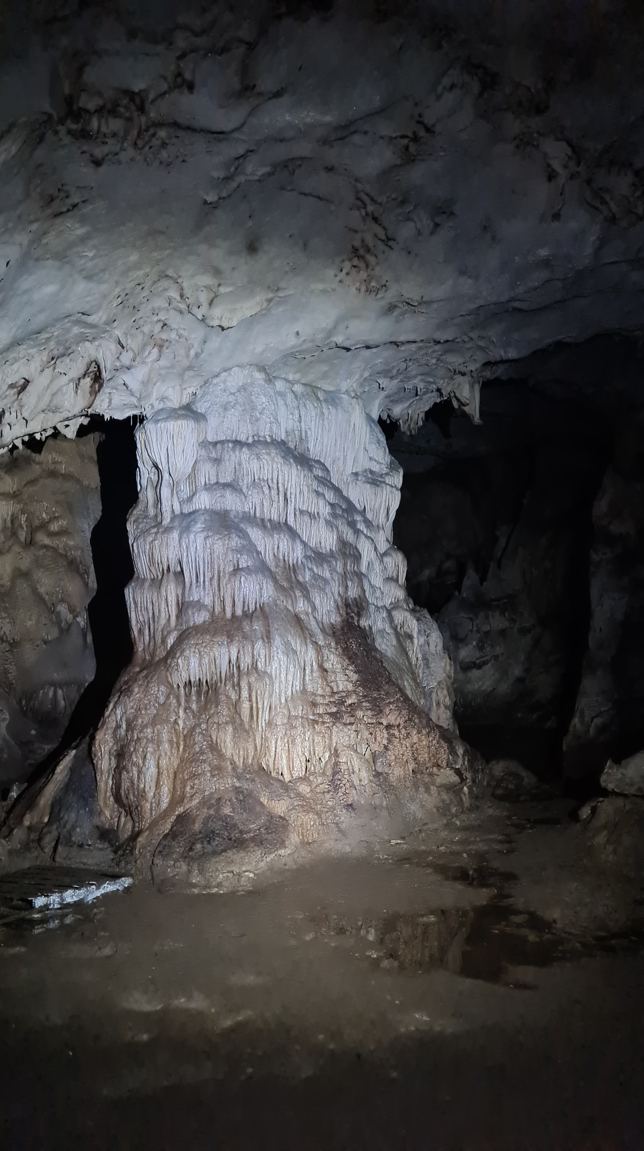
The Syri i Ciklopit cave near Tirana was amazing. There was a great place to park at a restaurant where we had dessert and a drink before heading further north. The walk to the cave takes about 45 minutes and the restaurant owner asks if you need a guide, we didn’t, it’s only one track, but his son will try and follow you and get money from you to use him as a guide, but with a firm ‘no’ he backed off. The cave was one of the most amazing caves I’ve been in, remember to take a head torch!

We thought about heading into the mountains from here up to Ulza Regional Nature Park and beyond, but as we got to a park up we found on Park4Night we weren’t 100% convinced. We went in for a drink and then decided to turn around as the weather was due to come in with a whole load of rain. We then drove further north to near Shëngjin.

Bar Ledh, Kune Shëngjin

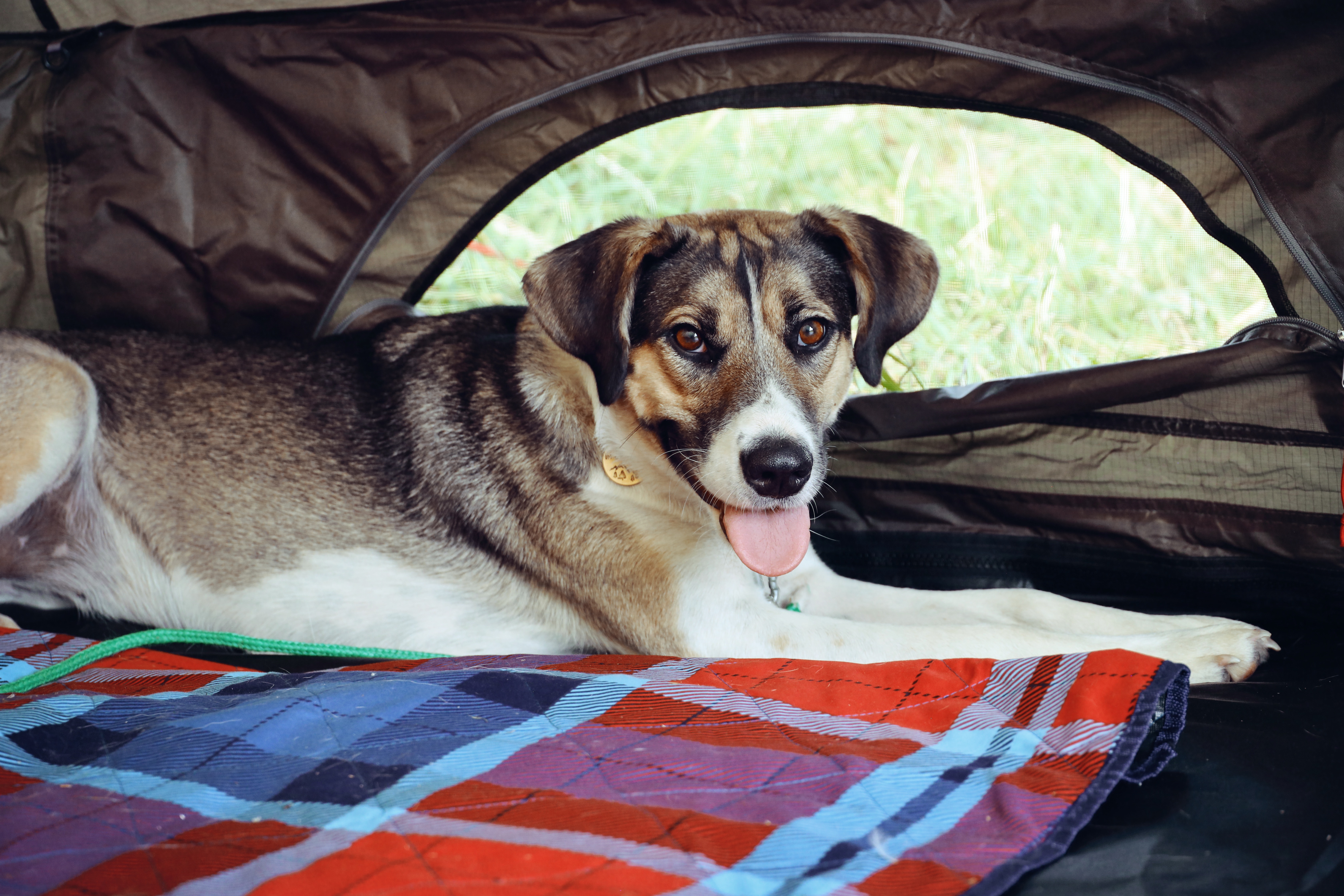
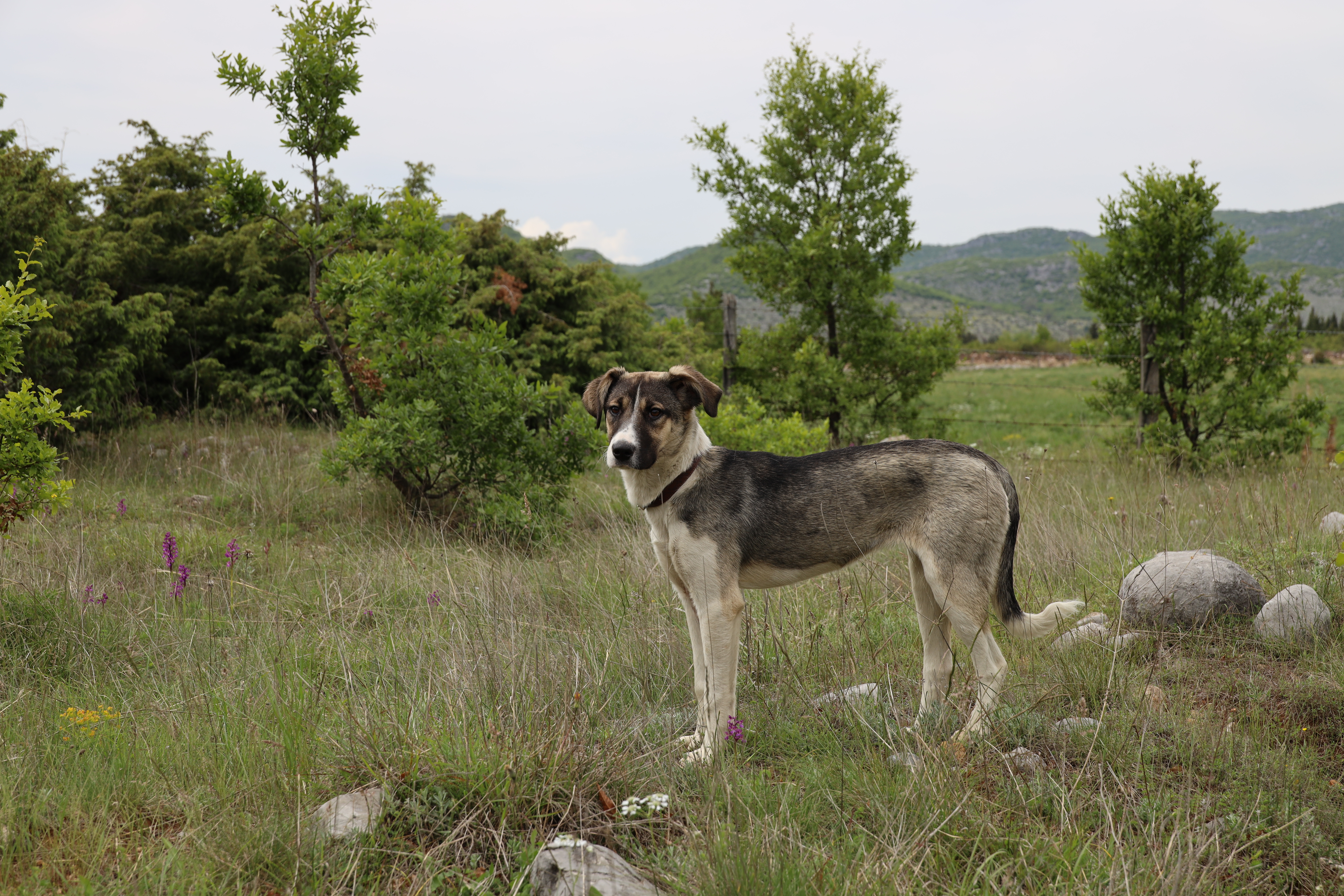
This next location is where we have done something which has changed our life. At Mario’s Bar Ledh, near Kune Beach, near Shëngjin we adopted a stray dog, Alba. You can read about that story in full here.

Alba
Alba

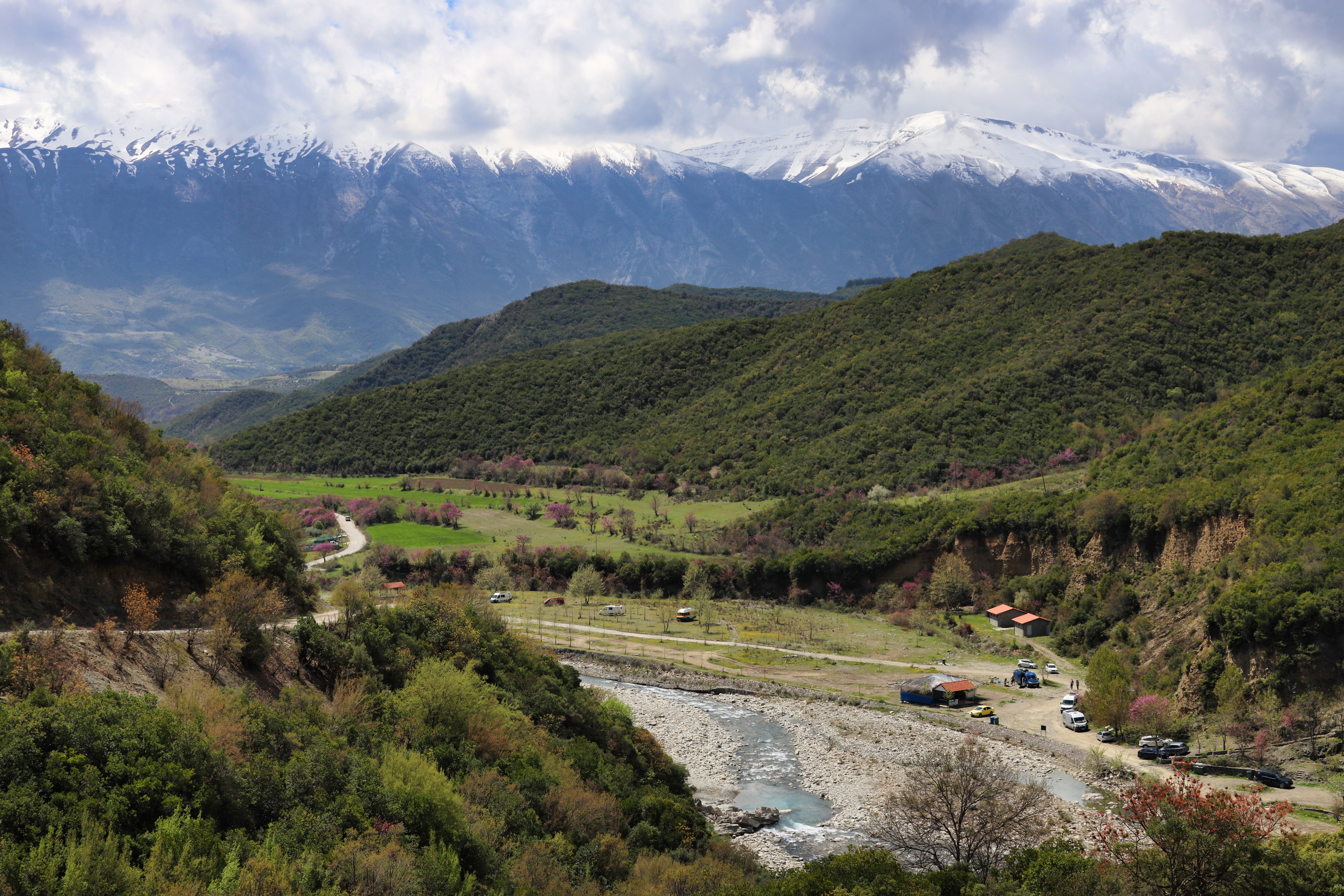
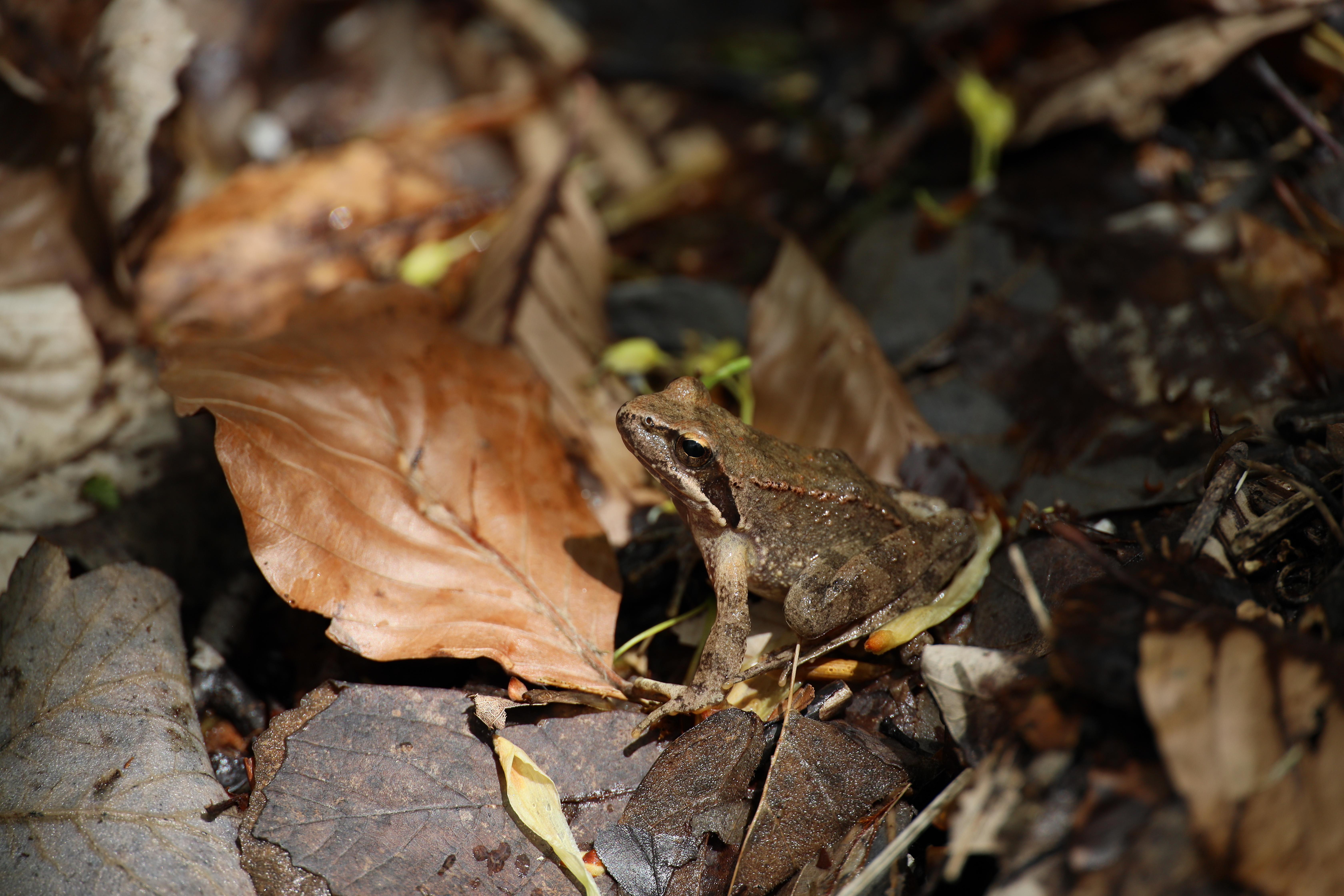
We then spent a few days at Thethi National Park which was beautiful. The drive up was pretty steep and took a fair amount of time. I managed to use my Water to Go refillable filter bottle here as there were rivers and waterfalls all around.

Thethi National Park

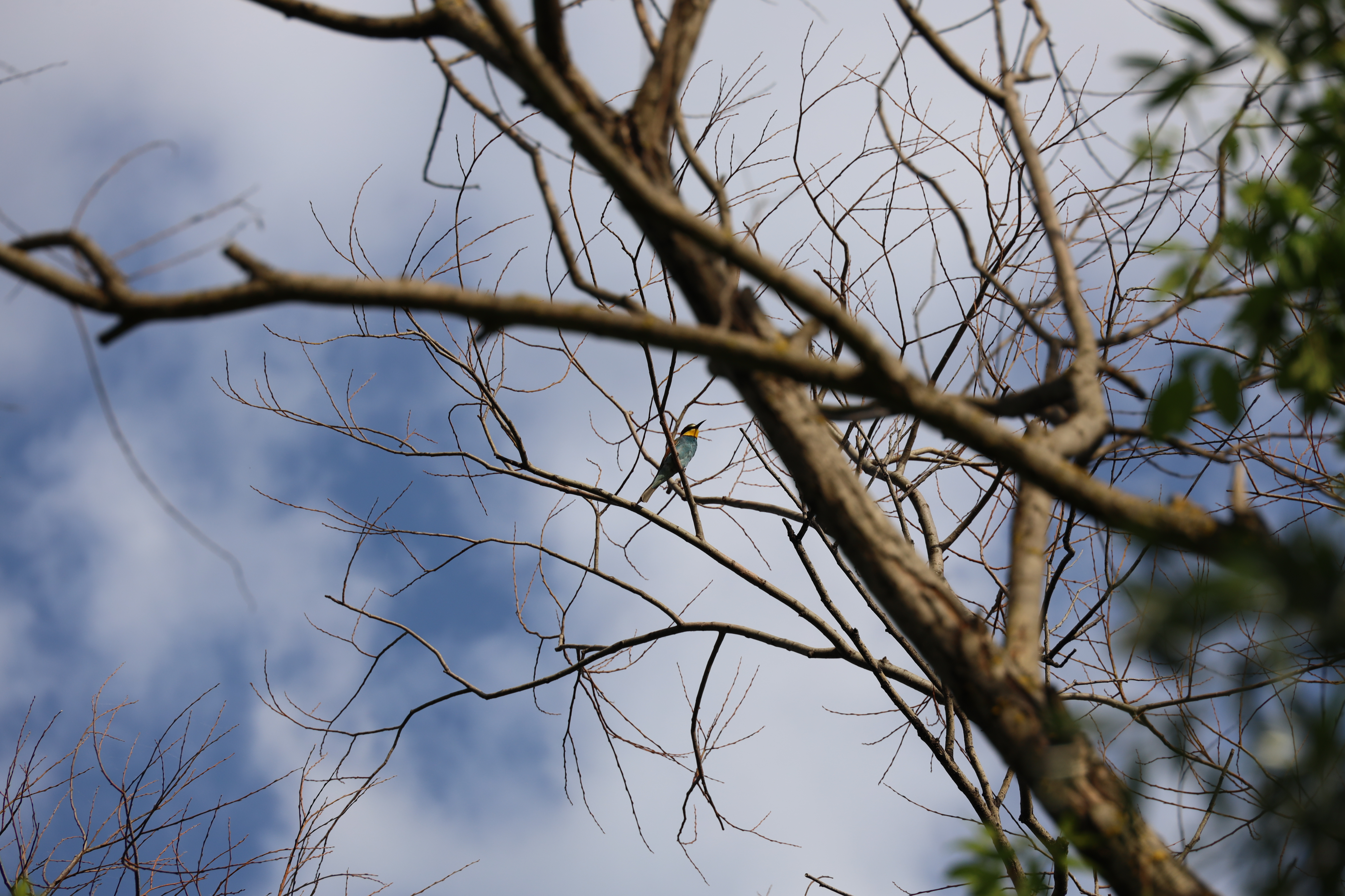
There was some beautiful wildlife in the national park, birds of prey, wild horses and lots of amphibians.

Wildlife of Thethi National Park

We then stayed around Shkoder until Alba, our newly adopted dog, could get her next jab. We stayed on a campsite, which you can find out more on CamperGuru, here, which was right on the lakeside.

View from Lake Shkoder Campsite

Top of page ↑

Montenegro

Pavlova Strana Viewpoint

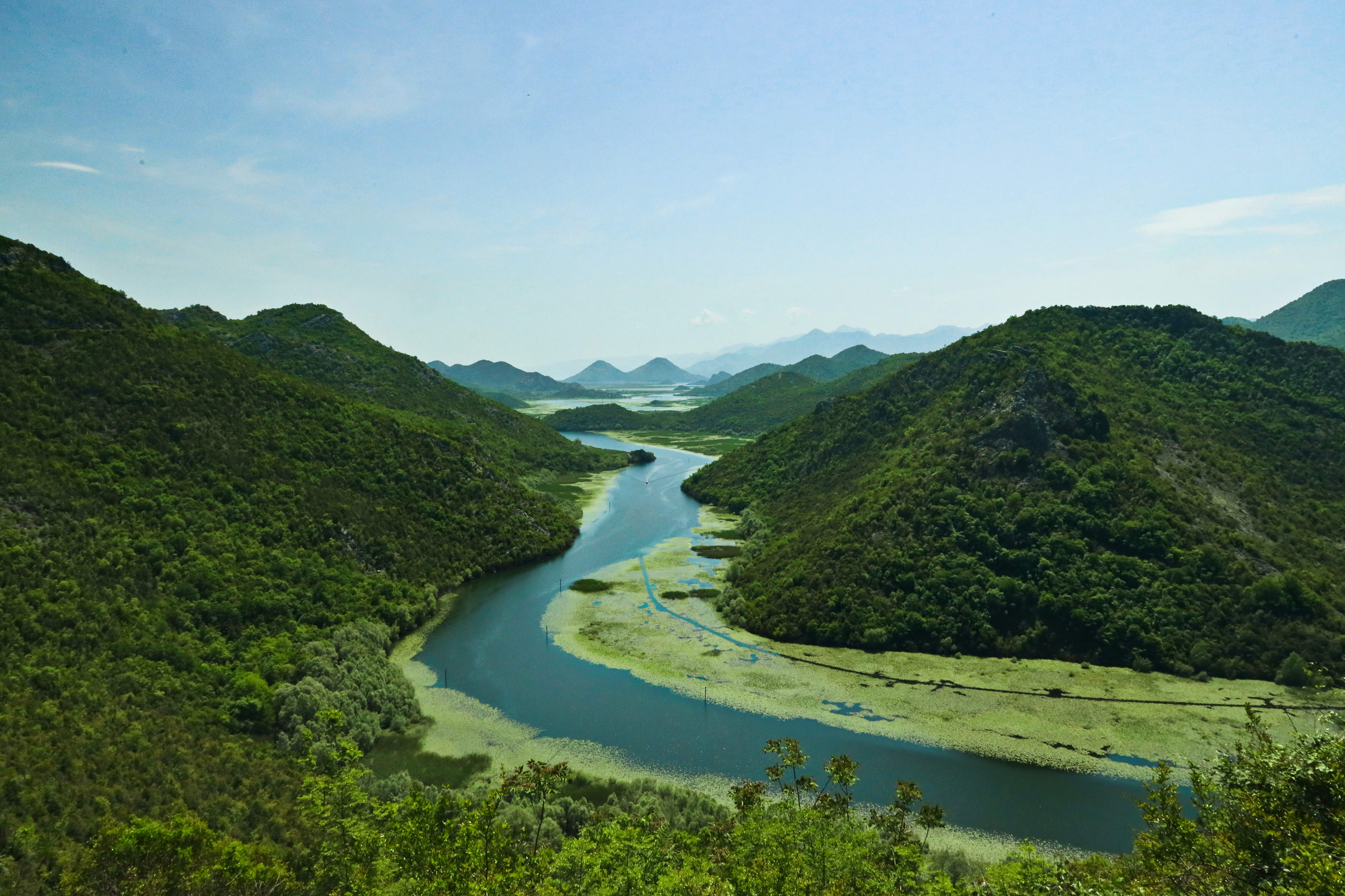
We drove into Montenegro and were pulled over at the border, but no asked to open the van, they just asked us some questions about where we were going and what the trip was for. We then drove along the edge of Skadar Lake National Park. Which is the same place as Shokder, just spelt differently.

Rijeka
Rijeka

We parked up at a dock near this cute little village and met a Spanish couple who were lovely, they had two dogs and so Alba made some new friends. We were asked to not sleep at that spot so we just pulled up to the roadside in this village and then back back to the spot the next day.

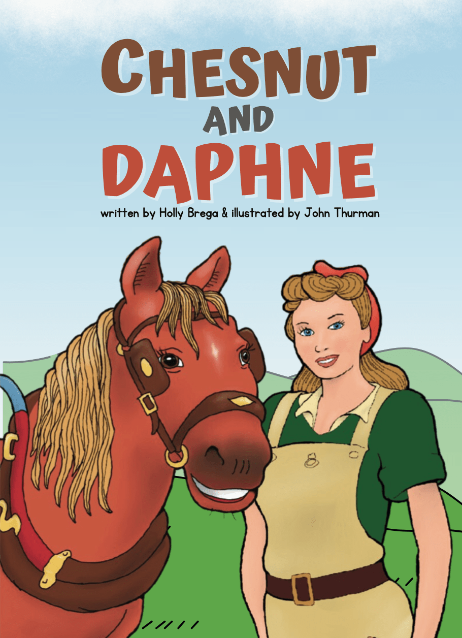
From here we had to head back to Podgorica as I had to fly back to launch my new children’s book ‘Chesnut and Daphne‘. We had a wonderful wedding with Guy and Sophie and Mike had a fun time travelling with Callum too. Top of page ↑

We’re back in action!

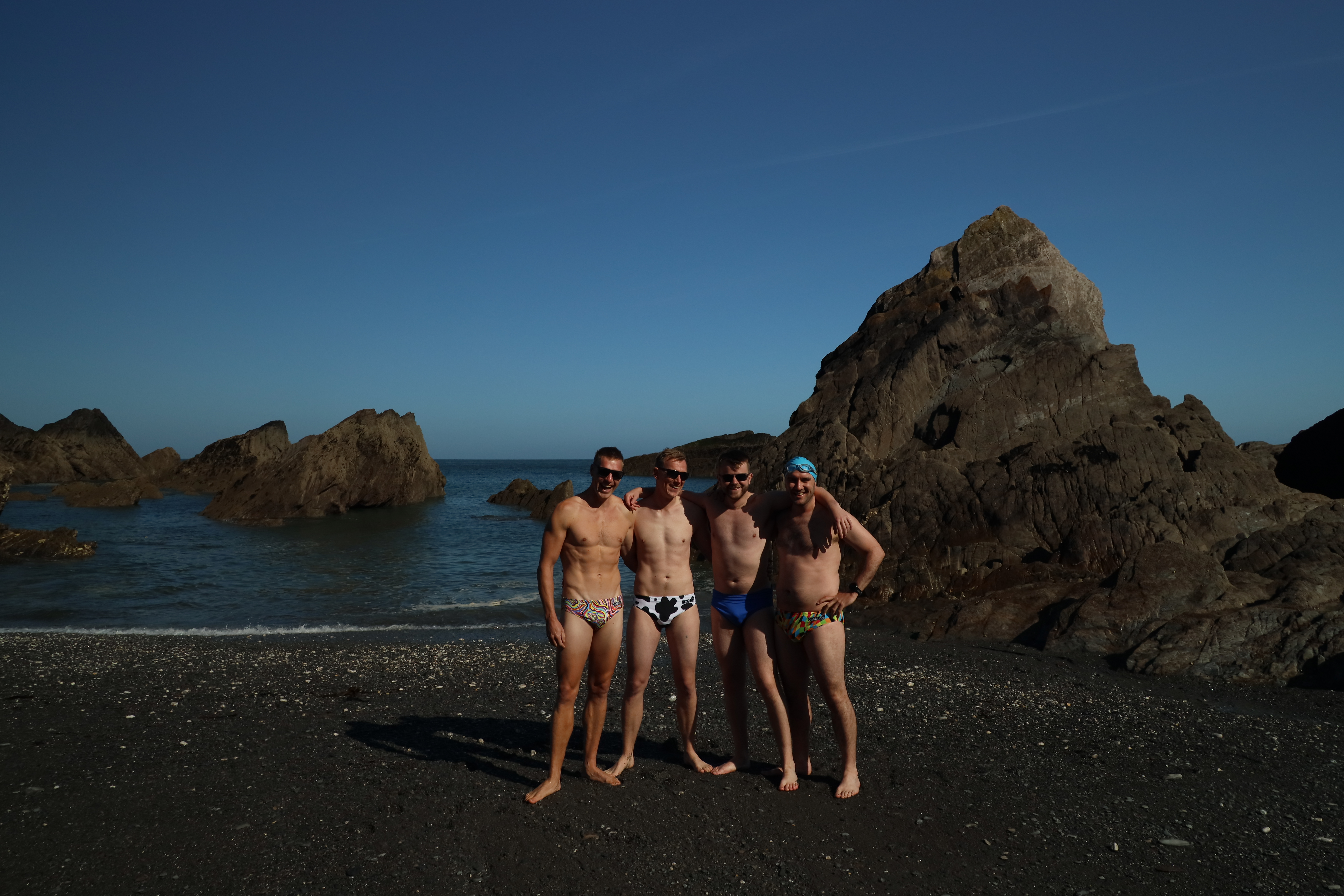
We had a fab time at home and seeing all our friends – congratulations to Guy and Sophie on their beautiful wedding in Devon. The boys went for a morning swim in their OddBalls budge smugglers!

Guy and Sophie pre-wedding swim at Tunnels Beach, Ilfracombe, Devon

Back in Montenegro we went to stay with Mike’s brother, Stephen for a few days to check out his new cabin in the hills above Kotor. He is also writing a blog which can be read here.

Kotor Cabin in the Woods, Montenegro

After visiting the cabin we went down the coast to Budva Old Town where we had a lovely meal within the walls of one of the oldest urban towns on the Adriatic.

Top of page ↑

Budva Old Town Marina

After exploring on foot Budva Old Town we drove further along the coast for a really quiet overnight spot on Luchina Beach at Petrovac, then we headed north to Biogradska Gora National Park.

nose horned viper
nose horned viper, Vipera ammodytes

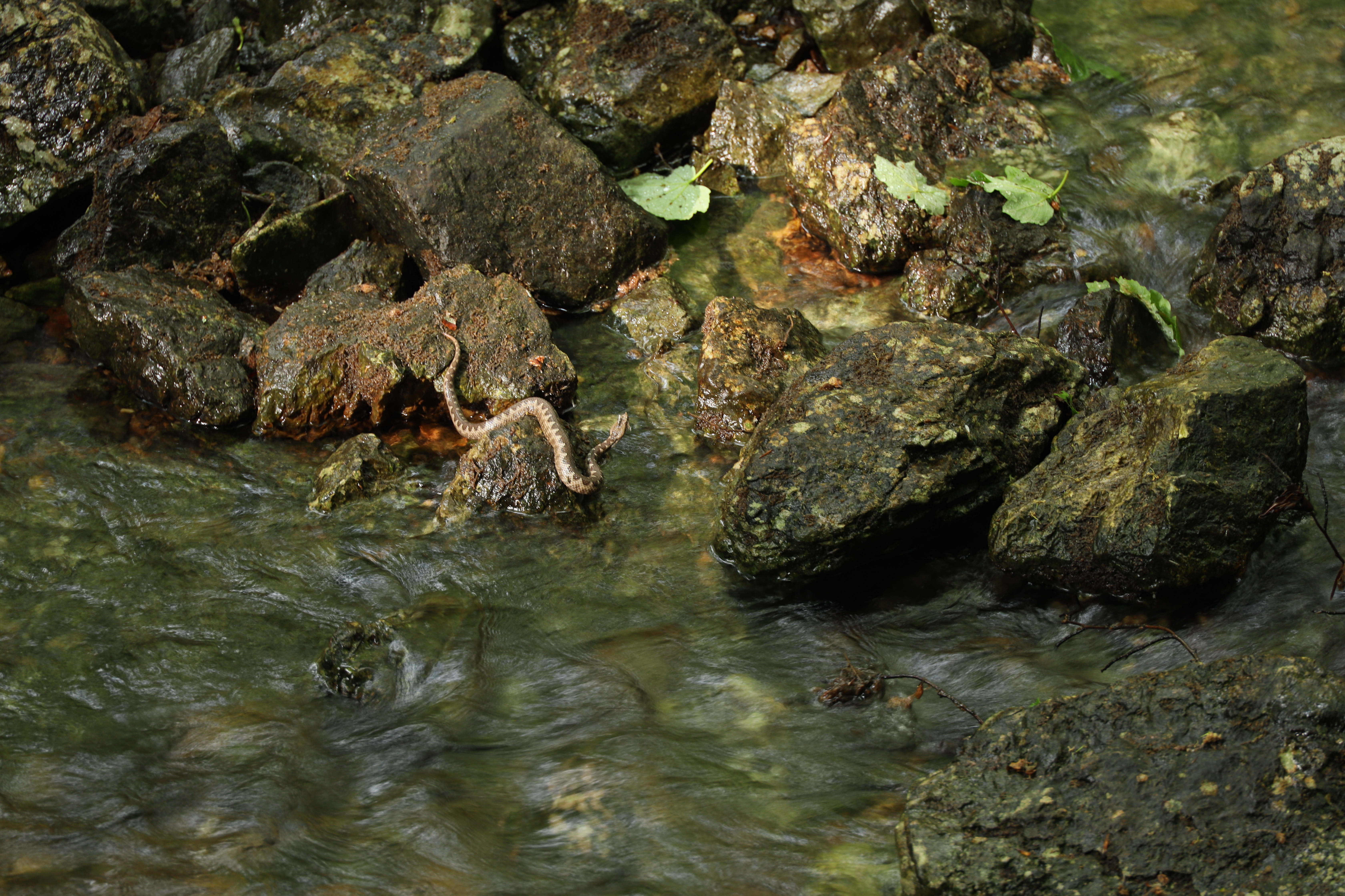
It was €3 each to enter the park and then if you want to stay overnight in the carpark it is €22 which is quite expensive for the fact you are still in the Balkans, but we paid it, had a hot shower and the use of the toilets (squat toilets!) Here we did two walks, one around the lake, we went off course a little and saw a beautiful nose horned viper (Vipera ammodytes)! The second walk took us through the trees up to Bendovac. Grid reference for where we slept: 42.8963608,19.6010097. Top of page ↑

Biogradska Gora
Biogradska Gora

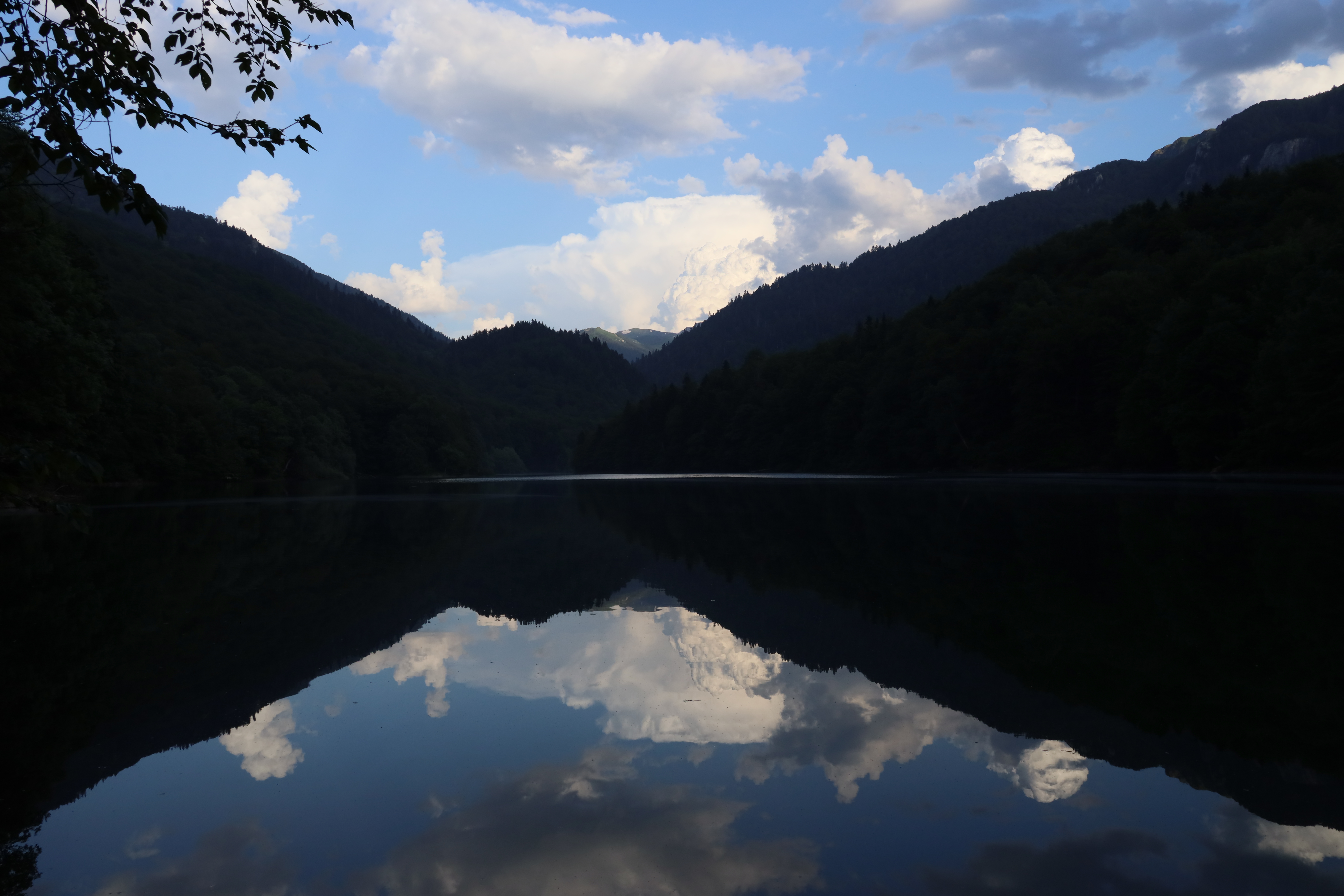
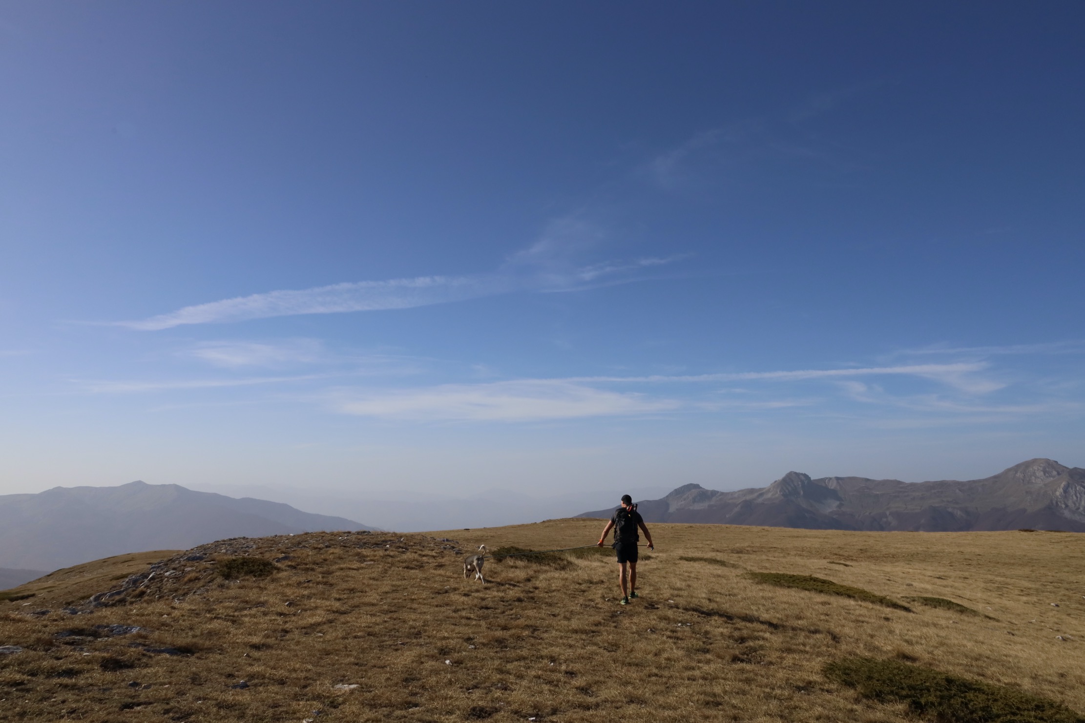
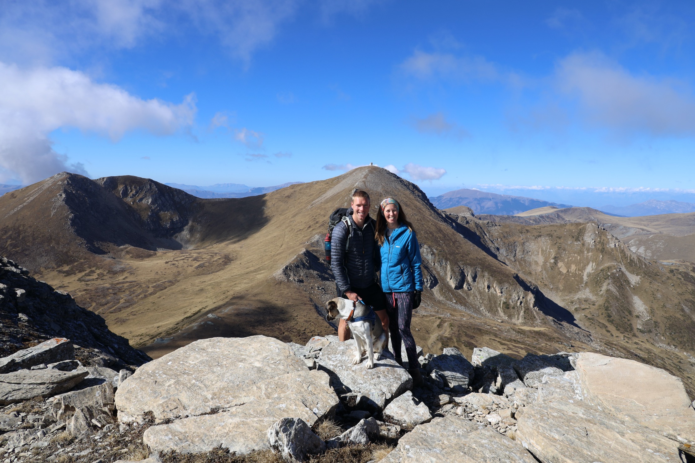
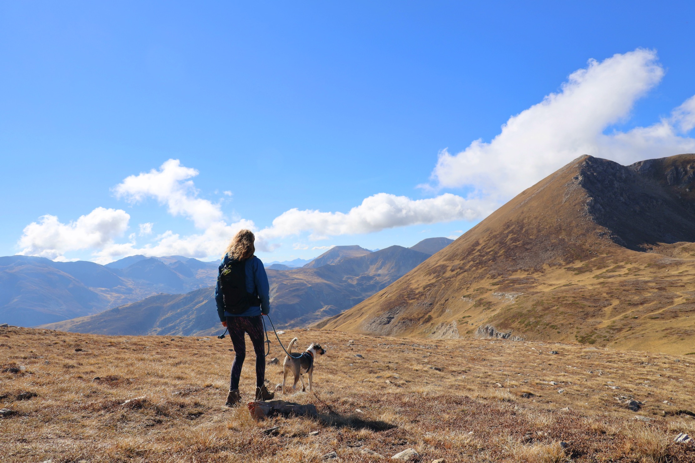
Durmitor National Park – this is probably one of our favourite places so far. We spent about 4 or 5 days here. We hiked to the foot of the tallest mountain, Bobotov Kuk. We didn’t go up as there was still snow and this was Alba’s first proper mountain day. There are so many cool places to park here, either at the abandoned ski lift or up on the Prevoj Sedlo mountain pass.

at the foot of Bobotov Kuk, Montenegro

CROATIA

After our visit to the mountains we decided to head back down towards the coast and go into Croatia back to the Prevlaka Peninsula. Here we met our friends Rob and Rabia and their dog they adopted from Albania, Gaia. We also made some new friends, Charlie and Tasha who have a great Youtube channel, you can check it out here.

Top of page ↑

We stayed here about a week or so. I will be uploading a full vanlife in Croatia blog soon. Watch this space.

SLOVENIA

Top of page ↑

We came into Slovenia from the south, just north of Karlovac, and headed for a night at Zuzemberk, we then found a climbing book in an Iglu shop in the capital. After this we went to scout out some climbing at a mountain side place called Creta, then to explore some castles, and north up to Logarska Dolina where we stayed for about one week before heading west towards Italy.

NORTH ITALY

Top of page ↑

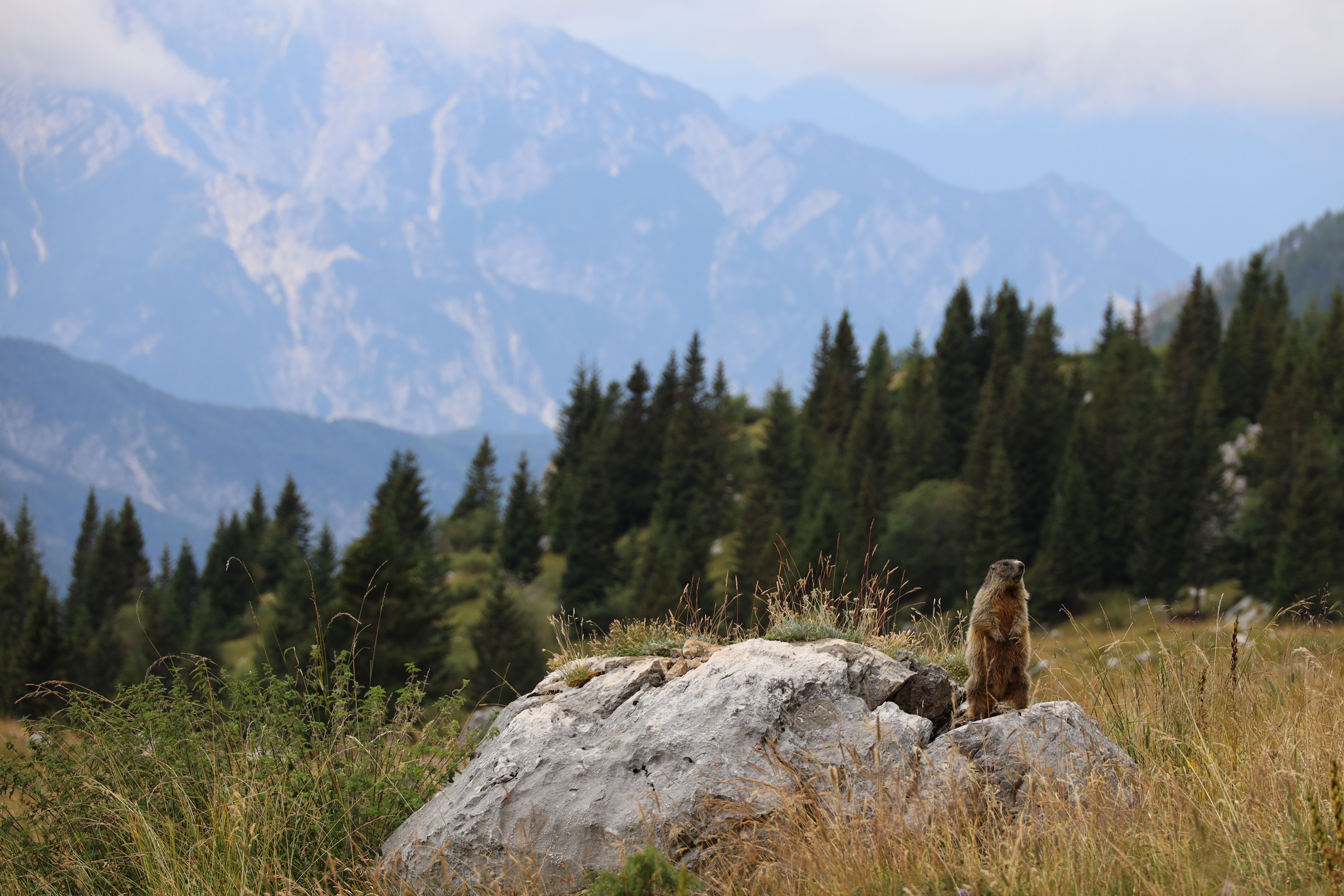
We entered Italy at Kranjska Gora and then explored the area and took a cable car from Camprosso and hiked to the amazing Cima Del Cacciatore. From here we went to Sella Nevea and up into the mountains on one of the narrowest and steepest roads we have done yet, give or take.

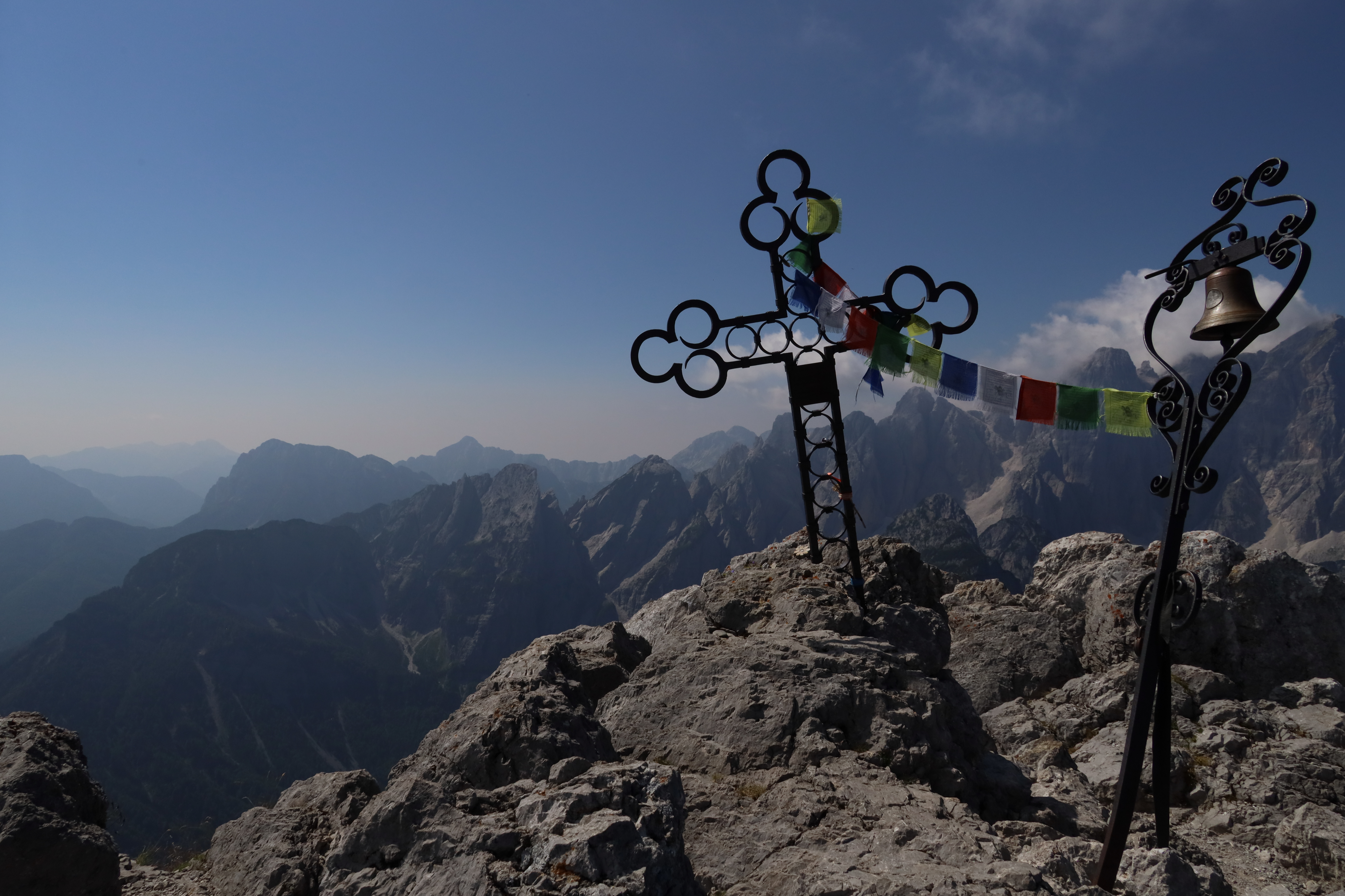
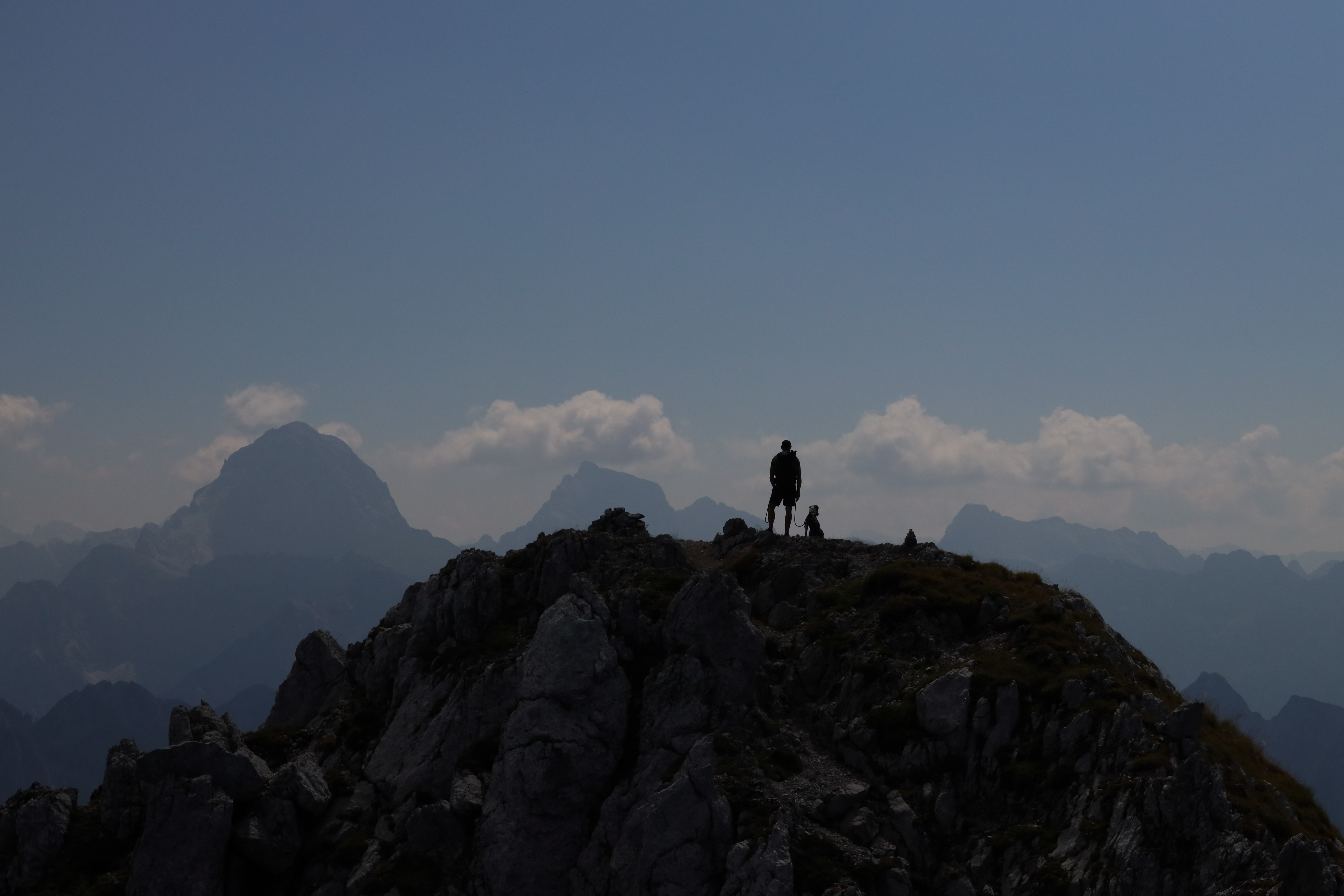
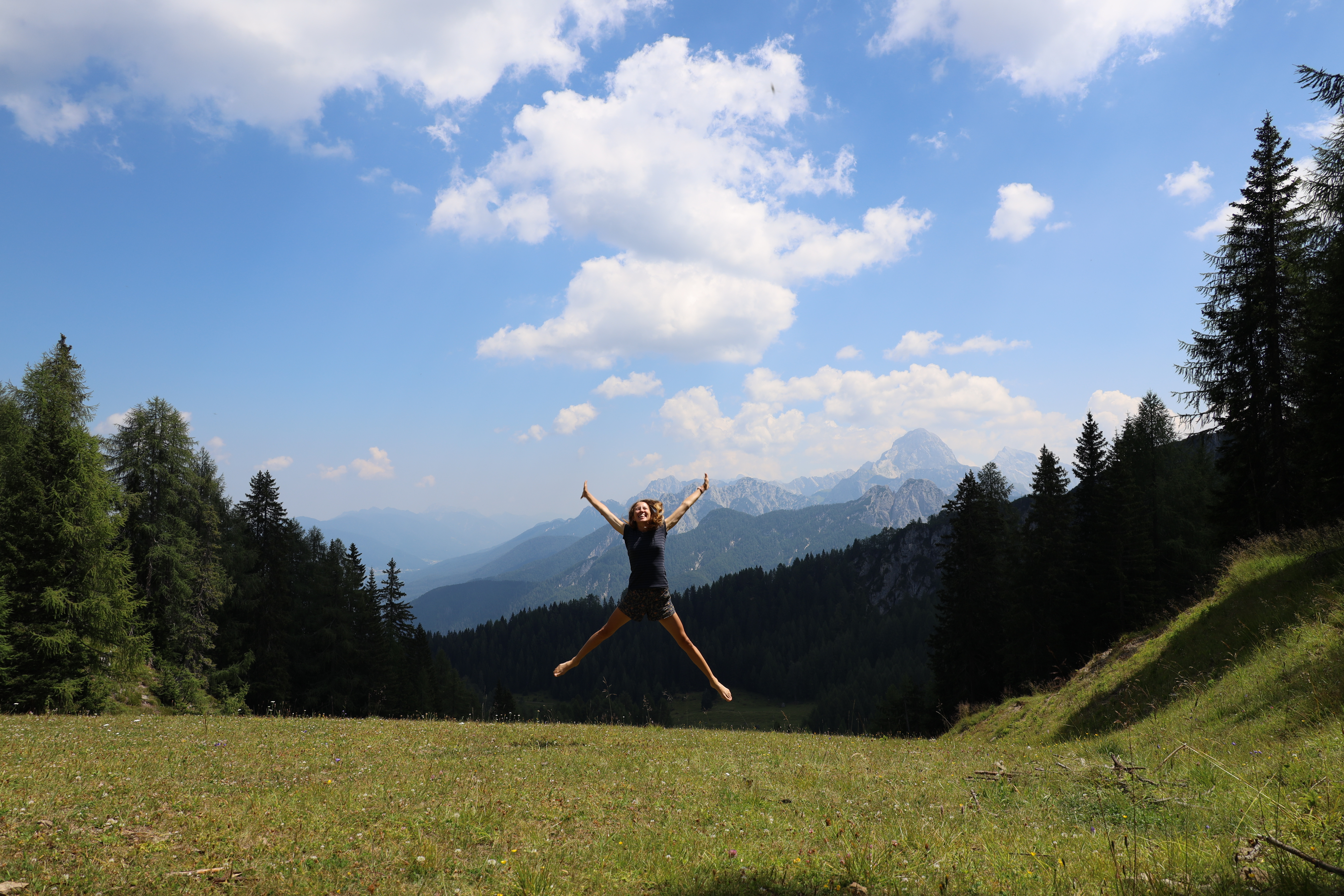
There are quite a few different footpaths up here depending what sort of walk you want to go on, including some via ferrata sections.

Top of page ↑

We are now 6 months into our trip and below is a video overview of some of the things we have been up to.

We got into Tarvisio and found a nice park up just on the edge of town. In town there were lots of choices of places to eat. I tried to practice my Italian but the waitress just spoke to me in German, I think she just assumed I was another german tourist, to be fair to her, there were no other UK vans. In fact, on the whole trip so far, we have only seen about 4 other UK vans. 

Advertisement

Visit Croatia – Vanlife Diary 1

Croatia – 1st Entry from Montenegro

We first entered Croatia on the 1st June from Montenegro. We went to join some friends we made in Albania on the Prevlaka Peninsula, which is an old abandoned military base which overlooks Montenegro.

Prevlaka Peninsula
Prevlaka Peninsula

The border crossing went smoothly, they only asked for passports not the v5c or the pet passport, albeit they didn’t see Alba. But we have crossed this border quite a few times now as we have visited Mike’s brother who has just bought a plot of land in Montenegro and he is setting it up to be an eco-retreat next summer. There’s some more information about that in this link.

Prevlaka Peninsula

Prevlaka Peninsula

Is the entry point to the Bay of Kotor, which came under Austrian Empire rule in 1813 where they built a fort, which you can un-officially go in. Then Nazi Germany took over during WW2, you can still walk through the communication tunnels today! (It’s incredible, take a head torch).

We left here and went to top up some water at a nearby tennis court. Two minutes around the corner from here is a beautiful water garden. There is a little car park and a tranquil looking restaurant, the water garden follows the man made streams into and around the flour mills. There are some information boards in English and it is the perfect spot for a picnic. 

Kupari  Bay of Abandoned Hotels

Still heading north we decided to visit the abandoned hotels of Kupari. We had heard about these from a couple who are also travelling in their van, @weboughtavan, and decided to take a trip there. We arrived at night and even though we had our head torches we decided to wait until morning to explore, one because I was worried about what would be on the floor and we had Alba’s feet to consider, but two, I was a little scared in the dark! 

I found out that these once exclusive hotels, built in the 1960s (except The Grand, built in 1920s) were used by the elite of the Yugoslav military where it became a place you could only get a booking if you knew someone. All seven were then destroyed during the 1990s Croatian War of Independence. They are only about 10km from Dubrovnik and you can park up here for free, exploring these hotels is a must do – but watch out for the broken glass if you have a dog with you. 

Dalmation Coast

We stayed at Ploče on the windsurf beach which was fab. After driving further north, we had thought about having a beach day but changed our minds seeing how busy the coast was already (beginning of June), so many German vans! We shopped at Lidl where the car park was pretty easy for the camper, before heading to Cibača Pizza Trica for dinner. You don’t get a normal size pizza here, they are all ‘jumbo’! We got one each and then had a takeaway box so we could have the leftovers for lunch the next day. I would highly recommend this place. The parking is a little limited, but there is a sports pitch just down the road which I think would be worth parking at and then walking up about 100 meters or so. 

As the coast was too busy for us we found a spot on Park4Night which was up a rather steep mountain side near Bast, the road was really made only for 4x4s however we made it up, just! Up here there was a mountain spring and some climbing pitches. We didn’t have any climbing gear with us at this point so we couldn’t make the most of this location. I would say it is worth going if you have a 4×4 and take supplies for the duration of your stay. 

Self-build campervan conversion insurance

We then decided to head into Bosnia at Gornji Vinjani Border and out again at Granični prijelaz Izačić on the M5. We only stayed in Bosnia a short amount of time because a message came up on the dashboard saying ‘Engine will not restart in 300km’. We knew there was an engine light and worked out it was the N0X sensor which needed to be sorted so just incase the 300km was a mistake and meant 30km, we thought it would be best to get the work done in Croatia where we have loads of data on our phone to get us out of trouble if needed. 

Read more info about Bosnia here.

Read the next instalment of Visit Croatia – Vanlife Diary 2 here.. COMING SOON

Related Posts

Seven Lakes Walk in Rila National Park, Bulgaria

One of the best hikes in the whole of Bulgaria.

Rila National Park is found in the West of Bulgaria and hosts a whole range of footpaths for those looking for an adventure. It truly is one of the best places to go hiking in Bulgaria. Musala (2,925.4 m (9,598 ft) the highest peak in Bulgaria can be found in Rila national Park and can be best accessed from the Borovets Ski Resort. Rila is a 1 hour 40 minute drive from the capital of Sofia and can be accessed all year round. 

This 20km hike is straight uphill from leaving the car park until you get about two hours in and above the tree line. From here the scenery opens up and you can watch the horses graze as you make your way over the juniper covered grassland towards the rising ridgeline. 

Seven Lakes Rila National Park

The ascent becomes a lot more gentle now as you get closer to the base of one of the highest points of the route, Kaboul 2543m. Here you need to trust the map as it will guide you to the start of the footpath through the rocky terrain and up the steep edge onto the ridge. Once upon the ridge, the view opens up and you can take in a 360 degree view of the mountains of Bulgaria. 

Seven Lakes Rila National Park

Traverse the ridge and enjoy the views of the seven lakes from above. From here you will see the zig zag path that you will be taking down to get to those lakes. Once down you will see more people as many just take the ski lift up to the lakes and back again. We did this hike mid week in October and there were still a fair few people around who had taken the lift. 

Seven Lakes Rila National Park

Meander through the lakes until you find yourself at the ski lift, take the track under and follow through the woods until you meet a ski run. Here you have options but we just took the track to the left which led us all the way back to the car park. This part of the walk was beautiful, as the birds were singing as dusk approached. There was not another soul in sight or within earshot and it was the perfect way to end the walk. 

Seven Lakes Rila National Park

Walk Overview:

Length: 20.9km (about 13 miles) Start Altitude: 1610m
Highest Points:
Kaboul 2543m, Otovitsa 2712m and Razdela 2603m.
Total Elevation:
1,225m

Parking:

Parking is available at the ski lift, however we started our walk at this location.. (Park4Night #254110) where you can sleep in your campervan. There is a water tap there but as it is directly from the ground I would advise using a water filter bottle, (like Water2Go).

The route can be viewed on our account here: https://strava.app.link/zrDG7qkn0ub

Top Tip: The best places to visit in Rila National Park:

  • Rila Monastery 
  • Borovets Ski Resort
  • Skakavitsa Waterfall 
  • Musala 
  • Belmeken 
  • Seven Lakes 

Road trip holiday in the UK 2023 ideas

My top five places to visit for a van adventure in the UK.

There are so many places that you could visit for a road trip holiday in the UK from the tip of Lizard Peninsula in Cornwall to the depths of the Scottish Highlands. Here are some of my favourite locations.

1 Cumbria

  • I would camp at an eco campsite, somewhere like the The Quiet Site.
  • Then book a nature experience with Wild Intrigue like their Breakfast with Red Squirrels on Haweswater.
  • Followed by a hike up one of the many fells, one of my favourite being up Pavey Ark.
  • If the weather was a little on the rainy side, I would take my climbing gear to the Kendal Climbing Wall.
  • Spending sunrise at Castlerigg Stone Circle is a must, especially at seasonal festivals like Beltane or Samhain.

2 Kilmartin Glen, Scotland

This is a great place for a road trip. It is in the West of Scotland and has over 350 ancient monuments to stop at and explore. We haven’t stayed at a campsite here, however Forestry and Land Scotland were running a Stay the Night project, so we took advantage of this. Remember to leave no trace.

  • Visit Carnasserie Castle.
  • Explore Nether Largie Standing Stones.
  • On the way a hike which was fantastic is up the Cobbler.

3 Chiltern Hills

I’d bring the camera and a flask on a walk in the Chiltern Hills.

  • Photograph the red kites.
  • I would walk up Whiteleaf Hill in the Nature Reserve.
  • I would camp at Orchard View Farm, they have a great little cafe with local produce too.

4 Suffolk

  • Head to Constable Country and visit Flatford Mills.
  • The following day I’d do the The Three Churches Walk (video below).
  • I would also visit one of the oldest oak trees in the county at Ickworth House.
  • I’d take a flask and a camera to watch the birds at Lackford Lakes.
  • Not forgetting, if the season is right, a visit to the seals at Horsey Gap (remember to keep your dog on a lead).
  • For coffee and waffles in Bury St Edmunds, I would recommend Lotties at Angel Hill.

5 Moel Famau, North Wales

The Clwydian Range in Flintshire is a great place to hike and bike away from the crowds of Snowdonia. There’s a few spots on Park4Night which we have slept at with no issues.

  • A great little cake shop I would highly recommend is in Rhewl, called the Sugar Plum Tearoom.
  • A summit to walk is up Moel Famau which is the highest hill in the area.

Related Posts…

Follow our adventures on Instagram @hollyandmike_

Vanlife in Albania

Exploring Permet Springs and picking up a new four legged friend..  

We first went to get a sim card from GJirokaster. I had no expectations of this town, but I was suitably impressed. First, the lady in Vodafone was really helpful, we got a 31gb sim card that cost €17 and lasted for 30 days. Then we took a look around, it started to rain so we went up to the castle, which normally costs a couple of euros, but today they let tourists in for free, maybe because they were doing some building work. This castle is one of the biggest in the Balkans and was occupied by the Ottoman Empire in 1419 and was used as a prison during the communism times. All the little side rooms, that in the UK would be cordoned off or that would be behind locked doors, were open, and we could explore to our hearts content. I have never been in a prison in a castle before and explore here was fascinating.

After we went back into the little town and had lunch. Here I had the best moussaka I have had ever before. We then followed a classic route, which every van blog seems to tell you to do and we drove up to Permet Springs. There were about 6 other vans here, a few stray dogs and we took a dip in the baths. There are a few to choose from and we just went into the main one after an 8 mile walk. It was warm, and refreshing. We stayed here 2 nights before heading to Vlore. The route we hiked can be found on Outdoor Active here.

We went to Vlore but wasn’t too impressed with the area, just down the road is the  Ancient Greek trade colony of Apollina, which is worth a visit.

After we visited Berat, which was nice to look around but decided to keep moving.

We then went up the coast and made some great friends on the beach at Buona Vila Beach Bar (park4night location #90870). Highly recommend this location.

Another place I would recommend is the Shpella Pëllumbasit cave up the road (near Tirana). This is the second best cave I have ever been in (number 1 is a cave in New Zealand). You can park at the restaurant for free. We had some food there after our walk. Remember a head torch.

The next main spot I would recommend is Bar Ledh near Shëngjin and the Lezhe District, just south of Shkodër. I have met a few people along the road and directed them all to Mario’s (Park4Night #144655). This is a great, free, location and also where we picked Alba our street dog up from. You can read about how to adopt a dog off the street here.

The next stop on our route was Theth. After a lot of research we found that the road there was now tarmac which was great news, as without this, it would be near impossible, or just very slow!

We stayed here for a few days exploring some of the hikes and then went want to Shkodër to get Alba vaccinated before heading out to Montenegro.

My top tips:

  • Eat Trilece for dessert
  • Adopt a stray dog, or at least bring dog food to feed them
  • Do a good food shop before entering

Related Posts…

Latest on Instagram…

Our favourite road trip must-see locations in Europe and the Balkans

In no particular order here are our favourite places we have visited whilst exploring Europe and the Balkans in our campervan conversion, so far. (We are only half way through out trip!)

1. Gjirokaster in Albania

This was our first stop in Albania coming in from Greece. We had no issues at the border, they checked the back and saw it was just a camper. We stopped to get a Vodafone sim card and had the best moussaka in a little restaurant. The old town up the hill is full of character and a walk up to the castle is a must. Parking for groceries in the new town is a bit chaotic so would avoid. 

Best place to park: 40.0766227,20.1430734 

2. Sierra Espuña in Spain

We really enjoyed the Sierra Espuña because it was the greenest place in Spain that we found. The trees were all cut down to build the armada but they have been replanted in the 19th century by Ricardo Codorníu, a local philanthropist who also got the nickname of the Tree Apostle. I have to say, the area is flourishing! Despite the lack of rain last winter. This place is great for hiking and biking with the best coffee at the monastery where you can sleep overnight. 

Best place to park (and can stay overnight): Sanctuary of Santa Eulalia de Merida.

3. Prevlaka Peninsula in Croatia

This is a great little communal spot, every time we have been here we have made new friends. There are many places to park and loads of old military building to explore. Prevlaka, meaning portage, came under the Austrian Empire rule in 1813 where they built a fort, which you can un-officially go in. Then Nazi Germany took over during WW2, you can still walk through the communication tunnels today! 

Best place to park and stay overnight: 42.4063171,18.5054017

4. Lefkada in Greece

Boat hire on Lefkada

Lefkada in Greece because of the stunning scenery. On this island you can hire mountain bikes, boats, hike down a gorge or go for a massage. We did all of the above and it is all within about 45 minute driving distance. 

Best place to park: Campsite Santa Maura 38.6722277,20.71082

5. Near Bosača in Montenegro

Near Bosača in Montenegro

Here was a great place to visit when exploring Durmitor National Park and the surrounding areas. There are lots of hiking and biking in this area and the park up spot is next to an abandoned ski lift, it’s pretty cool. It feature in our monthly travel video below.

Best place to park: 43.163311, 19.096261

6. Tarvisio in Italy

 A hike from near Tarvisio overlooking Triglav National Park.
A hike from near Tarvisio

Tarvisio in Italy because of the mountains. You will find that it is hard to park in the neighbouring Triglav National Park so why not head to the other side of the border where you are welcome and the locals are so friendly. There are cafes to relax in, mountains to climb and the best thing is that there are loads of cable cars to get you to up to the ridge line and so you can do the more interesting sections of the walk instead of getting tired zig zagging up the hill or following the ski tracks. 

Best place to park: 46.5037825,13.5773484

Related Posts…

To follow the rest of our adventures visit @hollyandmike_ on Instagram…

Hiking in Bosnia

A land of beautiful, yet somewhat inaccessible mountains.

I initially thought that hiking in Bosnia and Herzegovina was dangerous, but have found out that the areas which still have land mines are well marked with a red skull and crossbones. If you see any other red marking on the route (flags, sticks or general make shift signs) other than the red circle route markings, then be wary. There are still land mines around from the Bosnian War between 1992 and 1995, which lead to this country having the worst land mine contamination in the world, but don’t let that put you off! There are some great hiking routes in Bosnia.

Here is a comprehensive list of the best hikes in Bosnia and Herzegovina and from an app we use which has an offline feature, OutdoorActive. This is the route we took up Vran, 2020m in Blidinje Nature Park, which encompasses part of the Via Dinarica, a route that takes you from Slovenia to Albania.

Some other great location to go walking are near the capital Sarajevo, Mostar and Lukomir. The only mountain region which you need a permit for hiking is for Preučica, one of the last of two remaining primeval forests in Europe, found in the Sutjeska National Park in Bosnia’s oldest national park. It is here that the highest peak can be found – Maglić, 2396m. There are many places to explore here, just make sure to do your research first.

Related Posts…

Follow us on Instagram @hollyandmike_

A short visit to Bosnia and Herzegovina in our campervan

Hiking in Blidinje Nature Park, friendly locals and a ‘your van will not restart message’.

We decided to head into Bosnia for a few days and so we did that by entering at Gornji Vinjani, below Split, and we got ourselves a sim card at Digitrend in Posušje which had 4gb, for about €3. He tried to explain how to top it up but I didn’t quite understand so we just were careful with our usage. We had downloaded the maps before we went so didn’t need it too much. 

Blidinje Nature Park

We hiked in the Blidinje Nature Park and stayed at this beautiful lakeside park up which does have some no camping signs, but there were loads of locals camping that weekend too so we thought it would be fine, and it was. The route we hiked was this route from Outdoor Active.

Hiking up Vran, Blidinje Nature Park

From here we headed north and stopped off at Jajce and Krupa Falls, a mini waterfall river where they use the falls for grinding corn and grain. We had a beer at the restaurant at the foot of the falls but Alba was in heat and the stray dogs were showing a bit too much interest, so we decided to go for a walk. En route, we met a lovely couple on our walk and they invited us in for a drink, with limited language on both sides we had a really enjoyable evening! 

We then went to Una National Park, the entrance fee was a couple of euros each. You aren’t allowed to stay inside the park overnight. The parking in the whole area for staying overnight was a bit tricky. Don’t get me wrong there were some campsites available, but the temperature was getting 30c + and we needed shade! None of those sites could offer us shade, so we decided to head back into Croatia. Another reason we went back into Croatia was because we had a message come on the dashboard ‘vehicle will not restart in 300km’! The N0X sensor needed replacing, so we wanted to be in Croatia for that for insurance reasons! So we left at the Granični prijelaz Izačić border on the M5 with no issues or queues. 

Related Posts…

Follow us on Instagram @hollyandmike_

Attenborough’s Volcanoes

I am no expert on volcanoes in the slightest, but an interest sprung up, whilst watching ‘The Lord of Nature’, Sir David Attenborough in ‘A Perfect Planet’. I didn’t know that there were 1,500 active volcanoes and that the most active are in Hawaii.

Kilauea Volcano, Pixabay

I knew Mt Etna was still active and having seen it for myself on a trip to Sicily, I however wouldn’t fancy living underneath it. The first carbon dioxide was from volcanoes and this gas is the ‘foundation of life’, as Attenborough puts it, and rightly so.

David Attenborough Credit Africa Press
David Attenborough. Credit Africa Press

Nor did I know that Volcanic islands make up 5% of the planet’s land, but are home to nearly 20% of the planet’s species and on top of that, a single ash cloud can carry billions of tonnes of minerals.

I went to Pompei and could see for myself that land around the volcanoes are some of the most fertile, it was an experience to go there and see Mt Vesuvius peering at you in the distance. 

Pompei with Versuvius in the background. Pixabay

So far in 2022, there have been five big volcano eruptions (at time of writing in August). Those include, Mount Bulusan in the Philippines in June where an ash plume rose up 500 meters covering local communities. Then in January there’s Hunga Tonga, a submarine volcano in the Tongan archipelago which is one of the largest eruptions ever recorded and the largest in the 21st century.

Mount Bulusan in the Philippines

The Hunga Tonga eruption rose more than 30 miles above the earths surface creating atmospheric shock waves that reached 720 miles per hour. The fastest speeds ever recorded in our atmosphere! It not only created a tsunami thousands of miles away killing people in Peru, but Nasa has found that the effects also reached into space creating unusual electric currents and strong winds up to 450mph.  

Hunga Tonga

Then in March there was Mount Merapi at 2968 meters high on Java, one of the most active out of more than 120 volcanoes in Indonesia where lava avalanches and hot clouds reached up to 5km, but luckily there were no casualties. 

Mount Merapi and Mount Seremu. Pixabay

The greenhouse properties of Co2 have kept our planets atmosphere stable and warm but now, humans release 100 times more carbon than all of earths volcanoes combined.

The quote which I want to leave in your minds is one from Sir Attenborough himself “humanity itself has become a new kind of supervolcano”.

Some food for thought. 

Hawaii's Mauna Loa Volcano, the worlds largest
PHOTO: MINT IMAGES/GETTY IMAGES

Hawaii Mauna Loa Volcano Diary

Recent activity on Hawaii’s Mauna Loa Volcano, the worlds largest! The volcanoes in Hawaii are unique as they do not sit on a tectonic plate boundary unlike others..

October 2022 Update: Recent earthquake activity is currently occurring on Hawaii where the volcano Mauna Loa is situated. There have been between 5 to 10 earthquakes a day since June, and over the past few weeks that number has gone up to 40 to 50. Something is going to happen, but when…


November 2022 Update: There have been about 50 earthquakes in the last 24 hours around Mauna Loa. The local defense has issued a yellow alert. More information can be found here: https://www.usgs.gov/volcanoes/mauna-loa/volcano-updates.

December 2022 Update: It has happened! For the first time in 38 years, the Mauna Loa volcano erupted on the 28th November 2022. Lava shot up to 148 feet and has travelled 40 feet per hour. BUT ALSO nearby Kilauea volcano which has been erupting slowly since last year. Surely the two are linked. In addition, there are volcanoes currently erupting in Alaska too, but I’ll save that story for another time.

Related Posts…

Follow Holly on Instagram…

Analysis of Andrew Skurka’s Yukon Expedition

The aim of this essay is to analyse case study material from an established expedition and evaluate the performance of the expedition in one specific area.

Andrew Skurka received the Adventurer of the Year Award in 2007 and since 2002 has completed about a dozen solo expeditions. It was his Alaska – Yukon Expedition (AYE) that caught my eye – he was the first person to have done it. This expedition lasted for 176 days starting March 14th and returning on the 5th September 2010, during which he travelled 4680 miles by skis, on foot and on a Packraft.  His aim was to traverse the Alaska Range and Brooks Range in one trip. He describes this as wanting to achieve an “exceptionally unique, rewarding and challenging experience”. 

(http://www.andrewskurka.com/AK10/about.php, 2010)

the route

I have chosen to write about this expedition because I am very interested in that area of the world and how different the seasons are, compared to here in England. I like the fact he has three main ways of travelling, adding a bit of variety and giving me more to look into regarding his kit list and how he packed. I like the way he documented his journey, buying a new camera along the way, keeping in touch with loved ones and fans whilst out amongst the mountains. The fact that you can do that with today’s technology is just fascinating.

Credit Andrew Skurka

I am interested in gaining new experiences, travelling and documenting them along the way; something I have done before and want to carry on. Therefore, by choosing an expedition where the main aim is to go somewhere never gone before, the ethos between us is the same. In an online interview he was asked would he go back?  His reply was that it was very beautiful and really enjoyed it, however, as his life goal is to gain many new experiences then no, he wouldn’t go back. This I agree with, hence why I am especially intrigued by the Skurka AYE Expedition. 

I aim to assess and evaluate the factors affecting his choice of equipment, one of the most important elements of planning under technical leadership skills. I will look into how having the applicable knowledge reinforced his planning strategies and techniques.  This will take into consideration the packing aspect and whether being sponsored altered his choice. 

Although writing about this expedition may be limited by the fact that it hasn’t been established for long (at time of writing in 2010) which means I have no academic material to look into, I have two main information sources; firstly I am in email correspondence with Skurka himself and secondly, the internet. Skurka kept a blog whilst in Alaska.  He updated it often and also, interlinked with the National Geographic set up a blog where the public could send him questions. This, I think, was an important aspect in keeping his morale high as he was travelling solo. 

As this expedition finished earlier this year (at time of writing, 2010), there is currently limited written material about it.  There will however be an article about it in the March 2011 issue of the National Geographic magazine. I will be using expedition handbooks to look at advice and applicable theories. The internet provides blogs from Skurka whilst out travelling and his personal website provides a lot of information about planning, including a gear list, food advice and a final itinerary.  I also found out his mother played a big part in his expedition and I can use her as a source too.  

The objective tests Technical, Interpersonal and Meta skills, which every good expedition should.  As he is travelling solo I feel the Interpersonal skills needn’t be evaluated. Regarding Meta skills, he did encounter problems and had to use his perception skills to get through, however, I am looking into the technical skills needed for the expedition, as this has many fundamental values which I can explore. The specific area I will assess will be whether the fact he was sponsored limited and deterred his choice of gear or whether this was beneficial to him, also if he would have preferred another brand. I will look into what his gear means to him, my main focus being how he decides what to take and what to leave behind. I feel this is important as the gear you take can be the make or break of an expedition. 

Sponsors want publicity – when seeking sponsorship it is important to find the right company which wants the type of publicity you can generate, be it sales of the latest product or primetime television coverage. There are pros and cons with gaining a sponsor and I want to use Skurka’s AYE expedition to discover whether it has been helpful to him or not and whether it changed how he went about his journey. Commitment to the sponsor is a big issue, also there is a need for a unique selling point, as there is with the products you use, the food you eat and the same applies for an expedition. 

Companies will only put money in if they believe they can get something out of it and there is every expectation that the expedition will be a success. Sponsors will be looking for two types of expedition; external, which involves high end publicity and internal, which is the test of a prototype. I plan to evaluate the planning phase of Skura’s latest expedition. He states that it took 12 months in total for the whole expedition – 6 months planning and 6 carrying it out. When packing you have to think about weight and whether you can get equipment which performs two jobs in one while retaining the high quality. 

Skurka was sponsored by GoLite who provided him with equipment.  He tells them what works and what doesn’t and from this, they develop a mutual partnership as they can then go on to design future products which could then make them a profit. This is important because these designs can then help with other future expeditions.  

Staying comfortable on an expedition requires maintenance of homeostasis of the human body. (Long S, 2003) To achieve and maintain the correct temperature requires different types of gear, and this is where the layering system comes into play  A dynamic equilibrium is held by consistent control and regulation of the body, the sensors we have notice the change within this regulated variable and the effector responses take the appropriate intrinsic or extrinsic action. (Jurd, 1997)

The physiology of the human body has given us hairs which involuntarily become erect and trap air when we get cold.  The base layer is of most importance when energy requirements vary. Skurka carried two different types of pants, tights and base layer shirts.  As materials have developed with hydrophobic properties and insulating synthetic layers it means that the shirts can be worn more often, meaning less equipment needs to be carried. The two shirts he used were not made by GoLite (his sponsor), however he found that they both had defining properties – the two tops were made by Ibex and Ex Officio, both long sleeved base layers.  The Ex Officio top is designed with a very effective bug deterrent feature. He also chose an Ibex long sleeve top; because it was wool it was more effective in the cold and wet conditions, and the post trip comment for this was that it was most definitely worth taking. Having found that Ibex designed such a good piece of equipment, only time will tell to whether he will go back to GoLite and if they will design something similar. Skurka (pers comm. 2010) tells me that “I also try to find the companies that are willing to make the gear I want, if they don’t make it now”. 

The backpack he chose determined the weight he was to carry – over the years he has decided to get lighter and lighter, with the repeated saying “Go Lighter” on his website, which also interlinks with a play on words regarding his sponsors, GoLite Ltd.  The GoLite Pinnacle rucksack carries up to 18kg comfortably and has been ergonomically designed for long distance usage and winter conditions.   At most Skurka carried 15kg during the late winter to spring leg of the journey. At the food depot there was another pack waiting for him along with the rest of his food supplies, and this was to last him for the summer and early autumn length. This pack was designed by ULA and was the prototype for 2010. Even though he is sponsored by GoLite he can still test out other companies’ future products – this is a good way of getting his name known and maybe for future expeditions ULA will be inclined to sponsor him.  This suggests that because he has been sponsored by GoLite, he became a recognised explorer, thus opening more doors and giving him the opportunities to test out new products. The more “top of the range” products that will become available to him will gradually increase; this could result in the performance of the expedition escalating as new products reduce the limiting factors of an expedition. 

Equipment choice for this expedition required a lot of thought, especially as it was such a long period of time that needed to be accounted for.  In my opinion he travelled very light considering the time period and conditions he had to contend with.  I think this is due to not only previous experiences, but what is available to him which otherwise wouldn’t be, for example the prototype ULA backpack.  Skurka (pers comm, 2010)  states “I try to be sponsored by the companies that make the gear I want” This tells me a lot of research and knowledge has gone into what he requires for this expedition to be a success. Skurka (pers comm, 2010) explained “I have never contacted companies like Gregory, Spyder, or The North Face – they don’t make what I want”. The sort of products he needs are high performance, top of the range and therefore costly; sponsorship and fundraising are two ways of acquiring the kit he needs. Skurka (pers comm, 2010) says “Having sponsors certainly improves the likelihood that my trip will be a success”…“I wouldn’t have all the top-of-the-line stuff,” 

He had many advisors to help plan the expedition route, and advise on the environment and weather conditions – this all influenced his choice of equipment. The best way to find out about a new location is to ask others who have experience of the conditions. He contacted Professor Roman Dial who has explored Alaska and Ryan Jordan, a publisher and leading practitioner in trekking styles and technique. He found many Alaskan guides and adventurers who have all experienced not only living there but exploring the outback from a rucksack. They included people like Erin McKittrick, Bretwood Higman, Bill Merchant and Ed Plumb. It is ideal to get advice from a lot of people as each will have specific areas of interest, therefore increasing the amount of information you will gain. 

Skurka had a kit list for which he wrote pre and post trip comments; this was a requirement of his sponsorship.  His main aim when being sponsored is to test the kit – by looking at the kit list we can see that he has many critical comments about some of the gear he took. For example, the Solomon La Sportiva Fireblade shoe he found would be “near- perfect if a forefoot plate were added”, it is this sort of comment which would be taken forward and redesigned. I doubt this altered his performance, and also I doubt that he has worn these shoes on an expedition before. Also with his choice in ski boot, he used a Crispi Mountain 3-pin Telemark boot which fitted him well but was not waterproof and never dried out. It is a piece of equipment like this which can make the expedition less comfortable. He did ski for two weeks longer than expected which could be due to travelling less during the day and at a slower rate due to being uncomfortable. If the human body is put under stress or pain then it is inevitable that tasks take longer to perform. 

On the whole Skurka benefited from the sponsorship as he is now able to get hold of some top line equipment which can enhance his performance therefore resulting in him being able to accomplish more with reliable gear.  I therefore believe that being sponsored has become an advantage to Skurka.  To me, it seems like there is no downside to being sponsored by GoLite for Skurka – he tests their products and gains equipment for more expeditions and in return they get a more thorough understanding of what is needed in the market, whether changes are needed regarding ergonomics, aesthetics and materials. Overall gaining a sponsorship has not inhibited the performance of this expedition, it has in fact, had a positive outcome. (2,188) References 

Becker K. (2010). Cheap Tents Outdoor Gear – Adventurer Andrew Skurka on his latest Expedition. Available at: http://blog.cheaptents.com/andrew-skurka-alaska-yukon-expedition/

Jurd R. D (1997) Instant notes in Animal Biology. BIOS Scientific Publishers Ltd pages 88 – 89

Long S. (2003) Hillwalking Mountain Leader Training Handbook  Vertebrate Graphics, pages 46-49

National Geographic (2010) National Geographic Adventure. Available at: http://ngadventure.typepad.com/blog/2010/10/andrew-skurka-answers-your-expedition-questions.html#more (accessed: 10/12/2010)

Skurka, Andrew (2010) Personal communications. askurka@comcast.net

Winser S. (2004) Royal Geographical Society Expedition Handbook  Biddles Ltd, pages 92-98

www.andrewskurka.com

Appendices 


email

  1. I try to be sponsored by the companies that make the gear I want.  I don’t get sponsored by a company first and then sort through their product list to find items that will work.  This explains why I have never contacted companies like Gregory, Spyder, or even The North Face – they don’t make what I want.
  1. I try to find the companies that are willing to make the gear I want, if they don’t make it now.  Part of the benefit to them in working with me is that I put a lot of field time on gear, so I can tell them what works and what does not over the long term.
  1. Having sponsors certainly improves the likelihood that my trip will be a success, though it’s a primary determinant.  If not sponsored, then I would be paying for my gear, in which case I would probably be more cost-conscious – I wouldn’t have all the top-of-the-line stuff, and I probably wouldn’t replace things as often (e.g. shoes and socks).

Andrew

The questions were as follows: 

  1. What do you look for in a sponsorship regarding kit?
  2. How do you choose your sponsors?
  3. How is having a sponsor beneficial to your?

Related Posts…

A quick guide to the Isle of Mull in a Van

The Isle of Mull, home to the White Tailed Eagle, the second largest bird of prey in Britain and the second largest of the Inner Hebrides. We took the ferry from Oban to Craignure to see what it had in store for us.

Three Lochs Viewpoint

We are part of the Leave It Better Community who inspire and encourage others not only to leave no trace but to be pro-active in areas where they arrive, and we make it part of our travels to pick up litter in each car park we stop off, or beach that we walk to leave it better than how we found it.

There is an abundance of wildlife on Mull with over 250 species of bird. We saw a few beautiful red deer stags, one popped over the mound as we sat quietly waiting by the loch side to see an otter. He was being chased by a doe and nearly ran straight into us! It was magical watching him trot up the steep hillside and back into the woods.

One of the many Red Deer stags we saw

There are two species of seal on Mull, the Common Seal (Phoca vitulina) also known as the Harbour Seal, and the Atlantic Grey Seal (Halichoerus grypus) and both are found throughout the British Isles.

Common Seal in Calgary Bay

Calgary Bay is probably one of the most well known beaches on Mull and for good reason too. Apparently Calgary in Canada is named after Calgary on Mull!

Sunset at Calgary Bay

The best way to get to the Isle of Mull is the ferry from Oban. We didn’t book anything but we did go in off-peak season.

Isle of Mull
Isle of Mull

We were at Lochbuie Standing stones on Samhain, which is the day that marks the end of the harvest and the beginning of winter. It was very atmospheric.

Lochbuie Standing Stones

We found a route we wanted to do on Outdoor Active up Ben More, the only Munro on the island and a challenging hike. You can see the route here. It was a 9.5km walk which should take about 5 hours. On this hike we saw a Golden Eagle which I was most excited about.

In conclusion, Scotland on a whole is a beautiful place to visit in a van, make sure you park properly and not in the pull over laybys! For some further information of course head to https://visitmullandiona.co.uk/.

Related Posts…

Follow us on Instagram @hollyandmike_